
|
|
Route |
|---|---|
|
|
47.85997°N / 121.34172°W |
|
|
Hiking, Mountaineering |
|
|
Winter |
|
|
Most of a day |
|
|
YDS Class II |
|
|
Overview
Although San Juan Hill is already a seldom summited mountain within Wild Sky Wilderness, summiting the mountain from its lower southeastern corner is a very rarely accomplished feat. The southeast approach is longer than the standard (east) approach, but is arguably more scenic and has an easier final summit approach than the standard route.Due to the very brushy lower slopes of San Juan Hill's southeastern terrain, the southeast approach for the mountain is best recommended during Winter months while snow is covered on most of the mountain but the main forest road (FR-6500) that nears the mountain is accessible to traffic, or during early Spring months (March, April) if the above-mentioned conditions are still available.
The southeast approach for San Juan Hill has many scenic views. While on the southeast slopes of the mountain there are many opportunities for great views of nearby Evergreen Mountain. While on the ridgetop south of the San Juan Hill summit, there are multiple opportunities to look southwest across the San Juan Creek drainage towards nearby Spire Mountain, Quarter Dome, and El Capitan. And, if desired, small Boulder Lake is located on the southern end of the San Juan Hill ridgeline, only a few miles away from the summit.
The route is YDS Class II, with mostly off-road traverses up/down forested slopes. The route is approximately nine miles, roundtrip.
Getting There
1) Drive along Highway 2 until reaching Beckler Road (FR-6500), just 0.6 miles east of the town of Skykomish.2) Follow Beckler Road north for 10.5 miles to FR-6560, located on the west side of Beckler Road (FR-6500).
3) There are few places to park or turnaround a vehicle along FR-6560, and the road is essentially one-lane. Either drive up the forest road (if conditions allow) and park along the road where possible, or park along the main road (FR-6500) near the road intersection.
Route Description
Assuming the hiking route begins at the intersection of FR-6560:1) Hike or snowshoe up FR-6560 for approximately two miles until the road ends (~2800' elevation) near a creek tributary located south of the road.
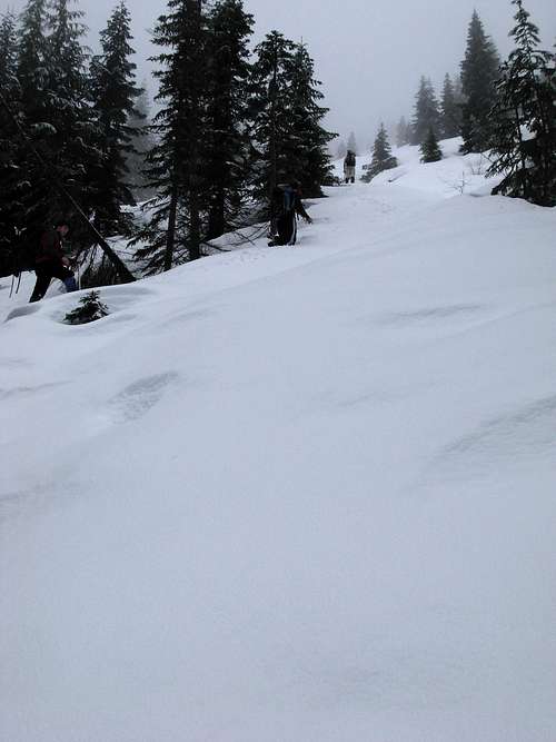
 Ascending FR-6560...
2) Head due west up snowy forested slopes overlooking the creek tributary for approximately one mile until reaching FR-6574 (~3550' elevation).
 Ascending above creek tributary...
3) Hike or snowshoe south along FR-6574 for a short distance, until reaching an upper section of the forementioned creek tributary. From that point, either climb directly uphill for approximately 350' vertical distance until reaching FR-6574 again near its end higher upslope (recommended), or continue following FR-6574 south and then north until reaching the same location.
 Ascending west up snowy slopes...
4) From the end of FR-6574, ascend west until reaching the San Juan Hill ridgetop near a location some maps (i.e. USGS) show as Point 4634.
NOTE: If another forest road is encountered while heading towards the ridgetop, it is actually FR-6570 which traverses parallel to the San Juan Hill summit. If this forest road is encountered, find the first most easily accessible section of forested slope on the west side of the road and ascend it to the ridgetop south of the San Juan Hill summit.
 Snowshoeing along FR-6570 southeast of the San Juan Hill summit...
5) From the ridgetop, hike or snowshoe north through dense forest for approximately 0.75 miles to the San Juan Hill summit (4895' elevation).
 Hiking along forested ridgetop to summit...
From the San Juan Hill summit, descend either using the same route as the ascent approach, or via the standard route leading back to FR-6500.
Essential Gear
Winter clothingHiking/trekking poles
Snowshoes
Ice axe
Crampons or spikes might be useful, depending on conditions
Map and GPS