
-
 7051 Hits
-
 85.36% Score
-
 20 Votes
|
|
Canyon |
|---|---|
|
|
34.48344°N / 119.6352°W |
|
|
Hiking |
|
|
Spring, Summer, Fall, Winter |
|
|
Overview
San Ysidro Canyon is a scenic canyon located north of the town of Montecito in Santa Barbara county, California.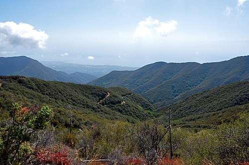
 San Ysidro Canyon
After the devasting 2009 forest fires in the hills of Santa Barbara that burned more than half of the hills and valleys in our front range, San Ysidro Canyon was spared. This canyon, along with a handfull of other survivors, have become the focal point of outdoor activity and wilderness experience for our town’s residents. The residents quickly realized that not all was lost, and we still had plenty to fall back onto. That turned out to be a good thing; we avoid the rut of hiking the closest trails to our house.
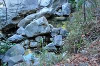
During the summer months when you are trying to escape the heat and the dusty trails, San Ysidro Canyon is the greatest place to visit. The year round creek keeps the lower half of the canyon green and cool. This is the boulder filled San Ysidro Creek that produces many cascades and pools for your mid-summer cooling. Hike up this canyon after a rain and see a sixty foot roaring waterfall, or hike up the first three quarters of the mile up the trail and check out the climbers on San Ysidro Rock.


 Choke Berries
 Montecito Peak seen from near the top
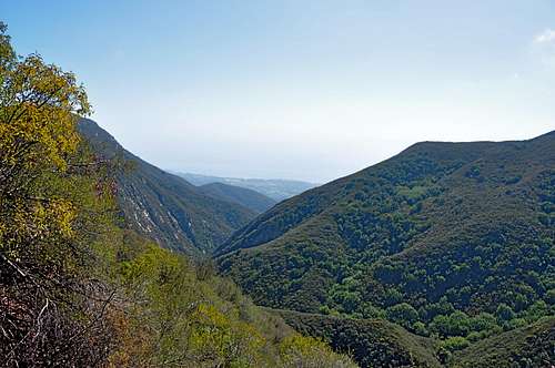
The upper half of San Ysidro Canyon is more exposed and void of tall trees and cascading waterfalls. The trail becomes sandy and steep. The upper half of the canyon, in fact, is great for colder winter months when you can enjoy hiking in the sun. You are hiking next to thousands of choke berry bushes. You may even run into a black bear coming up to feed on these tasty treats. (If they’re lucky, my wife and I may have left a few for them.)
An Interesting Phenomenon

Generally speaking, southern California has an arrid climate. Dry seasons can last long as eight or nine months during which you will not see a drop of rain. Even the year round creeks slow down to a trickle during the hot summer months. However, toward the end of the hot dry months, the creeks begin to run faster and fuller. Can you guess what causes this increase in the flow? The answer is not underground reservoirs or water diverting from another location.
Answer in the next section.
Answer to "An Interesting Phenomenon"


During the hot summer months without any rain, plants absorb as much water as they can from the ground. But toward the end of the dry season many plants die from lack of sufficient water and heat. After dying, plants cannot absorb any more water. That’s when the available water seeps back down toward the creeks increasing the flow.
The Trail to the top of San Ysidro Canyon
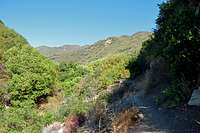

The greatest feature about San Ysidro Canyon is having a trail that takes you from the bottom to the top. This trail is just under four and half a mile long one way, with an elevation gain of of just under three thousand feet. During the winter months I have seen snow as low as 1500 feet putting the last 2000 feet of the canyon covered under the white stuff. To the residents of colder climate areas seeing snow during the winter months is ordinary. But, to the residents of California’s coastal towns, a little snow withing a half hour’s hike is really magical.
1- Start at the trailhead to “Camino Cielo”
There are short fences on either side separating the trail from private properties.
2- The trail soon joins an old fire road with a fence. Go around the fence.
3- Go past the junction with McMenemy trail.
4- Look across the San Ysidro Creek to see San Ysidro Rock, a popular rock climbing area.
5- Fork on the fire road in about .9 miles. Take the right fork.
6- Hike past the metal railing and wood supported steps.
7- Cross a creek. Note: After a heavy rain this creek crossing is very dangerous. There is no bridge or large rocks to use.
8- Hike out of the canyon’s bottom and get a great view of the Pacific Ocean.
9- Continue up the sandy and steep trail to Camino Cielo road on top in about 4.5 miles from the trailhead.
Directions to the trailhead


From Highway 101 take the San Ysidro Exit and head toward the mountains. Drive to Montecito Village where San Ysidro Road intersects East Valley Road. Turn right on East Valley Road and cross a small bridge to Park Lane. Turn left on Park Lane and veer left onto Mountain Drive. A short drive up Mountain Drive will bring you to the trailhead sign. Park off the pavement, please. We’d like to keep the access open and free.