
-
 35849 Hits
-
 80.49% Score
-
 12 Votes
|
|
Canyon |
|---|---|
|
|
35.57105°N / 106.79971°W |
|
|
Canyoneering |
|
|
Spring, Summer, Fall |
|
|
Overview
This rare New Mexico slot canyon lies just 45 minutes northwest of Albuquerque in the Bureau of Land Management's San Ysidro Trials Area (also known as Red Mesa to local mountain bikers). One of two canyons in this public area, this is the easternmost and more spectacular of the two. Nicknamed 'Grand Canyon' by motorcyclists and mountain bikers, this canyon doesn't span more than 50 feet across, but boasts a 30-40 foot deep sandstone slot that lasts for almost 1/2 mile. Most of the year, there are pools deep enough to wade, and some, to swim. Located among junipers and sandstone, it is a hidden wonder in a seemingly flat high desert landscape. This canyon can be joined with the western canyon for an enjoyable day of canyon scrambling.
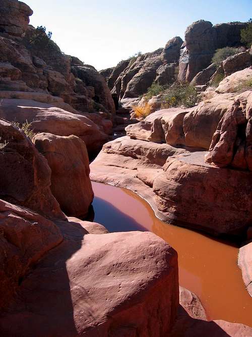 The Slot Begins to Form
Five times a year, the trails in this area are primarily used for the American Motorcyclist Association's trials for dirt bikes. But don't let this fact deter exploring the canyon...the area is very pristine despite the motorcycle use.
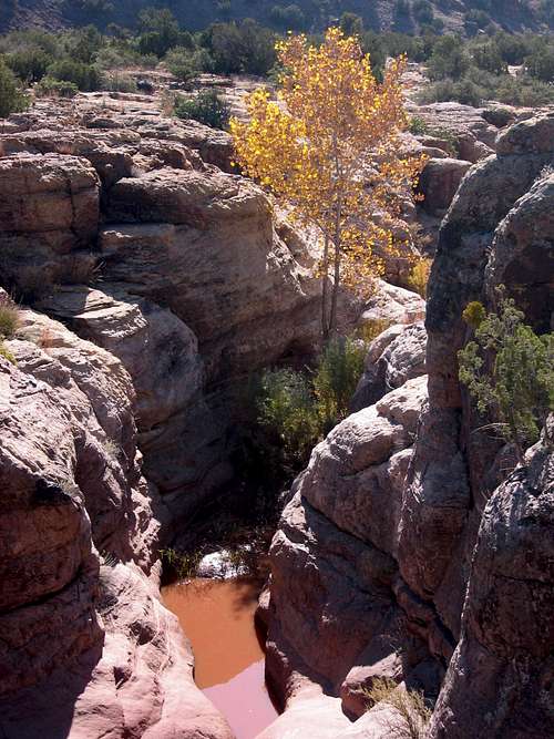
A Survey of the Canyon from the Rim
The main evidence of their passage is the large parking area and the single-track trails that run through the area. These single tracks look very much like mountain biking trails, are often used by mountain bikers, and don't show evidence of too much wear. Despite its proximity to Albuquerque, most people do not know about this area. The majority of the year it is usually deserted and open for solitude, hiking, bird-watching, canyon scrambling, and mountain biking.
The area lies on the southern end of the Nacimiento Mountains which is made up of granite, gneiss, and schist. The Trials Area is mostly sandstone, and forms the southeast edge of the Colorado Plateau. To the north and northeast lies the Jemez Pueblo Indian Reservation and the southern canyon country of the Jemez Mountains. On the east is a spectacular red vertical face formed by the San Ysidro fault. Far to the east, one can see the Sandias and the Ortiz Mountains. Bordering the area on the south is NM 550, the Rio Salado, and White Mesa. White Mesa is well-known for its gypsum deposits which are mined to make wall-board.
This canyon is non-technical but is very narrow in spots, has many pools, and requires wading and possibly swimming depending on the time of the year. The American Canyoneering Academy rating for this canyon would be 1B I meaning that it is non-technical, can be done in a few hours, and may require some wading and/or swimming. Remember to stay out of any canyon if there is any inclimate weather in the watershed area. Flash floods in canyons can be quick and deadly.
Canyon Description
This canyon is fairly straightforward. Once in the canyon bottom, head upstream (north) if you wish to hike and explore the non-slot portion of the canyon. There is a lot of spoor typically including tracks and scat from fox, deer, and bobcat.
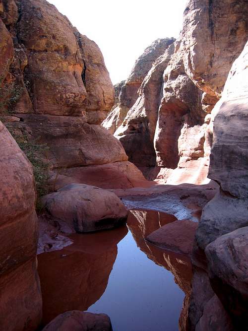 The Entrance to the Slot
Head downstream (south) for about 100 yards to encounter the slot. The walls narrow dramatically and you encounter the first pool that requires wading almost immediately. Once in the actual slot, continue downstream enjoying the twists and turns and the various pools. There is one pool that is definitely a swimmer. Other pools are waders, several waist deep and chest deep. Occasionally there are avenues of escape that allow you to climb to the rim and survey the landscape. Eventually, the walls become shorter until they peter out at the exit point. From here explore another small slot to the east before following the marked motorcycle trail back to the parking lot.
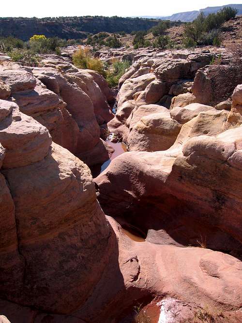 Towards the End of the Slot
Getting There

A Typical Pool in the Slot

Sandstone Curve
From Albuquerque drive north on I-25 10 miles to exit 242 and the town of Bernalillo. Head west on NM 550 through Bernalillo. Once through the town, drive 20 miles to the turn off for San Ysidro and the Jemez Mountains. Continue on NM 550 for about another mile. Keep your eyes peeled for a sign marking a trucker weigh station pull-off. There is a historical marker in this pull-off highlighting that this area is where the Colorado Plateau starts. The parking lot for the San Ysidro Trials Area is directly after this pull-off and is hard to see and easy to miss.
Once in the parking lot, go through the gate on foot and follow the dirt road for about a mile (20 minutes) until it drops down into a drainage and there is a large obvious parking spot on the right with a signboard. Head to the east side of the parking area and find a trail heading east by northeast and marked by a sign depicting a motorcycle rider. Follow this trail east for 10-15 minutes until you hit the edge of the canyon. Head north upstream until you find some cairns that mark easy access down into the drainage. Once in the canyon bottom, explore upstream if you like, but head right (south) downstream for about 100 yards and you will find the beginning of the slot.
Nearby Attractions
Perea Nature Trail: This wetlands is just east of San Ysidro and has a developed trail along the Rio Salado complete with bird blinds.
White Ridge Bike Trails Area: This area is a fantastic mountain biking area about 4 miles south of White Mesa. The turn-off is well marked and several miles east of the town of San Ysidro.
Ojito Wilderness: Located 4 miles further down the same dirt road as the White Mesa Bike Trails area, this trail-less canyon country is a spectacular day hike area.
Jemez Mountains: This southern-most extension of the Rocky Mountains boasts rock-climbing, hiking, and spectacular scenery.
Jemez Pueblo: Just 15-20 minutes north of San Ysidro, this is a great place to get some homemade Fry Bread among other things!
Cabezon Peak and the Rio Puerco Valley: 15 minutes west of San Ysidro is the turn-off that leads to Cabezon Peak - a giant volcanic plug that is ascended via a 4th-class gully on the east side. Other volcanic plugs and hiking opportunities exist further down the valley.
Red Tape
Please respect Indian and Tribal lands and do not cross barbed wire fences to enter. If camping, campsites must be 900 feet from developed water sources and campfires must be attended at all times.
Camping
Dispersed camping for free is allowed, but must be 900 feet from developed water sources. Campfires must be attended at all times.
Maps
The 7.5 minute USGS quad is San Ysidro (NM).
External Links
BLM San Ysidro Trials Area Site
New Mexico Trials Association
Ojito Wilderness
Perea Nature Trail
White Ridge Bike Trails
Jemez Pueblo
American Canyoneering Academy