
Comments
No comments posted yet.
|
|
Trip Report |
|---|---|
|
|
40.05540°N / 111.8295°W |
|
|
Mar 3, 2021 |
|
|
Hiking |
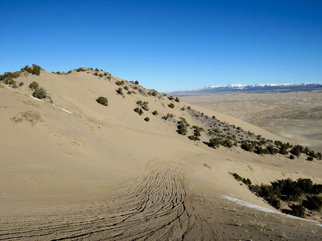
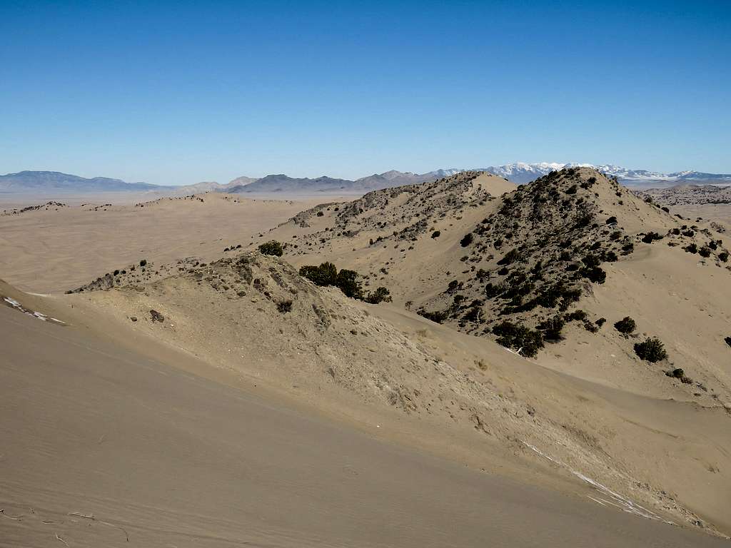
Little Sahara refers to an area of sand dunes 70 miles to the south of Utah’s Great Salt Lake. The highest sand dune in the area is known as Sand Mountain and rises more than 750 ft above the surrounding plain. With an elevation of 5702 ft and prominence of 777 ft, Sand Mountain is Utah’s 3830th highest ranked peak. I was surprised to see rocky cliffs forming the summit of Sand Mountain which has sandy slopes all around.
Unfortunately for the hiker, Sand Mountain and most of the big dunes of Little Sahara Recreation Area are a popular destination for ATV and motorcycle enthusiasts. A much smaller part of Little Sahara has been designated as off limit to motorized vehicles. My original plan was to climb Sand Mountain and then spend the rest of the day exploring the no motorized vehicles part. I wanted to then go to Spanish Fork, Utah to climb West Mountain the next day. Since I made my plans, weather forecast for the next day had turned to rain so I decided to climb Sand Mountain then drive an hour to climb West Mountain.
West Mountain Elevation= 6904 ft
Prominence= 2134 ft
Rank= Utah’s 2416th highest ranked peak
West Mountain sits to the west of the towns of Spanish Fork/Payson, Utah. It rises directly above the southeastern shores of Utah Lake. The distance between the summit of West Mountain and Utah Lake is 1.8 miles but it is 2417 ft taller. At first glance, West Mountain may appear as a not so interesting barren hill but its summit is strategically located to provide you with fantastic views of Utah Lake, The Wasatch Range as well as other area mountain ranges.
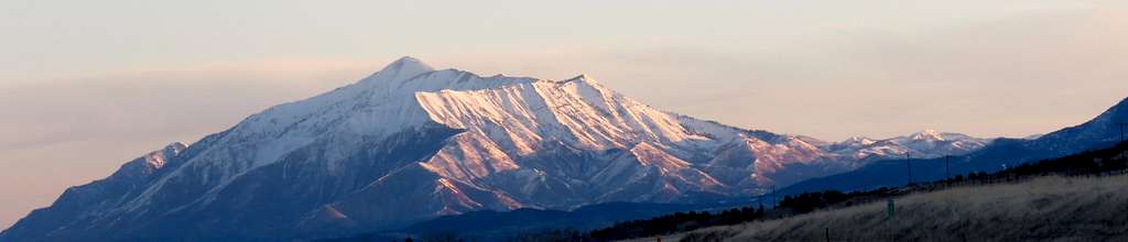
Left the hotel in Ferron, Utah at 5:40 a.m. when it was still dark. I had a 2.5 hour drive to Little Sahara and planned to spend the night in a different hotel in Spanish Fork, Utah. Driving north on Route 28, I could see sunrise over a beautiful peak to the west. Finally found a place to stop and take this picture. I later identified the peak as Fool Creek Peak.
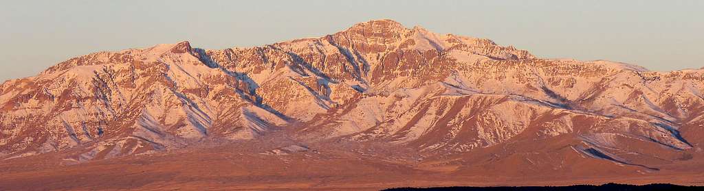
Mount Nebo appeared to the north.
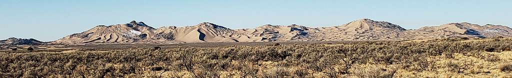
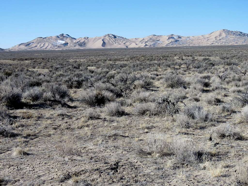
After driving on country roads, I finally reached Little Sahara Recreation Area. No attendant was there but I still had to pay to get in. Since it was early morning on a Wednesday, I was hoping that I would get lucky and not encounter any loud off road vehicles, at least until I climbed Sand Mountain and made it back down but just then I saw a big pickup truck with 2 ATVs on it driving by. Went a little south until the view of the big sand dunes appeared to the south. Some of the dunes had small amounts of snow on them.
Drove to the end of the road at the base of the biggest dune (Sand Mountain). I was amazed to see rocky cliffs on the summit of the sand dune.
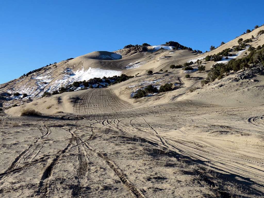
The pickup truck with ATVs was already there. I got into a rush to make it to the top of the dune and back down before the ATVs start running. I had not really paid attention to the map to see that reaching the top of dune required more than 750 ft of elevation gain. Started my hike at 8:30 a.m. It was 37 degrees F and elevation was 4920 ft.
Started walking up the hill fast trying to keep away from what looked like the main motorized vehicle pathway. Did not want to get run over by a fast moving one. I got paranoid thinking that maybe hiking was not allowed there but I had not seen any signs to that effect.
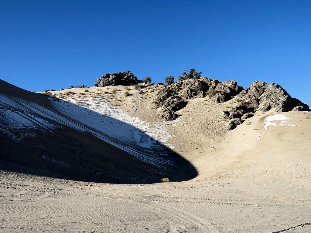
It became quite steep and the sand became unbelievably hard to the point that I could barely sink my hiking poles into it. Did not know if the sand was frozen, compacted by vehicles or was in the geologic process of turning into sand stone. Had to slow down and in some places was even afraid of slipping on the hard surface of the sand. A cold wind began to blow. Finally reached a big bowl just below the summit.
Went up more steep slopes to reach a soft sand ridgetop that lead to the cliffs on top. I heard the loud annoying ATVs starting down below but they did not come up where I was.
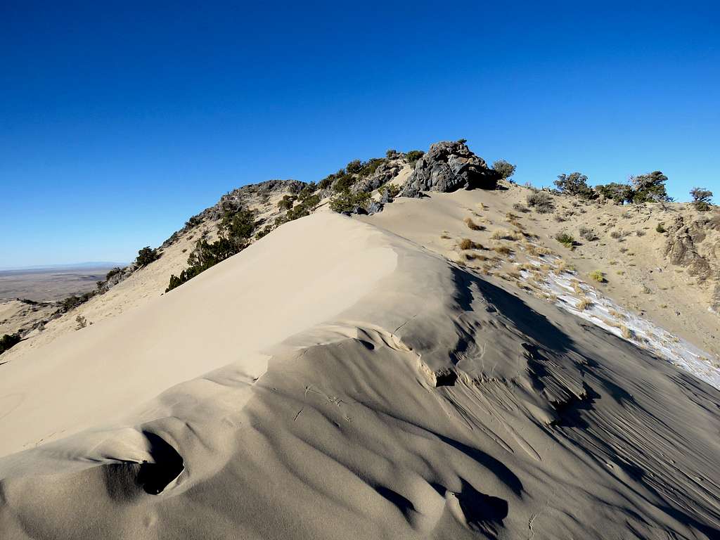
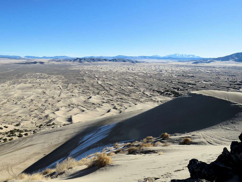
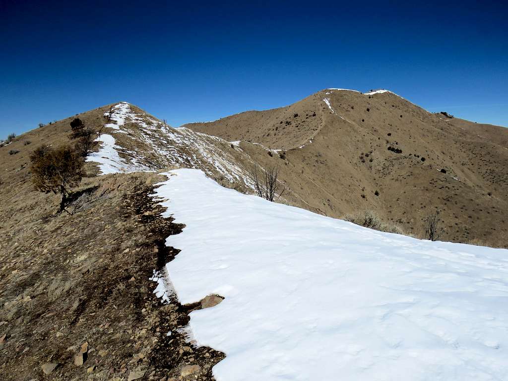
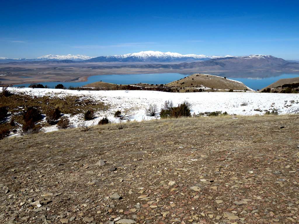
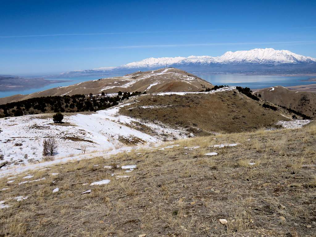
Followed the ridgetop to reach the first cliff. The true summit was a little farther away but to go there I would have had to traverse a steep very hard sand slope. Did not want to slip on that slope and was in a hurry to get back down before the vehicles came my way. Could not believe that crampons and ice axe would have come in handy traversing that slope. I was at an elevation of 5610 ft and had gone 0.81 miles. It was 9:02 a.m. and the cold wind was still blowing. Stood there to take a few pictures.
Looking northwest.
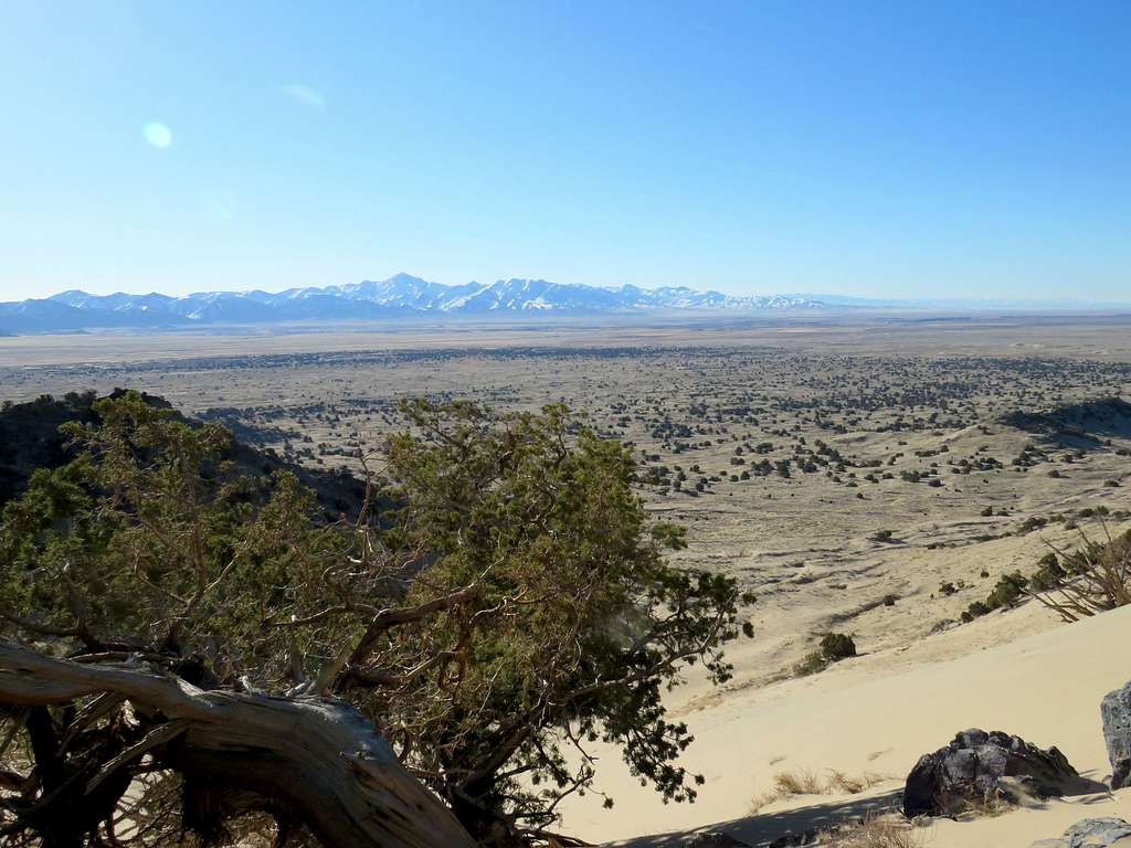
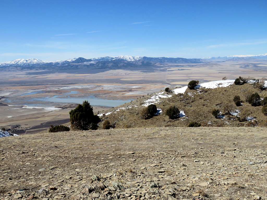
Looking northeast. Tintic Mountain.
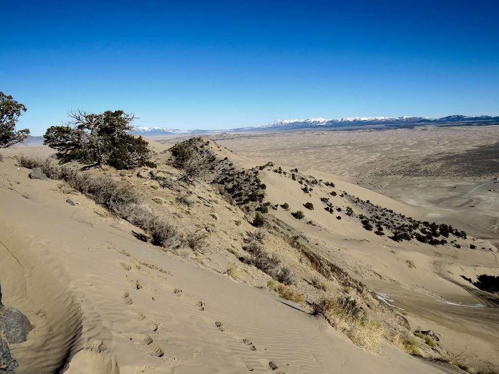
To the southeast, I was wondering if I was seeing the other side of the same mountain I had seen from Route 28 (later I confirmed that I was seeing Fool Creek Mountain).
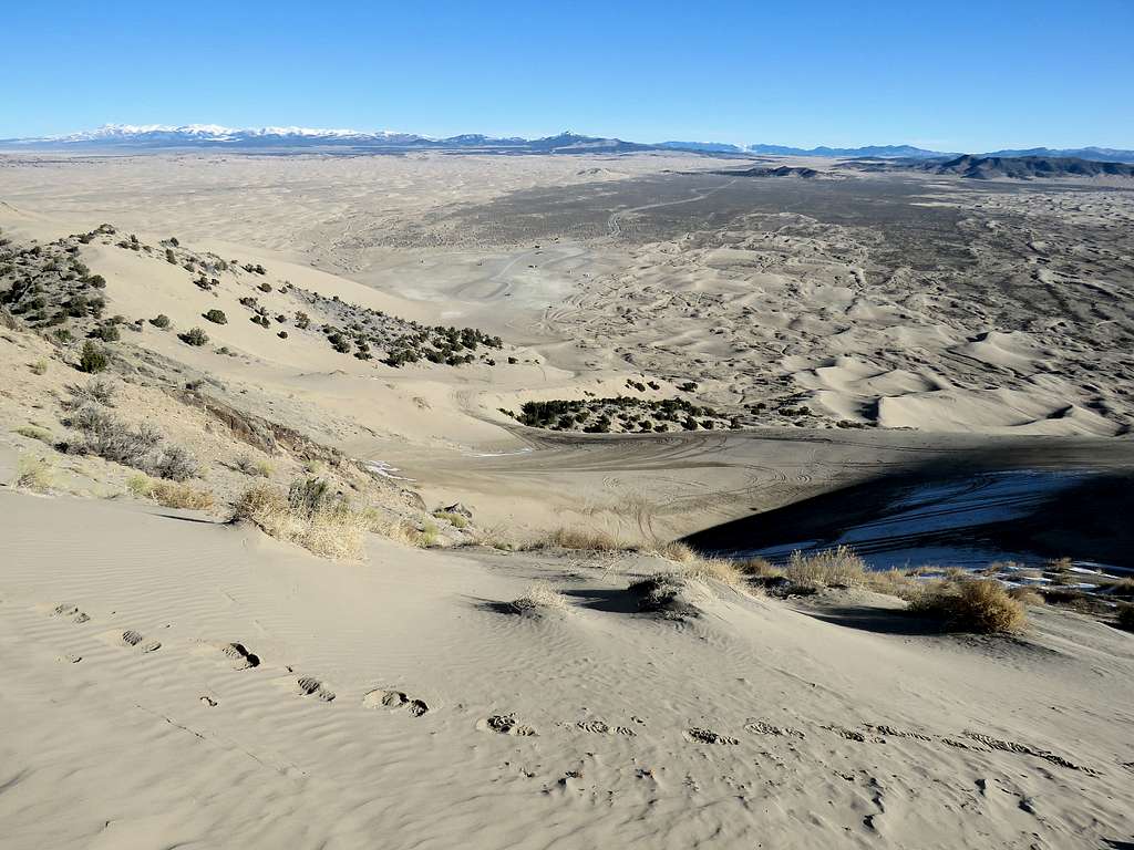
Other views.
I then began to go down the way I had come. The two ATVs and a motorcycle had come on the big dunes but where fortunately still not on my path. Reached my Jeep at 9:27 a.m. having hiked 1.57 miles.
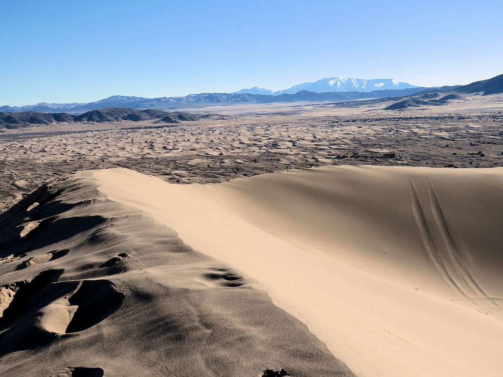
Had a little to eat and drink. Leaving the area, I stopped to take another picture of the big dunes.
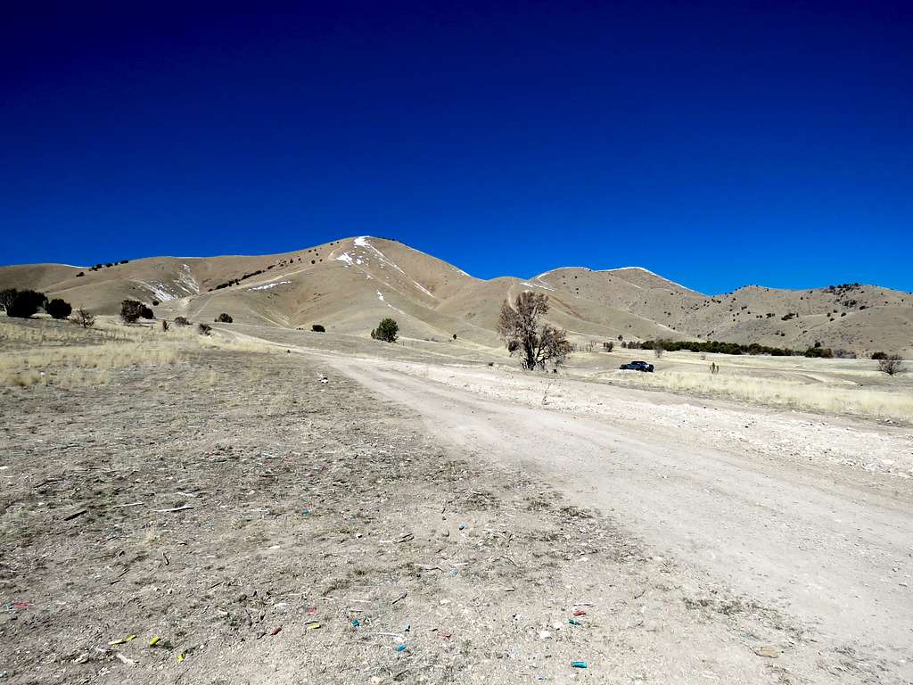
Drove more than an hour to reach the community of Payson, Utah and found my way to West Mountain’s trailhead. I was no longer in the wilderness. I was in greater Salt Lake City metropolitan area next to a noisy landfill. Drove a short distance up a dirt road where I decided to park. Another person had parked a little farther up and was target shooting. Was it safe to leave my Jeep there? Was I about to get accidentally shot by that guy? West Mountain appeared as a desert hill and not that interesting but it was a perfectly sunny day and the snowy Wasatch Mountains were well visible behind me. I knew I would get a great show from the top of West Mountain so I told myself to quit whining and be thankful for the beautifully clear day.
Started my hike at 10:50 a.m. Elevation was 5150 ft. Summit appeared deceptively close but I knew I had a 1750 ft vertical uphill.
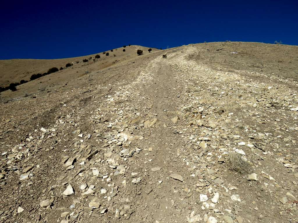
Walked not too far away from where the guy was shooting and continued up the path that became ever more steep going directly up the slope.
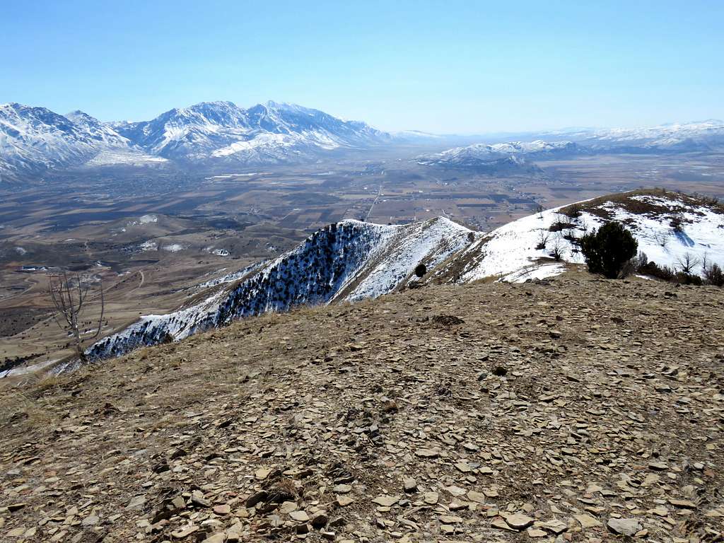
In only 0.8 miles, I had gone up 1300 vertical feet reaching 6450 feet elevation where I found myself on a ridgetop that did a little up and down going toward the summit. I did not see any other hikers but could hear the noise of the landfill and the hum of the city.
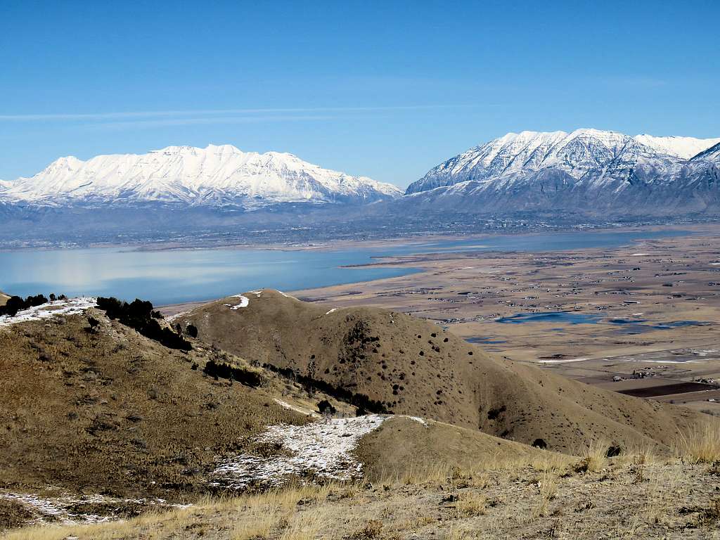
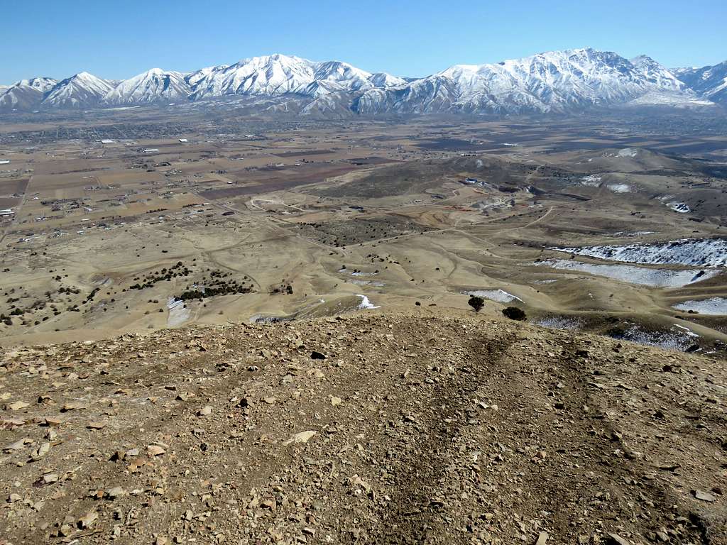
The ridgetop had some soft watery snow on it. Up to 6510 ft and then down to 6390 ft to reach the base of the final push to the summit which was again very steep. Reached the top at 12:15 p.m. and 1.64 miles of hiking. Could not have asked for better weather. The sky was completely clear with views of snowy peaks in every direction. Utah Lake was in good view. The hike had been well worth it.
Looking south at Mt. Nebo, Bald Mountain and Dry Mountain.
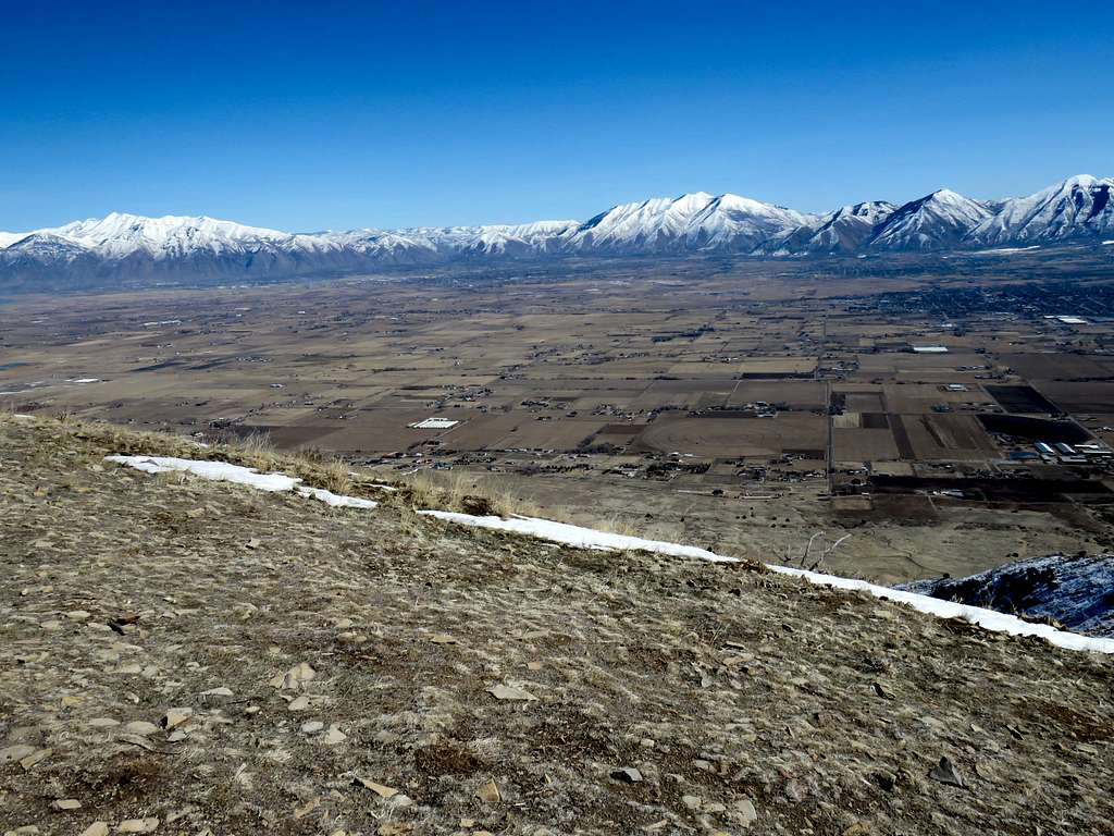
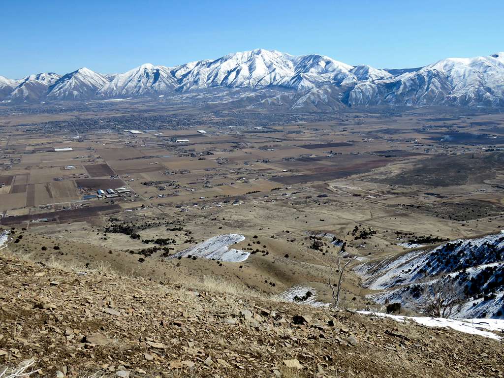
Looking northeast at Mt. Timpanogos, Cascade Mountain and Provo Peak.
Looking northwest at the Oquirrh and Stansbury Mountain ranges.
Twin Summits of Mammoth and Sioux Mountains to the southwest.
Provo Peak and Spanish Fork Peak to the east/northeast.
Santaquin Peak to the southeast.
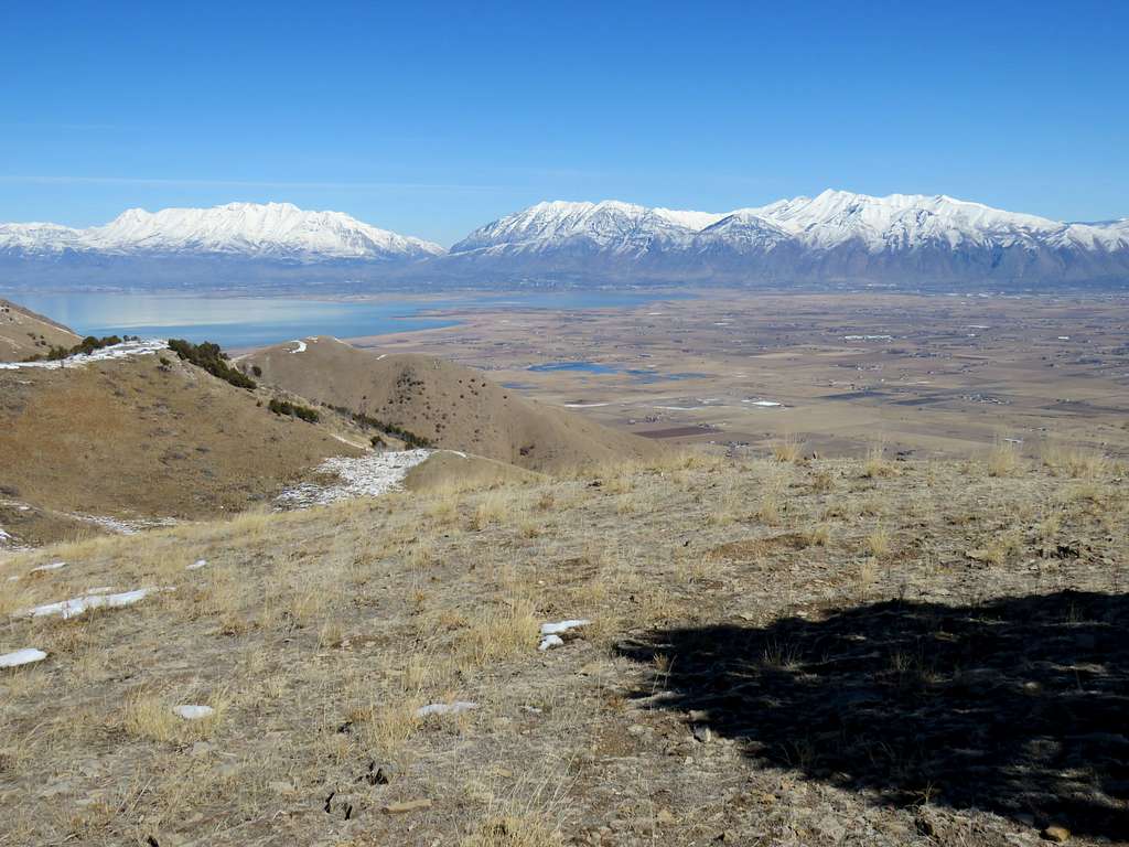
Looking north at Mt. Timpanogos, Lone Peak, Box Elder Peak.
Thought about going to lower high points to the west where I might get better views of Utah Lake but the cold wind was still blowing. I was sunbeaten, wind beaten, hungry, had to go find food, check into the new hotel and worse of all get on computer to do office work so I left at 12:47.
View from the top of the steep slope at 6450 ft. Santaquin Peak and Dry Mountain seen.
Made it back to the Jeep at 2:00 p.m. having hiked 3.31 miles with 2058 ft of total ascent.