
|
|
Route |
|---|---|
|
|
46.56341°N / 11.83494°E |
|
|
Hiking |
|
|
Summer |
|
|
Half a day |
|
|
EE |
|
|
Overview
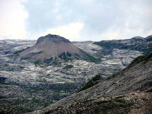
Sass de Ciampac Normal route
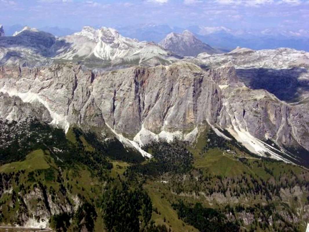
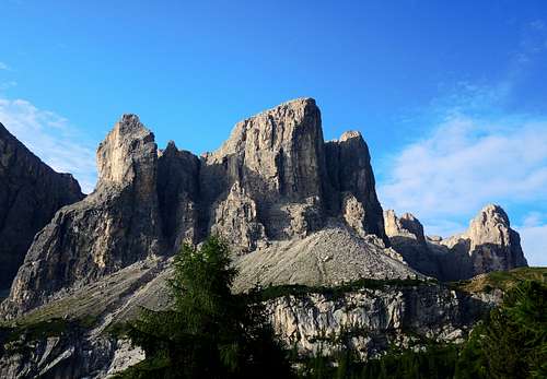
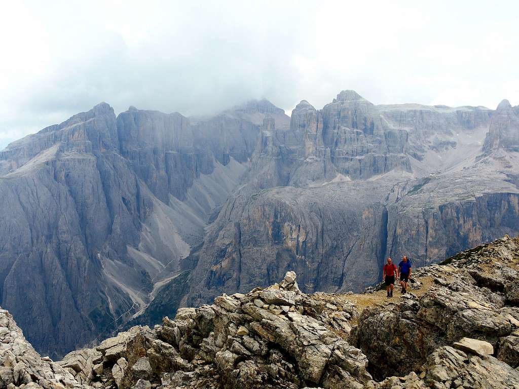
Sass de Ciampac 2672 m is a mountain in the Dolomites located thereabouts Passo Gardena and belonging to the Puez group. Towards the South Sass de Ciampac projects a vertical wall dominating the village of Colfosco. This stunning wall doesn't allow to imagine that it's possible to reach the summit without climbing.

The two sides of the mountain are in fact very contrasting. Indeed the standard route doesn't oppose any alpine difficulty. It's an easy hike from Grödner Joch / Passo Gardena, which crosses the beautiul Crespeina Saddle, from where the north-west slopes of the mountain can be climbed via a marked trail. On the contrary, to the South the mountain drops for several hundred metres towards Colfosco. On this wall of good dolomia there are a dozen climbing routes of all difficulties leading to the top.
Getting there
The starting point to climb Sass Ciampac is Passo Gardena (Grödner Joch) 2121 m
Road access to Passo Gardena
Passo Gardena is a mountain pass connecting Val Gardena with Val Badia and it can be quickly reached starting from Corvara or Colfosco (Val Badia) or Selva (Val Gardena).
Route Description
Sass da Ciampac Normal route
Summit quote: 2672 m
Difficulty: EE
Difference in level: 550 m
Starting point: Passo Gardena
Fine and popular panoramic balcony on the Sella group and the Odle plateau reachable through marked paths and without mountaineering difficulties
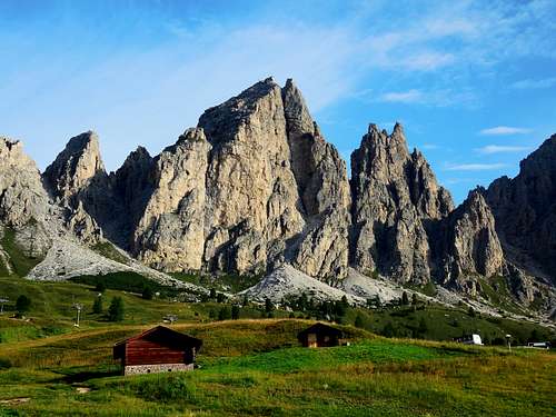
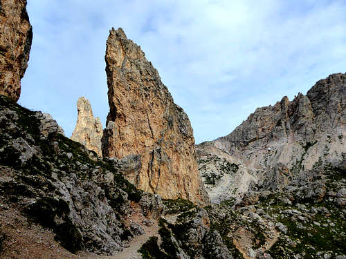
Start the hike on Passo Gardena 2121 m, taking a wide mule track just below the pass on the Val Badia side. The mule track quickly leads to the Rifugio Jimmy (former hut Ütia Clark) 2222 m. Here leave the mule track and take the path n. 2 which allows us to gain quickly altitude, while the view widens more and more both on the Sella group right in front and in the direction of the Sassolungo. Thus we reach a very characteristic point with a series of strange rocky pinnacles of the most disparate shapes.
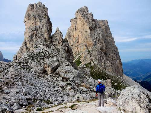
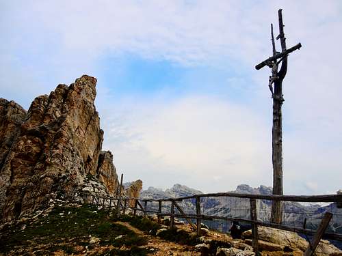
The path goes around some of them, then climbs up a short slope leading to Passo Cir m 2468 with a last steep stretch of hairpin bends. Here the itinerary changes completely the side, taking in fact a steep path that descends for about fifty meters on the opposite side (Val Chedul). With a flat stretch and a last ascent the route reachs the beautiful Forcella Crespeina 2528 m, where it's located a cross. From the wide saddle the route turns right (signposts "variant Sass Ciampac") and take the ridge, with a short section on a narrow path and a few meters on easy rocks in the beginning. Still following the summit ridge, the route reaches the summit cairn.
Descent: reversing the same itinerary
Essential Gear
Normal hiking gear, high mountain clothes and mountain shoes
Red Tape
Paying parking on Passo Gardena (5 euros in 2019).
Sass de Ciampac is located inside the Puez-Odle Natural Park, one of the nine areas acknowledged as an UNESCO World Heritage Site.
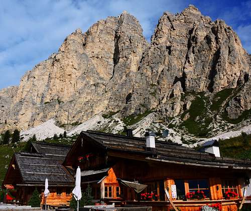
Rifugio Jimmy
When to climb
Summer is the best period
Hiking and scrambling scale
T - Turistico (Tourist): Itineraries on wide, clear and well worn paths, sometimes on mule tracks or gravel roads. The routes are never exposed, don't give any orientation problems and don't exceed 2500 meters of altitude. Suitable also for children.
E - Escursionisti (Hikers): Itineraries on marked trails, even narrow and with possible steep and impervious sections. They are never exposed and don't give any orientation problems. They can tread different kinds of ground, such as forests, gravel, meadows, pastures, easy rocks, etc.). They form the majority of the trails that wind up in the mountains and require a certain habit to walk; you need equipment suitable for the altitude and resistant footwear with soles suitable for rough terrain.
EE - Escursionisti Esperti (Experienced Hikers): Itineraries for hikers with experience and good knowledge of the mountain. Some of these paths may have exposed sections, however brief, which require firm foot and no dizziness. They require the ability to adapt to particular terrain, such as steep grassy slopes or stretches of rocks with difficulties that can reach the 1st degree of the UIAA scale. They can also reach high altitudes (3000 m or more). Sometimes they may include unmarked sections, requiring a good sense of orientation. Snow slopes are possible, however which can be overcome without specific mountaineering gear (rope, harness, crampons, ice-axe).
EEA - Escursionisti Esperti con Attrezzatura (Experienced Hikers with equipment - The same as EE, in addition these routes require the use of via ferrata equipment (lanyards, harness, carabiners, heat sink, helmet). This kind of itineraries range from the trails with short easy and not much exposed sections, previously equipped with fixed ropes and iron pegs, to the true and more difficult Via Ferratas climbing on rocky walls or on aerial ridges and ledges, previously equipped with long stretches of iron ropes, iron steps, ladders without which proceeding would constitute a real climbing. It is necessary to know how to use the technical equipment and have a certain habit of exposure and mountaineering terrains.
Where to stay
Various possibilities of accomodation both in Val Badia and Val Gardena
Bibliography
"Puez-Odle" - Collana Guide Monti d'Italia CAI-TCI
Meteo Forecast
METEO PROVINCIA BOLZANO ALTO ADIGE