Toggle navigation
Mountains
Routes
Images
Trip Reports
Forum
What's New
People
Areas & Ranges
Articles
Trailheads
Canyons
Huts & Campgrounds
Albums
Logistical Centers
Fact Sheets
Lists
Custom Objects
Gear
Plans & Partners
WELCOME TO SUMMITPOST
SIGN IN
REGISTER
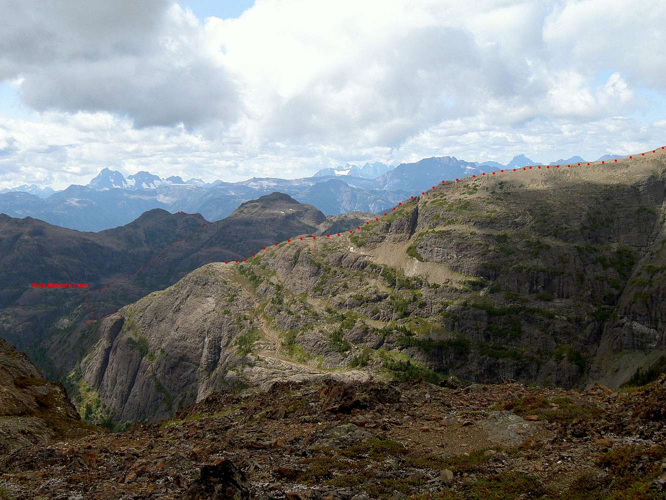
SE Aspect of the route
View High-Resolution Image
SE Aspect of the route
The route down the SW ridge of Mt Albert Edward, across the divide up to the saddle above Ruth Masters Lake and beyond. Augerpoint summit just left of centre in the middle ground. Taken from the summit of
Mount Frink.
« PREV
NEXT »
vancouver islander
on
May 23, 2006 10:03 pm
Comments & voting
Other parents
Image ID:
195802
3520 Hits
72.08
% Score
2
Votes
Log in to vote
Comments
No comments posted yet.
to post!
Don't have an account?
Augerpoint Mountain
(Mountain/Rock)
You are at
the First
Image
Viewing
#1 of 1
GALLERY
You are at
the Last
Image
vancouver islander's Image Gallery
« PREV
Viewing
#1156 of 1858
GALLERY
NEXT »
Augerpoint Mountain
(Mountain/Rock)
Loading....
×
You need to login in order to vote!
User Name
Password
Remember me
Forgot your password?
Log me out when I close my browser.
Keep me logged in all the time.
sign in as a user
Don't have an account?
Register now for FREE
Rating available
Suggested routes for you
People who climb the same things as you
Comments Available
Create Albums
Register Here


