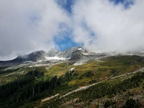
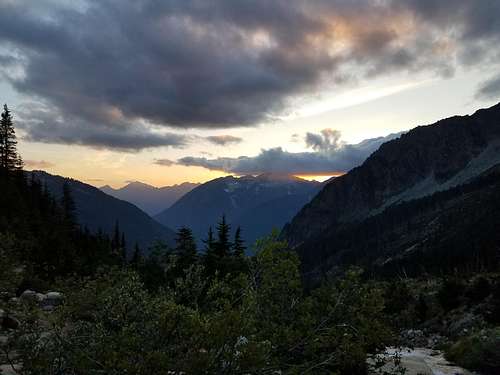
Approach to Boston Basin
My fiance and I have been itching to get out to Boston Basin, and we are so incredibly happy that we did! Although it was a little bit clouded when we got there, the clouds rolled away quite quickly and we had a beautiful sunny day in the Cascades. Starting off, the parking lot/turn-off for the basin is fairly obvious and had a good amount of parking space (we got there around 9:30 on a sunny Saturday and found a spot!) The parking lot is at mile 22 of the road, and the end of the road is at mile 23, so if you feel uncertain about the pull-off, just go to the end and backtrack a mile! The entrance to the trail is on the north end of the pull-off, and the climbers trail is very obvious up until the basin. The trail is around 3 miles in length, a little bit over 2,000ft of elevation gain, and does have a few minor creek/river crossings that weren't anything crazy.
![Unnamed Image]()
When we got to the basin the clouds were covering the peaks, but they soon rolled away.
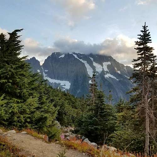
Once in the basin, we enjoyed a nice break with a beautiful camp-site and quite frankly, the best outdoor toilet we have ever stumbled upon! This was at the Low camp at 5,300 ft.
![Unnamed Image]()
The view of Johannesburg from the Low Camp
We got to this camp at 11:30, and because we were doing a day climb, we trekked on.
Moving Past the Low Camp
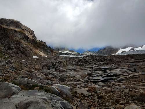
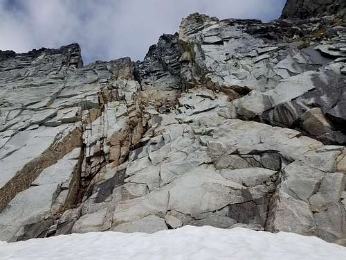
Because we were doing this climb in mid-August the Quien Sabe glacier was melted out and pretty choppy, so we decided to stay on the rock as much as possible and skirt the glacier to the climber's left. This was fairly easy and fun hiking, and the transition on to the glacier was very straightforward. When we hopped on to the glacier, we were pretty much as far climbers left as one could possibly get. This made for no uphill travel on the glacier, only traversing across it (which we wanted as we had very minimal traction - bring at least microspikes!)
![Unnamed Image]()
Our approach up the rocks just to the right of the moraine. You can just see Sharkfin behind the clouds!
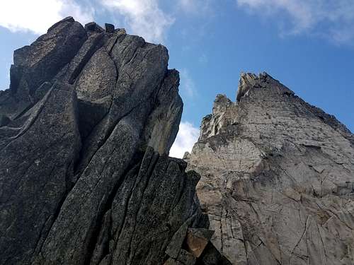
![Unnamed Image]()
Up on the glacier! Sharkfin is the rightmost peak in this picture. Note all of the rocks on the glacier - lots of loose blocks in this area.
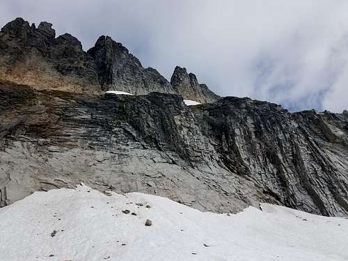
Finding the chute up to the base of the 3 pitch climb is (from what I had dug up from past attempts) one of the trickiest parts, however we believe that we found the correct chute as it felt like an easy class 2-3 scramble, route-finding was extremely easy, and it led exactly to the base of pitch 1 without traversing. From down lower in the basin, you can see this area and we went for the notch that was on the climber's right side of Sharkfin itself. It was the chute that had the lowest notch in the shelf. The moat at the base of this section was pretty borderline at this time of year, and I suspect it is getting worse rapidly. We were able to scout it, probe it, and find a good solid place to hop across, however there were many undercut sections. I would not have done this without scouting and without a rope.
![Unnamed Image]()
This is the base of the class 3 scramble that we did, and unfortunately this pic looks just like any other chute up there so it may not be helpful. But if this helps anyone, then awesome! Unfortunately we didn't get a very good beta pic of it.
This is where you begin very cautious climbing, as there is a lot of loose rocks, and rockfall is a big danger here. We got to the base of the first pitch at 4pm, and decided to call this our summit. We had chosen to take our 30m, 8mm diameter glacier rope, and decided we wanted something a little more beefy for the extremely exposed, very jagged portion of the climb. Though it is always disappointing to not complete a climb, we were very happy to be out in the Cascades and to be able to scout this area that we have been trying to get out to.
![Unnamed Image]()
Picture from the bottom of pitch 1, 100-200 ft from the summit!
The Descent
All in all, an average descent with no crazy route-finding mishaps. We spent an hour at our summit and got back to the car at 9:30pm - it was a long day!
Although we loved having a day of fast and light, we both agreed that next time we come in to the basin, we want to stay a night at the Low Camp - it was so beautiful and would be worth the time to be more energized.
Another great day in our beautiful state!
Comments
No comments posted yet.