|
|
Mountain/Rock |
|---|---|
|
|
45.58870°N / 115.08814°W |
|
|
Idaho |
|
|
Summer, Fall |
|
|
8405 ft / 2562 m |
|
|
Overview
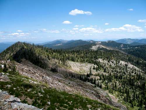
 The broad east face of Sheep Hill.
 Summit and lookout
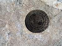 Summit marker
 View from Sabe
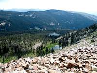 Rattlesnake Basin
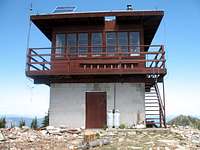 Lookout
 Point 8,094
 North ridge
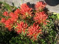 Rocky Mt paintbrush
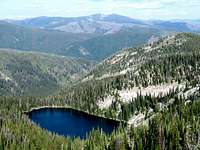
 Sheep Hill above lake basin
 Unnamed point 8,202
Sheep Hill is a large lenticular shaped mountain in the southern portion of the expansive Clearwater Mountains of north central Idaho. This area of the Clearwater Mountains is the highest with many 8,000+ foot summits rising above the low elevation canyons of the upper Selway and Salmon basins. The east side of the mountain is formed by a very steep mix of cliffs and large block talus that falls off 1,400 feet into the headwaters of Rattlesnake Creek. The south supports a broad basin near the summit and ridge continuation to the Salmon River over 5,800 feet below. The bottom of the large Bargamin basin is 4,000 feet below to the west and to the north the long ridge extends north with a deep ravine like cirque to the northwest. The views are especially spectacular to the south across the deeper than a mile Salmon Canyon to the Salmon River Mountains and southern Bitterroots. Sheep Hill is the highest point between Mineral Hill in the Gospel Hump area to the west and Salmon Mountain to the east; a distance of 41 air miles. On its longitude there is no higher point north of the Salmon in Idaho and none until well into Canada.
The 8,405 foot mountain has 1,665 feet of prominence and is the highest point in the extensive ridge system that forms the east boundary of Bargamin Creek and the upper portion of Running Creek. This extended ridge is peculiar in that it is the highest ridge around, but runs north and south crossing the main Salmon/Clearwater divide perpendicularly, while most large geographic features in the Clearwater and upper Salmon basins run east and west. This ridge system runs over 20 miles and has several points over 8,000 feet. The three summit basins support four lakes with Goat Lake in the north basin, Sheep Spring Lake in the south basin and two lakes, Rattlesnake and an unnamed lake to the east. The long hike to Sheep Hill from Dry Saddle passes by eleven other lakes.
While the area is beautiful, wildfires have diminished the appeal somewhat leaving much of the area a standing dead forest. Fires are not generally suppressed in the wilderness areas and after several years of severe burn conditions, there isn’t much left to burn with tens of thousands of acres impacted. Beautiful, lush green forests can be found in the upper Rattlesnake basin and the Lake Creek Lakes basin north of the mountain.
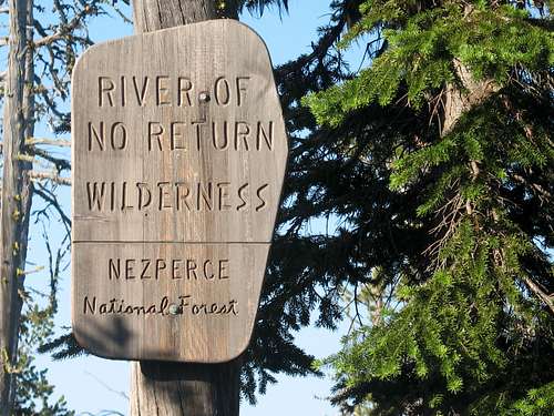
Though the mountain is quite remote, the lookout reports that he gets a fair number of visitors. This is probably due to the he Idaho Centennial Trail (see map) that crosses over the summit and connects the Salmon River to the Magruder Road at Dry Saddle trailhead. There are also multiple lakes in the area, an active lookout to visit and several outfitters packing into the Frank Church River of No Return Wilderness. Hunters with stock frequent the area in the fall so wear orange and be aware. In addition the area supports a good wolf population so consider leaving the dogs home.
Getting There
 Looking north over the route from Sheep Hill
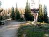
 Trailhead
 Shadows near trailhead
 Trial forks
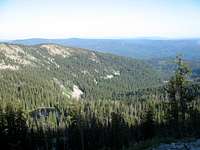 View northwest
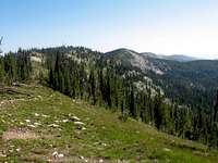 North on ridge
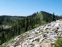 Saddle Point
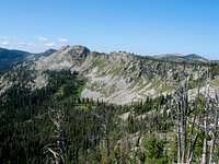 Point 8,202
 Trail relocation area
 Into the lake basin
 Deadman Saddle
 North ridge area
 Summit ridge
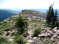 On top
 Snag city
 Sabe Mountain
 Grouse
The Drive
From Highway 95, turn east into Grangeville and continue on main street (Highway 13) for a long mile to the east edge of town. Town ends abruptly at the intersection of Highway 13 and the Mt. Idaho Grade road. From this intersection turn south (right) on the Mt. Idaho Grade road. After driving approximately 0.7 miles take the curve to the left at the drive-in theater (the curve is the main road). Continue on through the cluster of houses known as Mt. Idaho and soon the road will descend into the deep canyon of the South Fork of the Clearwater River. The road hits the canyon bottom and Highway 14 joins from the left, 9 miles after the theater curve.
At the bottom of the grade continue straight for 38 miles to the Red River Road. Turn right and continue up Red River for about 14 more miles to Red River Ranger Station. Turn right (keeping on the pavement) and go through the Ranger Station for 0.4 mile to the Montana Road, Forest Service Road 468 (also known as the Magruder Road or the Nez Perce Trail Road). Turn left off the pavement on this road and continue 19 miles to the junction of road 285 to Green Mountain. Keep right and go approximately 31 miles to trailhead at Dry Saddle . From Grangeville, the total drive will take approximately three hours depending upon traffic and driving conditions.
Caution should be taken on much of this route. For several miles on Highway 14 just east of the base of Mount Idaho Grade, the road is very narrow and twisted. Watch the speed and stay on the right side of the road and hope the oncoming traffic (largely composed of RVs and logging trucks) does as well. The shoulder is falling into the river on this already narrow road and in some places even the white strip is going, leaving absolutely no space between you and the river. On the mountainous portion, the road is very narrow and steep from a little beyond the junction with Road 285, which is about 19 miles in from the pavement, to Poet Creek. If you meet another vehicle, one of you could be backing up a long way.
Part of the adventure of going into this part of Idaho is driving along the South Fork Clearwater River. This small, but beautiful river has a steep grade over endless boulders of class III, IV, and V whitewater in the spring. About 10-15 miles upstream the canyon tightens into a spectacular gorge with miles of technical climbing that is never climbed. Low elevation mountain goats are not an uncommon site here on large granite walls. All is especially beautiful in the fall when the larch and broadleaf trees lining the rocky stream turn gold. The river also supports good runs of steelhead and Chinook salmon, which can be seen jumping some of the small waterfalls during the appropriate season.
The Trail
The trail system south of Dry Saddle is well maintained and used heavily by stock packers, outfitters and guides. To reach Sheep Hill from Dry Saddle requires about 10 miles (one way) of hiking on fairly gentle terrain. The trail is well located on broad ridge tops, often cutting through saddles and contouring across slopes of higher points to minimize vertical gain and loss. A day hike would be a very long and arduous undertaking but it is possible. There are several nice lakes along the way to camp.
The trail is very straight forward for the first five miles to the saddle above Saddle Lake. Here it is possible to get turned around a bit. Just through the saddle an old trail sign for Ring Creek Point is encountered. This appears to be the wrong trail on the maps. If you back up and look to the west a trail can be seen heading in that direction. Its easy to miss before finding the mentioned trail sign. If you follow the trail to the west it continues across the slope before descending a rocky ridge to the saddle on the west side of the ridge point. Its best to skip this trail to the west and continue on the trail past the Ring Point sign. New construction has taken the main trail beyond this sign and the trail will soon loop down to the right (west) and cross the lower slope below the old trail before meeting it at the before mentioned saddle. This latter way is the better way to go.
From this saddle continue on the trail along the ridge, and then it will drop down through a dense forest to the Lakes Creek Lakes basin. These three lakes are not on the main trail, but can be reached with short spur trails. The trail will climb out of the south end of the basin and turn right on the east side of the main divide. There will be many trails intersecting here, but stay on the main one that visibly will be going toward Sheep Hill, which has been intermittently visible at high points for the previous couple miles. The trail will follow below the north ridge and slowly climb until reaching the top just before the summit lookout.
Red Tape
The ares is included in the Frank Church, River of No Return Wilderness. Standard wilderness regulations apply.Camping
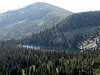
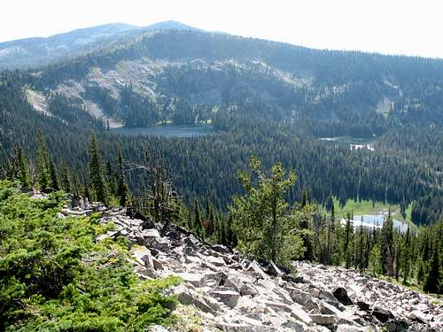 Lake Creek Lakes below Sheep Hill
 Upper lake
There are several primitive camping opportunities in the area. There are designated campgrounds at Poet Creek a few miles west of the trailhead and Dry Saddle at the trailhead. Neither has much in the way of services other than pit toilets and some places to park a vehicle and put out some tents. Water at Poet Creek comes from Poet Creek or Bargamin Creek, which join at the campground. There is no water at Dry Saddle.
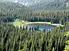
 Saddle Lake
With difficulty it is possible to drive to the summit of Burnt Knob just to the north and camp there. The lookout is unlocked so one could sleep inside if desired. There are flat spaces for a tent or to park a vehicle. Much of the forest in the area has burned, but the views of the lake basin below still make this a very scenic camping option. Just below this summit at the trailhead north to Three Prong Mountain there are some good flat tent spots that would make a good camping spot as well. There are several lakes between Dry Saddle and Sheep hill that would provide nice camping experiences. The closest are the three Trilby Lakes that are a little over a mile down the trail. There are four lakes on Sheep Hill itself and the three Lakes Creek basin lakes are two miles north. Finally there are several good pullouts for dispersed camping at a number of places along the road between the Selway River and Red River Ranger Station. But bring water because most are dry.


When To Climb
Obviously the summer is the best time to reach this summit. The Montana Road is not cleared in the winter so it is impossible to get anywhere near the mountain during that season. At this high elevation come prepared for any kind of weather regardless of the time of year, even on days that seem warm in the morning. Storms can and often do blow up out of nowhere and can drop temperatures dramatically and bring rain or snow. It is possible to snowmobile along the Magruder Road, but it’s a long way to Dry Saddle from the accessible ends of the road. Generally it’s a good rule to only snowmobile as far as you are willing to walk out. If this rule is followed, it is not possible to get close to the trailhead in the winter. And the mountain is several miles from the trailhead at Dry Saddle.More Information and Current Conditions
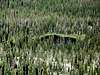
 Yellow buckwheat
Go to the mountain prepared for variable conditions. Weather and temperatures can vary dramatically between the canyons and the mountain. While it’s a relatively safe mountain with easy terrain, any trip this area should involve caution and good planning. It’s a very long day hike to the mountain and the trailhead is hours away from anywhere on a primitive road.
Before traveling the Magruder Road or for more information and current conditions in the vicinity, contact the Nez Perce National Forest or the Red River (Elk City) Ranger Station.
Nez Perce National Forest
104 Airport Road
Grangeville, ID 83530
208-983-1950
Red River Ranger Station
Elk City Ranger Station
300 American River Road
Elk City, ID 83525
208-842-2245
NOAA Forcast