
|
|
Route |
|---|---|
|
|
4.02685°N / 86.20797°W |
|
|
Download GPX » View Route on Map |
|
|
Hiking |
|
|
Most of a day |
|
|
moderate |
|
|
Overview
Shelly Mountain is the highest peak of the White Knob Mountains in southcentral Idaho (11,278' or just over 3438m elevation). An alternate route is described here (see Shelly Mountain page by SummitPoster mtybumpo, who details the East Ridge route via Sawmill Canyon). The start of the route is Antelope Pass, approximately 4.4 airmiles or ~7.1 airkilometers almost directly south.Getting There
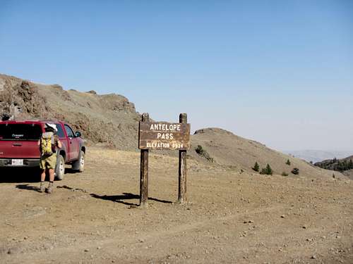
Antelope Pass
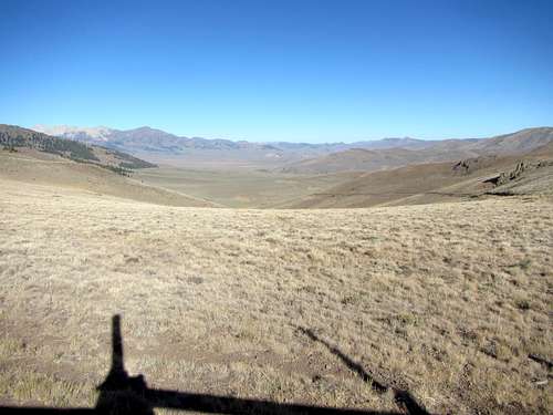
southerly view from Antelope Pass (into Antelope Creek drainage)
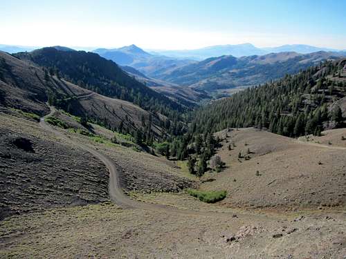
northerly view from Antelope Pass (into Copper Basin)
Route DescriptioExternal Links
Nearby camping
No official developed campgrounds are found along FR135 between Copper Basin and Antelope Guard Stations, but several are established beyond these stations (e.g., Lake Creek or Iron Bog campgrounds - inquire in Mackay or check the Challis NF page at USFS.gov). Dispersed camping is permitted along FR135. The best vehicle campsites are found south of the Pass along Cherry Creek and Larkspur Canyon, and also south of Bear Creek Summit along Death Canyon Creek. Lastly, some sites are to be found in the vicinity of the Antelope Guard Station (patchy private property holdings occur past this point). One could camp at the Pass itself in fair weather.
Route Description
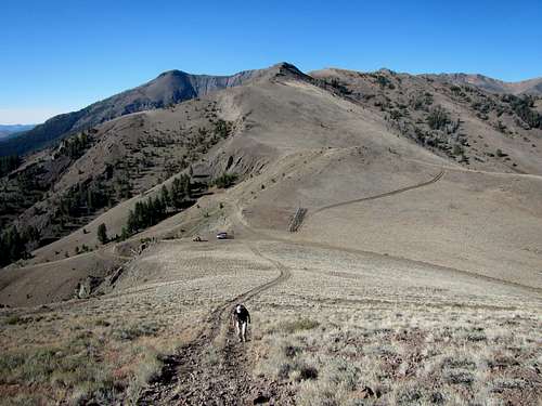
The route is mentioned by Tom Lopez in his excellent book, Idaho, a climbing guide: climbs, scrambles and hikes (2000, the Mountaineers, Seattle WA) under "Approaches to the White Knob Mountains". There are no route-finding difficulties. From Antelope Pass, ascend a rutted hillside to the north. After a few minutes uphill walking, the White Knob Mountains appear in view over the rolling windswept east-west divide between Antelope Creek drainage and Copper Basin. Shelly Mountain is prominently seen. Timber is sparse - a few peripheral stands of gnarled whitebark pines are seen. Much of the hike is on well-drained soil/rock derived from volcanic activity (cindery gravel, etc.). As one gets to the base proper of the White Knobs, the rock layers become different in nature (sedimentary) and pretty bare of vegetation. Some marine fossils (e.g., horn coral) are seen in the limestone as one ascends the SW ridge leading to the summit of Shelly.
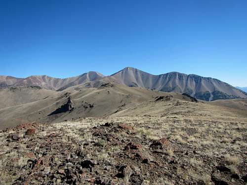
Shelly Mountain prominent on the horizon, with Lupine Mountain on the route there. Small Lupine Mountain (9554' or 2912m elevation) is in the foreground just left of being in line with the peak of Shelly Mt. It is not very prominent but has a survey marker on the summit. The west/north slope of Lupine Mountain is marked also by a volcanic plug.
Trailhead: Antelope Pass: Cherry Creek headwaters to left (~south) of pass (a tributary of Antelope Creek) and Copper Basin to right.