Approach
The Pointe de Drône is located a little west of the pass of Gd. St. Bernard on the border between Italy and Switzerland. The trailhead therefore is on top of the pass at 2469m of altitude. To get there be sure to miss the tunnel - you need to get to the top along the long and winding road!
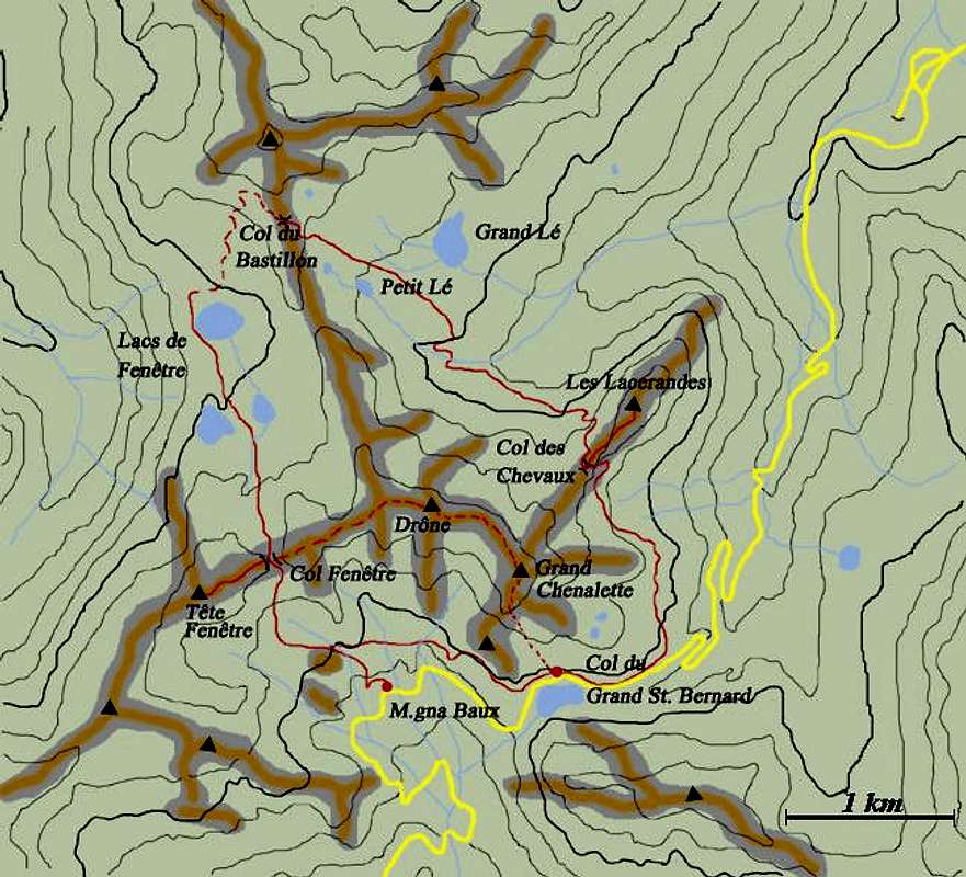
![]()
Interactive overview map of the Pointe de Drône area |
Overview
360° pano (made of 20 single images) from Tête de Fenêtre de Ferret 2823m: moving the cursor you can see the overall view
|
|
Though technically speaking not an ascent route to the summit of the Pointe, this roundtrip deserves an own post. Several SP-members have done the tour - more than have been to the top, I suppose - and it is the perfect way to spend a day among the highest summits of the Alps without actually having to climb them. The tour climbs through four passes and travels by a multitude of alpine lakes and gives you a day's worth of hiking and climbing fun.
|
1er Etappe: Col du Gd. St. Bernhard - Fenêtre de Ferret
|
The first stage starts as does the route along Fenêtre de Ferret - you head down the road on the Italian side of Gd. St. Bernhard and after some 1500m head right and upwards directly for the pass of Fenêtre de Ferret at 2698m. The climb takes about an hour. It is possible to avoid all the descent from the pass along the road (on the italian side) by a traverse that starts near the statue of St. Bernhard, so reaching the trail towards Fenêtre de Ferret at a point nearer to the Pass. Alternatively you can climb Pain du Sucre (2919m), which is situated a little south of the Fenêtre. The ascent takes another hour both ways. Still another possibility is to climb to Tête de Fenêtre (2823m) to the west of the pass.
|
2nde Etappe: Fenêtre de Ferret - Col du Bastillion
|
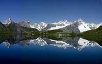
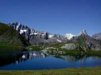
From Fenêtre de Ferret head down- and northwards towards the three Lacs de Fenêtre. This is a quite attractive and popular destination which can also be reached from Val Ferret on the Swiss side of the mountains. From the Lacs you have great views of Grand Golliat (3238m) and of Mont Dolent and Tour Noir. From the northernmost lake head a little to the northwest where a scramble to the next destination, Col du Bastillion (2757m), starts. This scramble is in some places (especially at the top) a little exposed but poses no serious problems.
|
3eme Etappe: Chemin des Chevaux
|
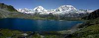
From the Col head downwards toward the Lakes Grande and Petite Lé. A little before the lake an unmarked trail heads along and below Pointe de Drône. This trail is rather exposed in places so you might want to take the marked one which heads straight ahead (southeastern direction) between the two lakes. It descends into a creek bed, the Combe de Drône and later climbs steeply to the next pass - Col des Chevaux (2716m). From here to the starting point at Col de Gd St. Bernhard it is an easy downward hike, again affording great views of Mont Velan and Grand Combin.
|
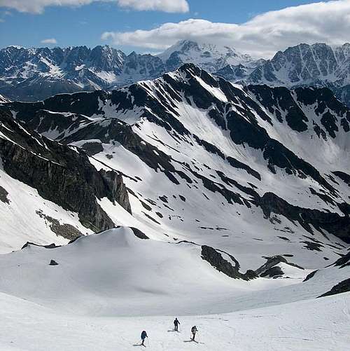
Ski Mountaineering
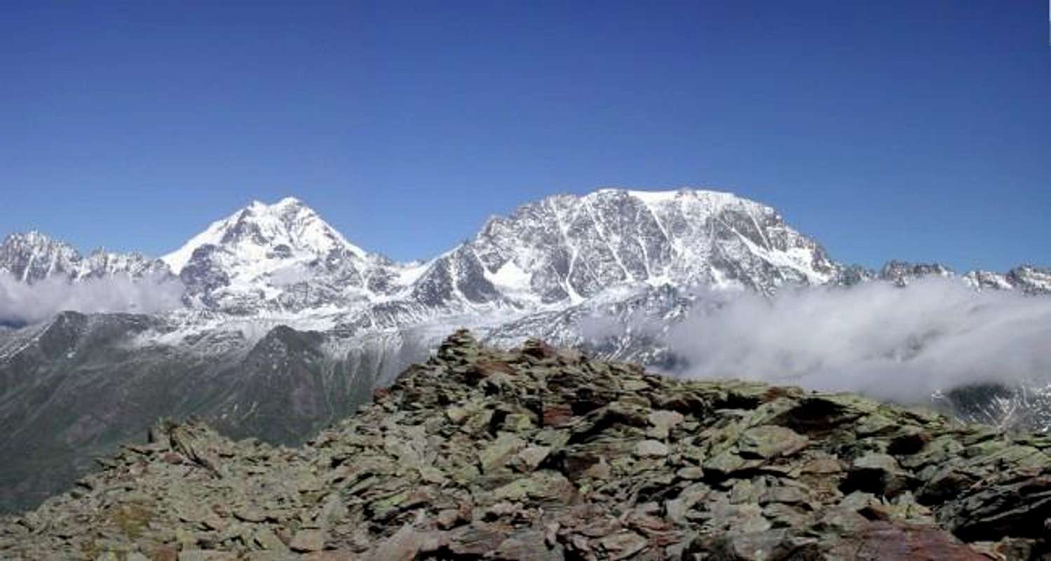
![P. de Drone and Gr. Combin...]() Pointe de Drone and Grand Combin in the clouds
Pointe de Drone and Grand Combin in the clouds
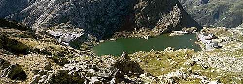
![Lac de Fenetre in late winter]() Lac de Fenetre in late winter
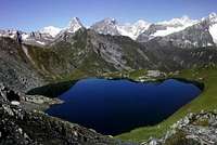
Lac de Fenetre in late winter![Lac de Fenetre in late winter]() Lac de Fenêtre: in the background Mont Blanc range
Lac de Fenêtre: in the background Mont Blanc range![Pointe de Drone. East ridge...]() East ridge of Pointe de Drone in May
East ridge of Pointe de Drone in May
Essential Gear
Hiking gear, food and water (though you might fill up at the lakes and creeks along the trail).


 9750 Hits
 83.1% Score
 16 Votes


 Pointe de Drone and Grand Combin in the clouds
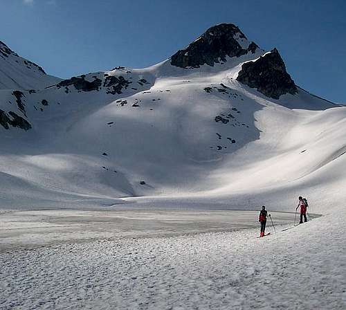 Lac de Fenetre in late winter
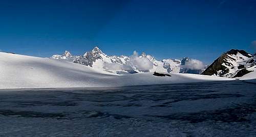 Lac de Fenêtre: in the background Mont Blanc range
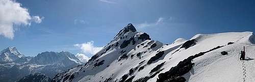 East ridge of Pointe de Drone in May