Overview
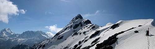
![Pointe de Drone. East ridge...]() Pointe de Drone. East ridge in May Pointe de Drone. East ridge in May |
Why would anyone want to climb this mountain, that is located among all those alpine 4000m-Giants? Grand Combin and Mont Velan to one side, the Aiguilles (Verte, de la Argentiere) to the other and Mont Blanc and Grandes Jorasses as well as Gran Paradiso and La Grivola just across the Aosta Valley?
To tell you my own reasons: the Pointe de Drône is easily accessible by car, the ascent includes a secured but lofty "ferrata" and the view is just breathtaking. And for all of you who might not be willing to do multiday climbs this is just as good as it can get.
Take a look at the pictures. Unfortunately the film I was using at the time was very grainy. Nevertheless the pictures should tell you a lot about the beauty of the place.
![]() |
Getting There
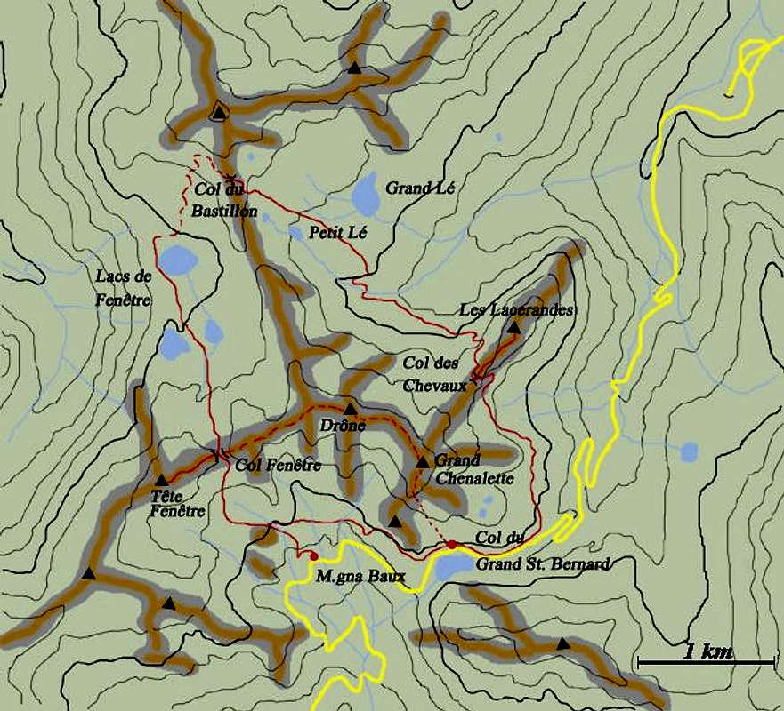
The Pointe de Drône is located a little west of the pass of Gd. St. Bernard on the border between Italy and Switzerland. The trailhead therefore is on top of the pass at 2469m of altitude. To get there be sure to miss the tunnel - you need to get to the top!
Red Tape
No red tape here. The parking lot atop the pass of Gd. St. Bernhard is rather small so be sure to start early.
When To Climb
As usual within the alps May through October is the best season. In winter you will probably be able to find easier routes with similar views.
Camping
There's no need for free camping in the region. A campground and lots of accomodations can be found in the valleys on either side of the border. The italian side might be a little less expensive.
Mountain Conditions
For weather conditions check with the Valle d'Aosta Meteo site.
External Links

 13612 Hits
 83.1% Score
 16 Votes


Garfield - Dec 12, 2005 10:10 am - Hasn't voted
Untitled CommentPhoto