
-
 4545 Hits
-
 81.18% Score
-
 13 Votes
|
|
Mountain/Rock |
|---|---|
|
|
44.46785°N / 109.53216°W |
|
|
Park |
|
|
Hiking |
|
|
Spring, Summer, Fall, Winter |
|
|
8100 ft / 2469 m |
|
|
Overview
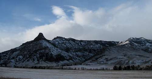 Signal Peak seen from the North Fork Highway.
At 8100 feet, Signal Peak is one of the lower mountains in the Northern Absaroka. It's surrounded by mountains that exceed 10,000, 11,000 and even 12,000 feet: Jim Mountain, Monument, Sleeping Giant, Trout Peak, Sunlight Peak, and many others. According to Thomas Turiano's Select Peaks of Greater Yellowstone: "Indians ascended thumb-like Signal Peak to send fire and smoke signals for long-distance communication (p209)."
Signal Peak's rocky southern spire catches the eye as you drive along the North Fork Highway. However the spire is made up of the crumbly volcanic rock (breccia) typical of this area and it can't be safely climbed. The true summit of Signal Peak is actually about 3 miles north of the highway and can be reached on a pack trail in summer conditions. The hike is roughly six miles round trip, with about 2300 feet of elevation gain. The trail is not marked and can difficult to follow when it's under snow.
Getting There
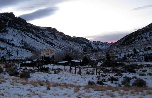 Trail Cafe (turn right at this sign)
 | From Cody, take the North Fork Highway (14-60-20) toward Yellowstone National Park. After driving into Wapiti, watch for the Trail Cafe sign on the right. Turn at the sign and follow the road across a small bridge, then immediately turn left. Follow this rough road as far as it goes, to a small parking area by the river. 4WD shouldn't be needed in summer but in the winter it may be drifted and there is a steep section. You'll cross over the trail just before reaching the parking area and will have to hike back up the road a short way. It's not marked so keep an eye out for it. |
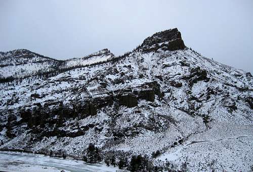 South side seen from nearby Flag Peak
 |
The Hike
Follow the good obvious pack trail along the river until it eventually switchbacks up the hill and cuts through the cliffs. A fishing trail continues along the river and it would be easy to keep hiking along that trail by mistake. The pack trail goes close to the summit but you will have to break off at the end and hike the obvious summit ridge to the top. In summer, it will be no problem to follow the trail to that point.
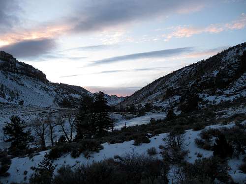
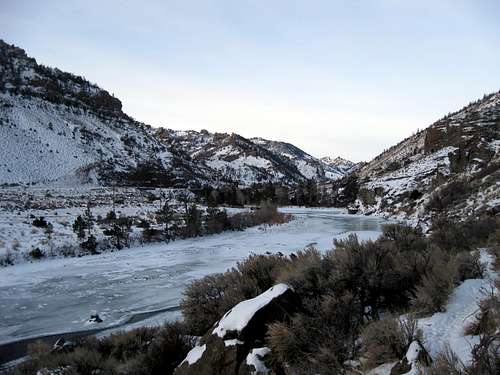 Following the river.
WINTER In winter, following the pack trail is difficult to impossible. You should be able to follow it along the river until it cuts through the cliffs and winds up into forest. At that point, even with a GPS, you'll have a hard time guessing where it is. The trail tends to stay low in the trees, where the snow is deepest. In winter, you may prefer to stay high on the more wind-scoured ridges. This will cost you some additional elevation gain and loss but may be better than struggling with deep soft snow. Your call. Either way, it's a good bet to bring snowshoes.
Views
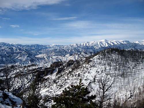
The views from Signal Peak are magnificent. Ptarmigan is most prominent to the south and great views of Jim Mountain can be had all the way to the top. Monument Mountain's three distinct summits can be clearly seen to the West. It's not easy to get a good look at Monument, so this is a wonderful vantage point.
 View to the west
 | 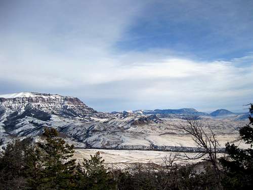 View of Jim Mountain with Rattlesnake and Cedar in the distance.
 |
Map Notes
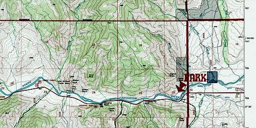 This section of map shows the parking area and trail. The summit is north, off the map.
The trail does not show up on NAD 27 maps.
 Parking area for Signal Peak.
Red Tape
None