
|
|
Mountain/Rock |
|---|---|
|
|
39.21904°N / 120.25413°W |
|
|
Placer |
|
|
Hiking, Scrambling |
|
|
Summer, Fall |
|
|
8426 ft / 2568 m |
|
|
Overview
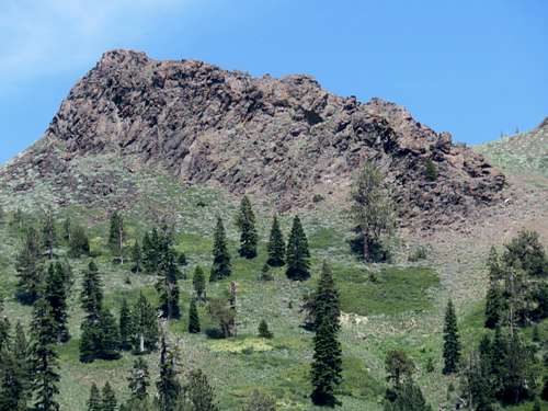 Zoom shot of south face of Silver Peak-West Peak
Silver Peak-West Peak (Peak 8426 on topographic maps) is located west of Silver Peak 8,424’ above Olympic Valley northwest of Lake Tahoe. Besides being referred to as the “west peak” of Silver Peak, it is actually 2’ higher than Silver Peak.
Silver Peak-West Peak is prominent, rising 346’ above its saddle between it and the long ridge that makes up Tinker Knob 8,949’. It is often combined with nearby Entin Peak 8,506', which is an impressive, albeit non-prominent, mountain summit that is visible from Olympic Valley.
Silver Peak-West Peak is a rocky summit, requiring some hard class 2/easy class 3 scrambling from the standard route. Views from the summit are awesome, with Lake Tahoe in view as well as numerous Tahoe peaks. The area itself is gorgeous.
Silver Peak-West Peak is located across Olympic Valley from the Palisades Tahoe Ski Resort, and very busy in winter months. There are no lifts anywhere near Silver Peak-West Peak. It is west-facing from the standard route, and in a dry year, hiking can begin in mid-to-late May. But typically early June through late October are good times to attempt this summit.
Getting There
The standard trailhead is the same starting point for Granite Chief. This differs from Silver Peak, for which the trail starts near the intersection of Squaw Summit Road and Navajo Court and approaches the peak from the southeast. This can be a starting point for Silver Peak-West Peak if combining with Silver Peak. Although Silver Peak and Silver Peak-West Peak can also be hiked together from the standard trailhead.
For either approach, from Truckee or Reno, you take Interstate 80 to CA State Route 89 going south for 8.5 miles to Olympic Valley Road. Follow Olympic Valley Road Westward for a couple miles until you hit the center of the village. Take a right at the sign for the Olympic Valley Inn. Follow it past the entrance to the Inn. There is a parking area on the right next to an unmarked trail.
If going up Silver Peak first via the trail, drive about a mile and a quarter up from 89 and turn right on Wayne Road, then a left on Sandy Way, drive a half a mile and turn right on Navajo Court.
Route
If hiking Silver Peak first from the trail near the intersection of Squaw Summit Road and Navajo Court, take the trail up to Silver Peak, then drop down 350’ to the saddle and climb steeply back up to Silver Peak-West Peak.
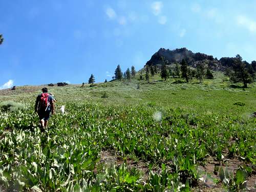
The standard approach starts by hiking up from the parking lot on the access trail to the Granite Chief Trail (there are a few minor access trails heading up from the right side of the hotel to the trail). Follow the trail as it heads to the left where it winds around and eventually hits a sign pointing towards the Granite Chief Trail.
From here, if you want to hike to the saddle between Silver Peak and Silver Peak-West Peak, hike a little less than a mile up from the trailhead. The trail is heading north at this point, but shortly heads back to the west. You will see a trail junction on the right. Don't take the trail but use it as a marker for the point you leave the Granite Chief Trail. From here, you can hike steeply up to the saddle in about a mile, gaining 1,300'. There are any number of ascents, but it is less than 2 1/2 miles this way to Silver Peak and Silver Peak-West Peak, whichever you hike first. A good marker to guide you is when you see the rock tower below through the trees.
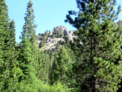 Rock tower below Silver Peak seen along the Granite Chief Trail
If continuing west on the Granite Chief Trail instead, follow the trail as it skirts up towards Entin Peak, which is in sight only part of the way. Continue up the trail as it enters an open slope. Here there will be the first wide open views of the mountains to the west, including the tram that heads up to the Alpine Meadows ski lift area as well as Granite Chief in the distance. There are two options here. Option one is that at the open slope, you will notice granite rocks above you. You can leave the trail here, about 2 miles up from the trailhead, and head straight up towards Silver Peak-West Peak, staying generally to the left. This is 2 3/4 miles one way to the summit, gaining about 2,250'.
 Option 1 off-shoot to Silver Peak-West Peak from the Granite Chief Trail
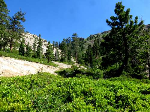
Alternatively, continue up the trail for another quarter mile until you get to a cross over point at an elevation of approximately 7300', seen in the photo below.
 Trail crossing for Granite Chief Trail
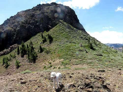
Once at the rock cliffs in the photo, turn right and head up the steep slope. Take the gully, or either side of the gully. This involves gaining more than 800' of open forest and scree slope to the ridge between Silver Peak-West Peak (to the south) and Entin Peak (to the north). The route to the ridge is very steep and can get overgrown. Be very careful on the way up. Once at the ridge, head right towards Silver Peak-West Peak. The best approach is from the west side. You gain about 70’ with a mix of hard Class 2/easy Class 3.
 Heading up the final slope towards the summit block
 Just below the rocky summit block
The total distance to the summit via this route is about 3 miles one way. Elevation gain from the trailhead to the summit is approximately 2,250 feet.
You can descend the way you came or combine the hike with Entin Peak or Silver Peak.
Red Tape
There are no restrictions to hiking or parking at next to the Olympic Valley Inn at the designated parking spots for hikers.
Mountain Conditions
Palisades Tahoe Weather Conditions and Web Cam