
|
|
Mountain/Rock |
|---|---|
|
|
38.86110°N / 120.1829°W |
|
|
Download GPX » View Route on Map |
|
|
El Dorado |
|
|
Hiking |
|
|
Spring, Summer, Fall |
|
|
9680 ft / 2950 m |
|
|
Overview

Smith Peak (peak 9680)
Peak 9680 "Smith Peak" is in Desolation Wilderness Area and is basically along the same ridge that connects Mount Agassiz and Mount Price. The peak offer great views to The Desolation Wilderness, to the south peaks within the Hope Valley area (Round Top, Hawkins, Red Lake, Stevens, etc), to the west the Crystal Basin and the Sacramento Valley. Ironically I stumbled on this peak as my goal was Little Pyramid and I took the trail up to Smith Lake unknowingly. After I climbed the south ridge and stood on the summit I noticed due north Little Pyramid. I hiked with my daughters boyfriend and told him, "Michael, we are not where I wanted to be". And then pointed over to Little Pyramid. But the climb was one that was a fun scramble and the summit offered great views. The summit area is not very big which makes it pretty interesting. There is room for maybe 3 or 4 climbers and on 3 of the 4 sides, slopes off pretty sharply so it is an impressive summit. Smith Peak in height is 303 feet lower than Pyramid Peak, the highest point in Desolation Wilderness and is the 8th highest in the area. Mount Price is just to the NE and Agassiz to the south of Price would be an easy link up for a trifecta of summits. One could also hit Smith Peak, descend back down to the trail headed to Twin Lakes and go for Little Pyramid. It's prominence is only about 180 feet however the summit block is impressive and offers three distinctly different route options to the summit. The West Face has solid class 4 climbing, I did not climb the face and can not say the stability of the rock. There is a bit of a chute to the southwest that offers class 3/4 climbing & the slope here is not nearly as vertical as the face of the summit block. The rock appeared to be very stable but I didn't climb it. Then there is the south ridge that is a straightforward class 2/3 scramble. All these options are very obvious while looking up from Smith Lake, simply boulder hop to the base of the summit block and then choose the best option for you.
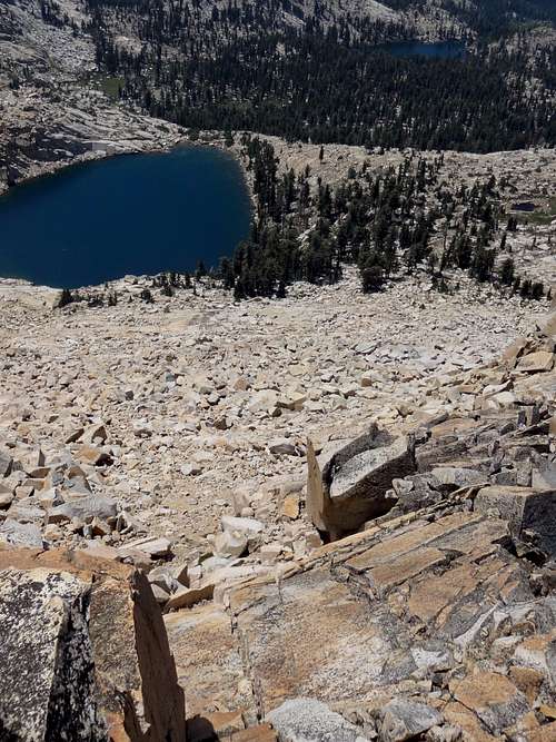
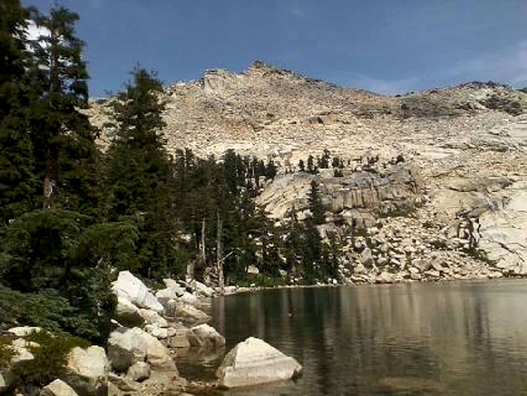
Smith Lake below the SW Chute
The approach is an easy walk-up from Wrights Lake which is lies within the U.S. Forest Service and El Dorado National Forest. The route is very gradual with very little route finding issues. There are maps that show the trail from Wright's Lake to Grouse Lake and then Smith. Depending on snow levels the gates back to Wright's Lake are open from Late June through Mid October. There are 80+ campsites around the lake, drinking water, pit toilets and US Forest Service allows for equestrienne usage as well. The route to Smith lake is roughly 3 miles and gains 1700 feet. Once at the lake the trail basically ends but there is a bit of a trail around the lake to the left (north) and then once above the tree line just pick a route through the granite boulder field to the south ridge. The Last 725 feet is steep, I would estimate that you gain that elevation in less than 200 hundred yards.

Smith Peak (peak 9680)
Getting There
From The SF Bay Area take Highway 80 East to 50 East to Wright's Lake Road. From Suisun 80/680 interchange the turn off to Wright's Lake is 130 miles. From Reno take 580 south to the US 50 West interchange. At this point your two options are the same in miles and travel time. Taking 50 West will take you through South Lake Tahoe to Wright's Lake Road. If you travel to State Route 395 south you connect with 88 west then 89 north to Meyers. At Meyers 89 connects back with 50 West and then to Wright's Lake Road. Through South Lake Tahoe the distance is 90 miles (2 hours) and route 395 is 100 miles (2 hours). The difference here is much of the time South Lake Tahoe can be extremely congested. From the Redding area take 80 south to 50 East @ Sac. Fresno or further south, 80 North to 50 East @ Sac. Follow the road for 8 miles once off 50 to Wrights Lake. A right turn across the bridge at the lake and then back to the trailhead parking lot.Route
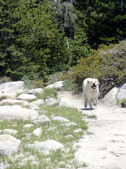
Our dog Mango coming back to check on us
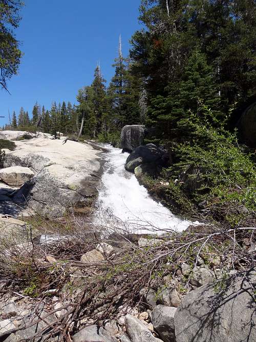
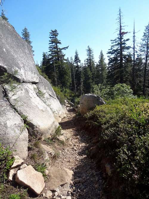
Trail to Smith Peak
Red Tape
Campfires are prohibited in Desolation Wilderness. Visitors are required to bury human waste 6 to 8 inches deep and at least 200 feet away from water, trails, and campsites. Toilet paper must be buried or packed out. Garbage must be packed out. Maximum group size is 12 people for both day and overnight use. Pets are allowed in the Desolation Wilderness. Day hikes are free overnight overnight wilderness permit fee is $5 per person for the first night and $10 per person for two or more nights up to 14 days (non-refundable).https://www.fs.usda.gov/Internet/FSE_DOCUMENTS/fsbdev7_018772.pdf
![Trail to Smith Peak]()
Trail to Smith Peak
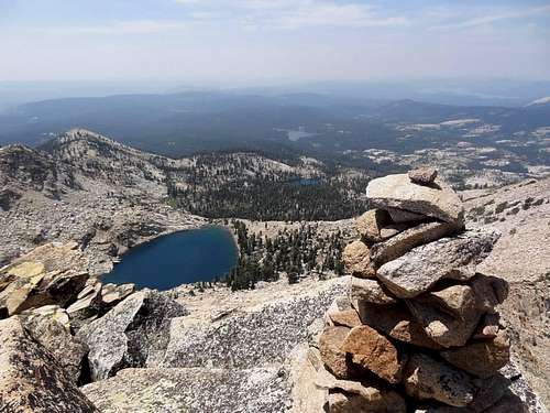
![Summit Cairn on Smith Peak]()
Summit Cairn on Smith Peak![Smith Lake and Smith Peak (peak 9680)]()
Smith Lake and Smith Peak (peak 9680)
When to Climb
Access largely depends on the snow levels. Hiking is year round, depending on how far the road has been plowed your trek in could be rather long during the winter and in early spring. The trails are marked high on many of the trees for travel over snow. Depending on snow levels the gates back to Wright's Lake are open from Late June through Mid October. Late Spring/early Summer and early to mid Fall are the best times as is can get very hot. During the summer there is the Mosquito hatch and they get quite bad.More Photos
Trail to Smith Peak
Summit Cairn on Smith Peak
Smith Lake and Smith Peak (peak 9680)
Camping
Wrights Lake camping- https://www.fs.usda.gov/Internet/FSE_DOCUMENTS/fsbdev7_018799.pdf
Recommended Gear
Warm weather- Sunscreen, Sunglasses, Hat, Deet, layered light clothing, water, map, ample snacks
Cold weather- Snow shoes, crampons, gloves, gaiters, ice axe, insulated clothing, extra pair of socks, matches, headlamp and extra batteries, ample food.