
-
 5141 Hits
-
 74.92% Score
-
 5 Votes
|
|
Route |
|---|---|
|
|
37.95570°N / 105.0845°W |
|
|
Download GPX » View Route on Map |
|
|
Hiking |
|
|
Spring, Summer, Fall, Winter |
|
|
Most of a day |
|
|
Overview
This route is a great option for summiting UN 11580 in the winter. Enjoy a peaceful snowshoe that is mostly on-trail until a short bushwhack to the mellow summit. This is a good route to do earlier in the day when the eastern sun warms the way. Later in the day, when the sun sets below the mountain ridgeline, this route gets rather chilly. Note that in the summer the trail is motorized, open to motorbikes (no ATVs), so if you don’t like to share your outing with vehicles, a winter ascent is strongly recommended. Most of this route runs through dense forest, protecting you from the winter winds.
See attached GPX for detailed map and elevation profile.
Roundtrip Distance: 10.5 miles
Elevation Gain: 3,600 feet
YDS Rating: 1+
Getting There

Looking northeast from the plateau

A few trees along this route are marked as wildlife habitat | 25 Nov 2012
UN 11580 is roughly 35 miles west of Pueblo, Colorado, near the town of San Isabel and Lake Isabel. The summit sits not far off of the Snowslide Trail #1318. The Snowslide Trail can be accessed from two points, and here I describe the route from the eastern side of the peak.
The trailhead is eight miles Northwest of Rye on State Highway 165 at Lake Isabel Recreation area on Forest Service Road # 376 near mile marker 19. There is limited parallel parking for a few vehicles near the closure gate at the trailhead.Route Description

Wind driven snow

Angel on the hike
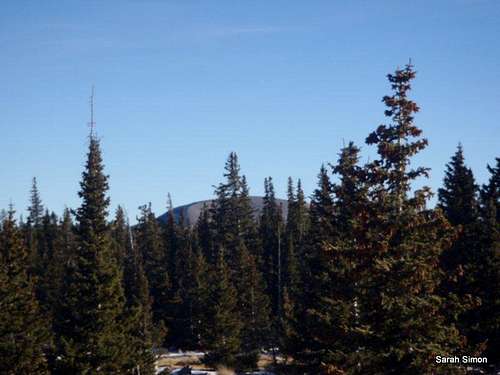
Toward Greenhorn Mountain

On the plateau
From the parking area at the Snowslide trailhead, head southwest past/around the gate on Trail #1318.
· The trail continues southwest along a drainage before hairpin turning sharply back to the northeast on the other side of the drainage.
· The trail then climbs mostly southward for about a mile before turning west again toward the ridgeline that includes UN 11580.
· This is mostly a rambling amble until reaching the base of the climb to the top of the ridge, where the trail steepens.
· Push on up the eastern slopes, switching back multiple times, to the ridgecrest.
· Follow the trail (as much as possible in the deep snow) across the broad plateau. Near a fence line, depart the trail and head northwest to the summit of the peak.
· The exact highpoint is difficult to distinguish from among several boulders nestled in the trees. We crawled around on several high point candidates, as we never found a register, to feel confident that we’d found the top.
Retrace your steps back to the trail, then head down to the vehicle!
Essential Gear

Windy plateau
•Map & compass and/or GPS
•Comfortable hiking boots or shoes
•Outerwear appropriate to the season
•Snowshoes or skis in snow season
•Water and snacks
•A camera to save memories of the high country
views
•First aid kit
•Other standard backcountry essentials