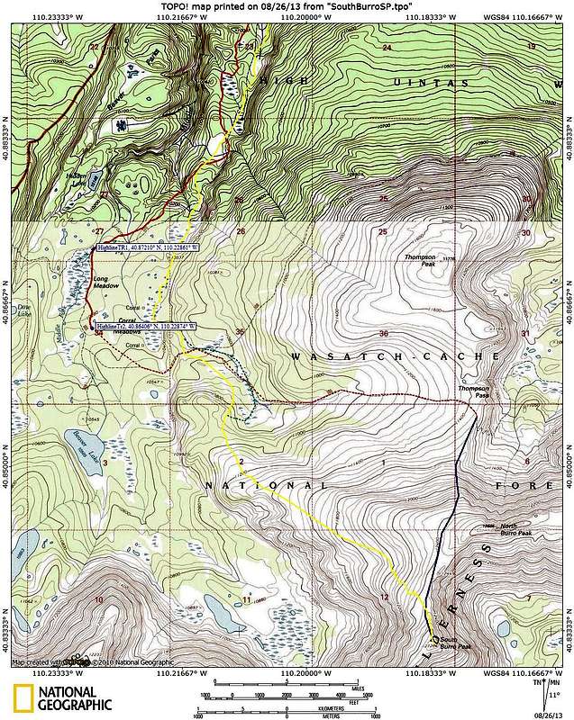
Summer
Red shows the trail. Solid red is the part I've been on and accurately shows the trail. I have not been on the dashed red section so it is just approximate. Blue shows the offtrail portion of the summer route.
Snow
Yellow shows the path I skied. I would have followed more of the trail towards the beginning had I been able to make it out. After getting to Corral Meadows, if I had to do it all over again, I would try following the route of the green dashed line which takes advantage of going through several open areas instead of going through the trees.


