
-
 2412 Hits
-
 74.01% Score
-
 4 Votes
|
|
Route |
|---|---|
|
|
43.38380°N / 110.41128°W |
|
|
Hiking |
|
|
Summer, Fall |
|
|
Half a day |
|
|
Class 2 |
|
|
Overview
The South "Face" is how Orrin and Lorraine Bonney describe this route in Guide to the Wyoming Mountains and Wilderness Areas, but that seems to me to imply something more difficult; it should be called the South Slopes. However, in deference to someone whose climbing experience surpasses mine and whose name is far more well-known in the mountaineering world than mine is, I'm sticking with the name given in the Bonneys' guidebook.
But there is a difference I must insist on explaining and standing by. The Bonneys call the route Class 3. It is not. Other than a few spots that arguably are Class 2+, this is a Class 2 route once you leave the trail. The crux of the route is finding the break in the cliffs that guard the mountain almost everywhere, and some study of the route from the road beforehand should enable you to do that without any trouble.
I realize that most people okay with Class 2 are fine with most Class 3 as well, but just in case you don't like scrambling, you should know that this route, despite being called Class 3 in at least one well-respected source, is not a scramble.
Although it's only a hike, this route is a workout. In only 2.5-3 miles, it climbs over 4300'.
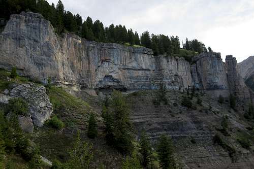 Cliff Bands | 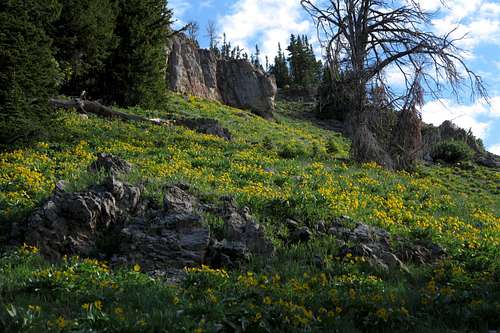 South Face |
Getting There
About 11 miles southeast of Hoback Junction, look for a signed road heading north into the Granite Creek Recreation Area. This gravel-and-dirt road, which can be a little rough but is still passable for most passenger vehicles, follows Granite Creek for 10 miles to Granite Hot Springs, a popular spa (admission fee required). Along the way there are spectacular views of Granite Creek and the Gros Ventre Range.7.5 miles up the road, look for a spur that makes a bridged crossing of Granite Creek. Turn here and follow signs for 0.1 mi to a trailhead. Find a spur road (usually closed) that makes a bridged crossing of Swift Creek. Just across the bridge, a sign indicates the beginning of Swift Creek Trail.
Route Description
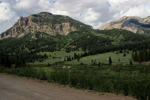
Open Door Mountain from near the Trailhead
Start hiking on the Swift Creek Trail (you cross the creek right away via a bridge on a gated road). Soon there is a junction. Bear right. Before long, there is another junction, and a sign points to Shoal Falls. Bear left this time to stay with the Swift Creek Trail.
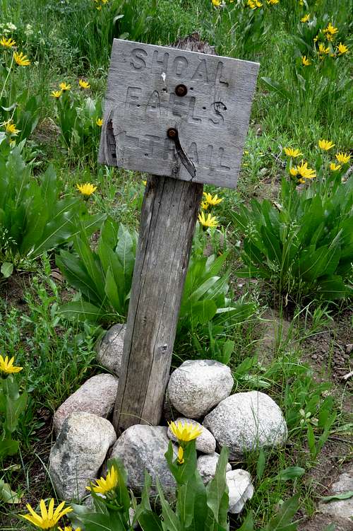
Shoal Falls Trail Intersection
Very soon after this junction, which is no more than a mile from the trailhead and more like half a mile, leave the trail in a meadow (see the picture below). Head up steepening slopes and ascend a drainage that cuts through the only apparent break in the cliffs that wrap most of the mountain.
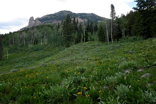
Leave the trail around here.
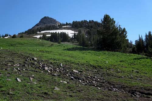
Near timberline, you pass an unnamed, unranked summit with a long, flat top, and what appears to be the pinnacle of Open Door's summit comes into view. It's not the summit, but it is the direction you want to head. After getting over that bump and some other teaser blocks, you reach the true summit block.
 The summit? Nope. |  The summit? Still not. |  The Summit Outcrop |
To descend, go back the same way or consider the traverse to Antoinette Peak and a descent to Swift Creek, and the trail, from there.