
-
 3329 Hits
-
 73.06% Score
-
 3 Votes
|
|
Route |
|---|---|
|
|
46.67560°N / 12.52420°E |
|
|
Scramble |
|
|
Most of a day |
|
|
Scramble-Up |
|
|
Approach
See the “Getting There” Section on the main page. The trails start from Kartitsch in the Tyrol Gailtal Valley.Route Description
- Start altitude: 1353m
- Summit altitude: 2689m
- Prevailing exposition: S
- Type: 1h 30min over forest roads, 2h along trails, 1h along the ferrata
- Protection: marked, protection for 75m along the slippery ferrata
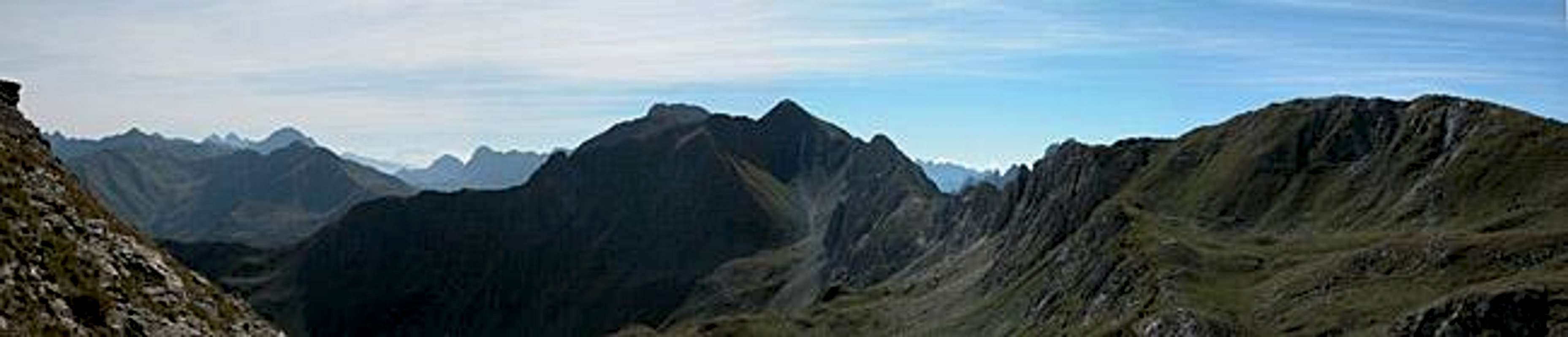
Follow the Gail River to the east until the forest road through Erschbaumer Tal turns off to the south. Follow the road to its end and enjoy the varying aspects of the Kinigat Trinity. From the end of the road a trail turns off east to head for the Tscharrehütte Bivouac. Now climb between Liköflwand and Grosse Kinigat through a ddep and narrow valley to the Mittersattel Pass.
From the pass you can see Filmoor Standschützenhütte, the closest refuge to Grosse Kinigat. Head for it but turn to the south, later west to get to the southern side of Königswand. Near the ridge you will come across positions and trenches from WW I. The trail splits: to the left you can reach Sandiger Boden and Kleine Kinigat, while to the right the South Flank Ferrata starts.
Leave Königswandtürml to your right and head for a ledge to the south of Grosse Kinigat. Here you’ll find fixed ropes which are important, since the limestone rock has been polished to near marble like smoothness. After this 50 – 75m section you reach a small plateau and from here you head north for the final ascent along the summit block of Grosse Kinigat.
 |  |  |  |