South Lake to North Lake through Evolution Valley
This summer I was challenged to select a backpacking trip that would be fun for me and my sixteen year old son but not too easy. If I made the trip to difficult I would lose my only backpacking companion. Last year, I had embraced ultra-light backpacking techniques to decrease the pain and suffering of carrying everything you need to survive in the backcountry on your back. Carrying a light pack definitely makes backpacking much more enjoyable. We only carried thirty pounds to start and finished with less than twenty pounds after eating most of our food supplies over five days. My only dilemma was finding the appropriate route.
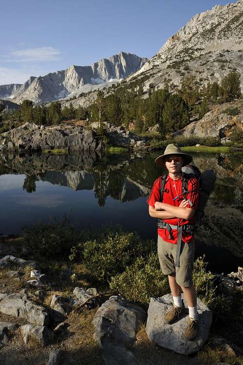
![Long Lake, Mt Goode]() Long Lake on the way to Bishop Pass
Long Lake on the way to Bishop PassI looked seriously at three different backpacking trips from easy to strenuous. This August, after much trepidation, I chose a rather ambitious “strenuous” fifty-three mile backpacking trip through the Sierra high country starting at South Lake through Evolution Valley and finishing at North Lake. This trip would cover more mileage than any of my previous backpacking trips since my first trip back in 1970. As a 53 year old weekend warrior I was concerned that I might blow a gasket half way through the trip. Also, I was worried that Joshua would experience more suffering than fun. I was partially right.
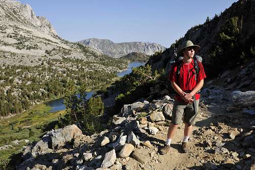
![Above Long Lake]() Above Long Lake on the way to Bishop Pass
Above Long Lake on the way to Bishop Pass
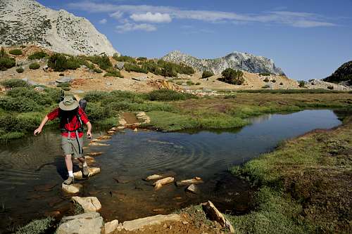
![On the way to Bishop Pass]() On the trail to Bishop Pass
On the trail to Bishop PassLast year Joshua and I completed a thirty-six mile backpacking trip from Tuolumne Meadows to Mammoth Lakes. The 2011 trip was Joshua’s first multi-day backcountry experience. The route I chose had relatively easy terrain with a manageable distance. We only had to hike over one 11,000 foot pass. It was very enjoyable trip except for being eaten alive by swarms of mosquitoes resulting from a previous winter’s record snowpack. Our August 2012 objective would be significantly harder.
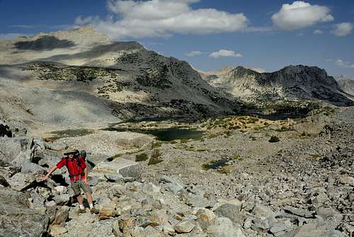
![Bishop Pass]() Bishop Pass
Bishop PassThe backpacking trip for 2012 involved crossing three passes at close to 12,000 feet surrounded by peaks over 13,000 feet. Each time we climbed up to a 12,000 foot pass we would then descend three to four thousand feet only to gain all that elevation back again. A friend, who recommended this trip, assured me that all this “up and down” was worth the effort. We would pass through lush forests, desolate high altitude moonscapes and everything in between.
The weather forecast indicated a “chance of thunderstorms” all week due to a southern monsoon flow from Mexico. The first day set the tone for the rest of the trip. After descending two thousand feet from Bishop Pass (11,960 ft) we got clobbered by a four- hour thunderstorm of intense rain, lightning and thunder. It had been thirty years since I had seen such violent thunderstorms in the Sierras. I was complacent and stupid. We kept hiking when I should have stopped to put on all our raingear, add a waterproof cover to our packs and set up the tent. We got soaked while the dry trail turned into a raging torrent. When we finally stopped at a protected place to camp, three thousand feet below Bishop Pass, we were at risk of hypothermia. We set up the tent, removed our wet clothes and got into our semi-dry sleeping bags. In early evening the storm passed. Almost all of our gear was wet. My son Joshua looked very concerned about our fate but I assured him we would be alright. I have a pretty good poker face.
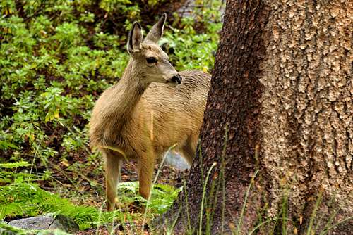
![Deer in Le Conte Canyon]() Deer in Le Conte Canyon
Deer in Le Conte Canyon
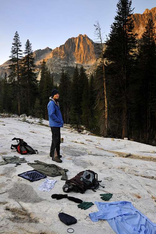
![Drying Out in Le Conte Canyon]() Drying out in Le Conte Canyon
Drying out in Le Conte CanyonThe next morning there was not one cloud in the sky. This gave us little comfort since the previous day started with clear blue skies. We laid out our gear on a huge white granite slab and waited for the sun. Our gear dried out in two hours when the sun rose high enough to reach into the deep recess of Le Conte Canyon. We turned our gear over and over again like some short-order cooks serving pancakes at the local IHOP. I asked Joshua if he wanted to abandon our trip. He said, “No, I want to do complete this trip all the way through.” I was so pleased Josh wanted to go on but felt foolish for my serious blunder from the day before. For the rest of the trip we were super-vigilant. Every time there was a drop of rain we put on all our rain gear and covered our packs. Our goal was to stay dry no matter what the circumstance.
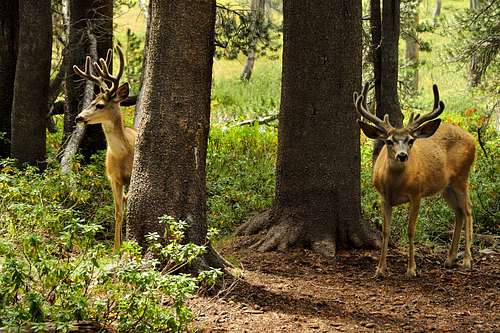
![A couple of bucks in Le Conte Canyon]() A couple of bucks in Le Conte Canyon
A couple of bucks in Le Conte Canyon
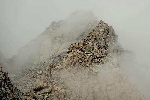
![South of Muir Pass]() South of Muir Pass
South of Muir Pass
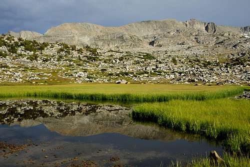
![Near Helen Lake below Muir Pass]() Below Helen Lake south of Muir Pass
Below Helen Lake south of Muir Pass
![Near Helen Lake south of Muir Pass]() Below Helen Lake south of Muir Pass
Below Helen Lake south of Muir Pass
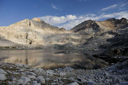
![Helen Lake]() Helen Lake south of Muir Pass
Helen Lake south of Muir Pass
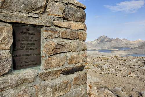
![Muir Hut]() Muir Hut looking north
Muir Hut looking north
![Muir Pass and Muir Hut]() Muir Hut looking west
Muir Hut looking west
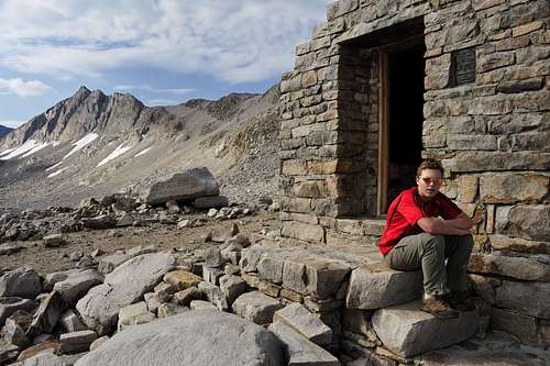
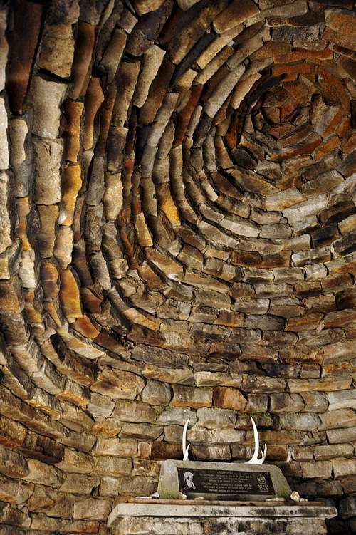
![Muir Hut]() Inside Muir Hut
Inside Muir HutWe spent 5-1/2 days completing the 53 mile loop. Sore thighs and shoulders, spasms in our mid and low backs, and tenderized feet were effectively counteracted with Vitamin “I” (Advil/Ibuprophen). Four out of the five days severe thunderstorms developed in the afternoon lasting for two to four hours. On the next to last day, hail pounded us on the trail for over two hours at 11,000 feet near Piute Pass. As an amateur photographer, the benefit of this weather pattern was varied lighting and wild cloud formations. The only downside was spending a couple of hours each afternoon trapped in a tent barely big enough for two people. Lying on our backs, shoulder to shoulder, we watched the rain pounded our small Tartent. We had the opportunity to talk about many random subjects that most fathers and sons don’t have time for in the course of a normal suburban day. We were also lucky to have low snow year last winter that reduced the mosquito population to almost zero.
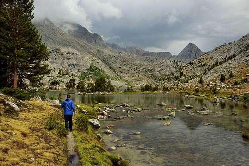
![Evolution Lake after a storm]() Evolution Lake after a storm
Evolution Lake after a storm
![Clearing clouds above Evolution Lake]() Clearing clouds above Evolution Lake
Clearing clouds above Evolution Lake
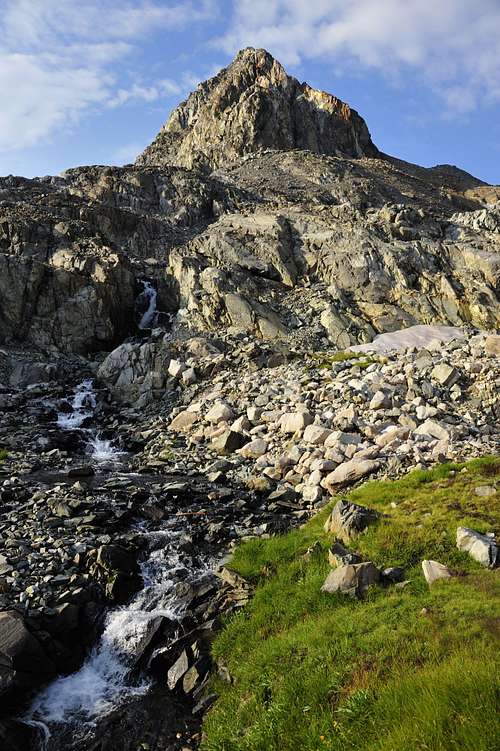
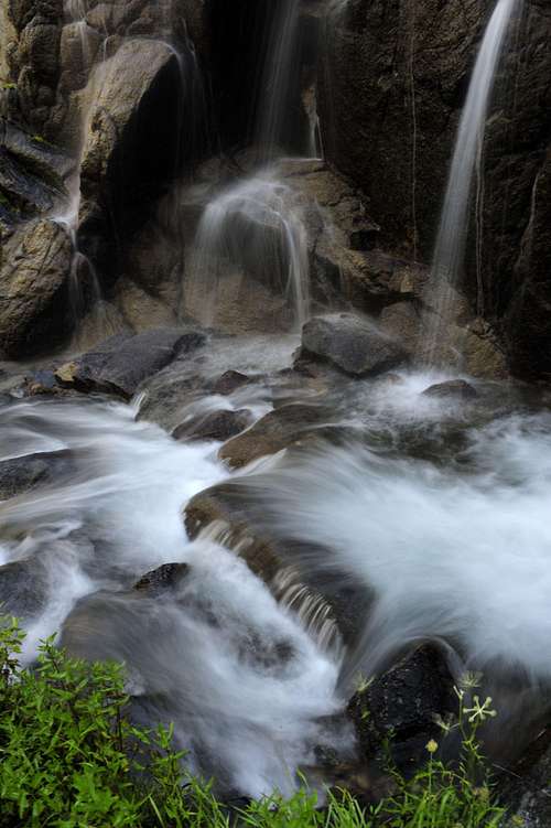
![Evolution Valley]() Evolution Valley waterfall
Evolution Valley waterfall
![Mc Clure Meadow, Evolution Valley]() McClure Meadow
McClure Meadow
![San Joaquin River]() San Joaquin River south of Muir Ranch
San Joaquin River south of Muir Ranch
![San Joaquin River]() San Joaquin River and Piute Canyon
San Joaquin River and Piute Canyon
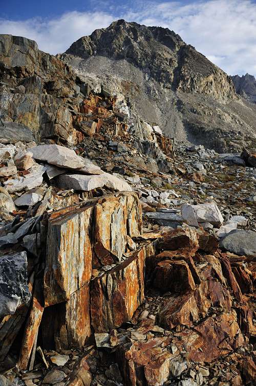
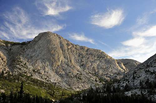
![Puite Canyon]() Many rock climbing possibilities along Piute Canyon
Many rock climbing possibilities along Piute Canyon
![Below Puite Pass]() West of Summit Lake and Piute Pass
West of Summit Lake and Piute Pass
![West of Summit Lake and Puite Pass]() West of Summit Lake
West of Summit Lake
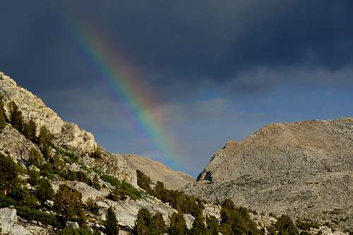
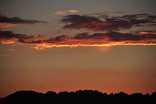
![Rainbow over Puite Pass]() Rainbow over Piute Pass
Rainbow over Piute Pass
![Cloud burst near Mt Humphreys]() Cloud burst near Mt Humphreys west of Piute Pass
Cloud burst near Mt Humphreys west of Piute PassOur backpacking adventure was an amazing trip covering beautiful and stark terrain. The quiet solitude with my son is a precious memory I will never forget. I am very pleased that Joshua looks forward to next year’s backpacking trip with anticipation even though this year’s trip was far from ideal. Hopefully, we will experience fewer thunderstorms next year. Last year it was snow and swarms of mosquitoes, this year it was intense thunderstorms. I am certain that next year the Sierra’s will serve up another surprise that is less than “ideal”. It appears Mother Nature has a sense of humor or finds it appropriate to serve up some “humble pie” almost every time I venture into her wilderness. This is a strange dichotomy about wilderness travel; on one hand the beauty and serenity is magnificent but on the other hand the suffering from elemental factors can be very stressful and more than a little annoying. It is amazing to ponder John Muir traveling through the Sierras with only a wool coat and a few biscuits in his pocket. Our trip is a good example of the axiom, “It’s the journey that is important not the destination.”
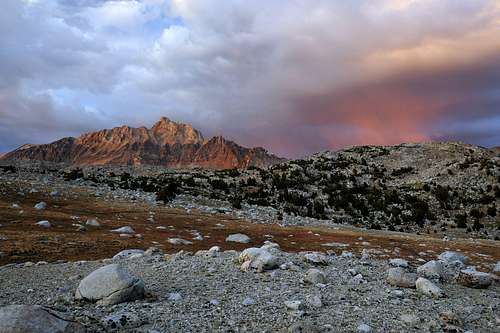
![Sunset looking west near Summit Lake]() Sunset looking west near Summit Lake, Piute Canyon
Sunset looking west near Summit Lake, Piute Canyon


Comments
Post a Comment