|
|
Route |
|---|---|
|
|
44.14107°N / 121.78173°W |
|
|
Mountaineering |
|
|
Spring, Summer, Fall |
|
|
One to two days |
|
|
Class 3 |
|
|
Overview
The south side/south ridge route provides some relief from scrambling up the scree slopes along the Middle Sister's more commonly approached north ridge. That said there is also a bit more solitude while taking this infrequently traveled path, but only once you're off the trail. If you aren't bothered by sharing your adventure with additional company hold up for the night at Camp Lake with its prominent views of the South Sister. Overall the route really isn't that strenuous, unless climbing it all in one day, and would make an excellent follow up objective to the popular South Sister climb.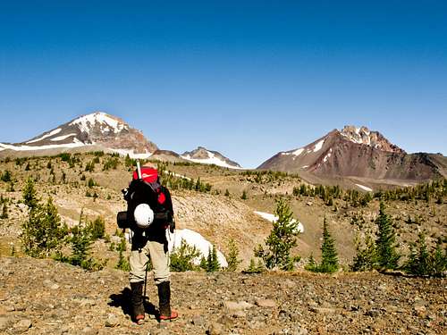
Getting There
Beginning in Sisters, Oregon travel west on Highway 242 a couple of miles just outside of the edge of town. After passing a large field with amazing views of the Three Sisters turn left onto Forest Road 15/Pole Creek Road and park at the Pole Creek Trailhead several miles up. The Pole Creek trail runs for 1.4 miles where it then becomes the Green Lakes Trail. Heading south until mile 2.0 is where you'll intersect with the Camp Lake Trail that by mile 6.7 will put you at Camp Lake. Keep in mind that the Camp Lake Trail passes Squaw creek at mile 3.9 and that this is where you'll likely emerge if you descend the Hayden Glacier route.Route Description
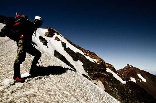
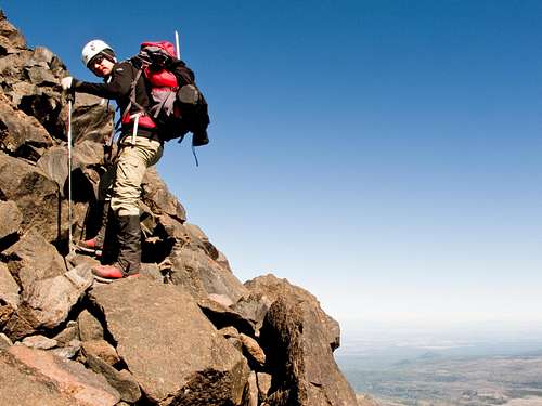
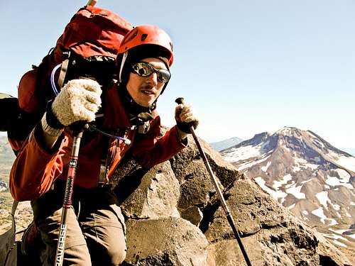
Overall this is a walk up route, but can vary depending on the variation you choose to take. From Camp Lake continue along the trail westbound until you reach the col at approximately 7600 feet and the trail begins to veer south. At this point you'll begin heading toward the Irving Glacier to the north. Either cross the glacier to ascend the scree slopes or follow its path for a bit softer ascent. Aim for two ridges running parallel to the glacier that come to a stop midway up the south face at about 8600 feet. At the top of these two ridges is a good resting point a couple hundred feet wide with soft meadow-like grass and a stream cutting down the middle. It is well sheltered from the wind and is surprisingly flat; it would make an excellent high camp. Bear in mind this is also your last source for water on the mountain, although it may dry up later in the season. At this point you can either choose to bow outward onto the broader slopes before reaching the southeast ridge or make a beeline for it by climbing some exposed class 3-4 rock. Upon reaching the ridge you'll be rewarded with views down the mountain's eastern cliffs, which drop a thousand feet to the Diller Glacier, as well as a glimpse up to the summit. The last 500-600 feet are easy scrambling up a mixture of talus and scree. Either descend the way you came up or traverse the mountain down its north ridge to Prouty Point and descend the Hayden Glacier's hogsback route following either the Hayden Glacier Trail, which I could not find, or alongside Squaw creek [also known as North Fork Whychus Creek] until it intersects with the Chambers Lakes Trail.


Essential Gear
Other than the usual items be sure and bring a helmet. The Irving Glacier seems like more of a permanent snow field than a glacier and doesn't appear to carry much crevasse hazard, but be sure to use good judgment. If descending the north ridge bring crampons and an ice axe, regardless of the time of year due to a summit ice traverse and its major exposure. Also bring a rope and harness for the Hayden Glacier. You'll want a map and compass as well if you do plan on descending the north ridge to the Hayden Glacier route.


External Links
Some good maps of the area: http://www.mazamas.org/your/adventure/starts-here/C463/Detailed route info on Camp Lake: http://www.portlandhikersfieldguide.org/wiki/Camp_Lake_from_Pole_Creek_Hike