
|
|
Route |
|---|---|
|
|
47.44080°N / 121.3308°W |
|
|
Hiking |
|
|
Half a day |
|
|
Walk-up |
|
|
Approach
Alta Mountain (10/17/13)
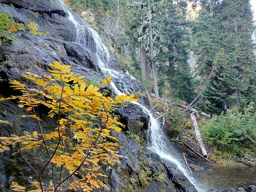
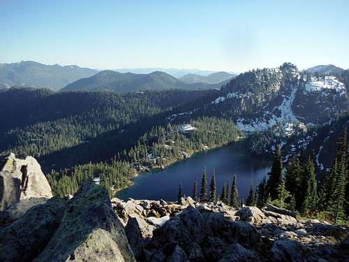
The approach to the south ridge of Alta Mountain involves a 4 mile hike past beautiful Rachel Lake to the ridge. Little elevation is gained for the first 2.5 miles but the last 1.5 miles can be pretty steep at times. This trail as of 2013 cn be quiet rough in places especially on the last 1.5 miles up to Rachel lake. Tree roots have now overtaken much of the steep part of the trail leaving footing on this trail to be quiet poor. Unless you want a broken ankle don't approach this trail as a running trail. It should also be noted that on the approach up to Alta Mountain there are a number of stunning waterfalls which will quickly grab your attention. There are several campsites around Rachel Lake. Alpine Lakes Wilderness regulations do apply, which includes no campfires.
Alta Mountain (10/17/13)
Route Description
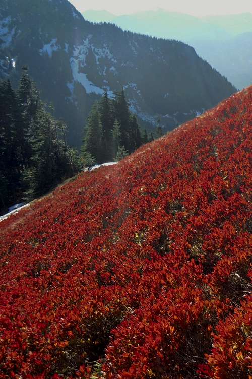
Berry fields on the upper section of the route up
Once the trail evens out, continue on a few hundreds yards and take the unmarked spur trail on the right. Enter the trees and past a couple of large boulders brings you to a steeper part of the trail. The south ridge is tree-dotted and moderately-angled at times. It has a false summit which can be tempting to stop at after already completing 5 miles. However the summit can be seen to the north and is about a half-mile away. In summer this last section has some exposure as one walks over what turn out to be a semi-knife edge (very walkable) to the summit. On sunny clear conditions this section offers little issue as most just walk right through it. With a thick coating of snow this last ridge become very sketchy and if one plans to climb Alta in the snow they should use heavy caution. From here, a walk across the ridge and a short downclimb brings you to a steeper part of the ridge, all along passing in and out of tree clumps. The final leg is on an open rocky slope to the summit where typically, on several pictures I've seen and what I've experienced in person, is a cairn in the shape of an arch.
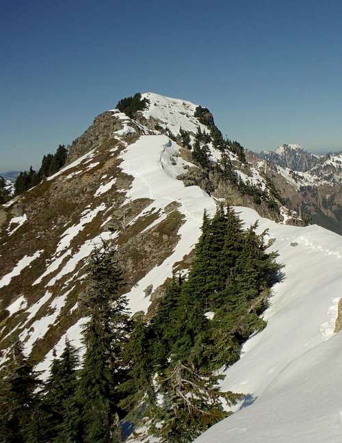
Last ridge to the summit! It is not advisable to continue climbing in these conditions, especially if the snow is loose.
Cascade Scrambler - Oct 6, 2009 1:18 am - Hasn't voted
Slight route correctionAfter you've taken the right hand turn at the crest of Rampart Ridge, the trail ascends through some light forest. As soon as the trail pops out of the trees (after 5 to 10 minutes), there is a poorly marked junction. The trail to Alta is to climber's left- straight ahead will take you to a series of unnamed small lakes.