
|
|
Route |
|---|---|
|
|
38.81220°N / 107.383°W |
|
|
Hike |
|
|
A long day |
|
|
Class 2 hike with difficult routefinding |
|
|
Approach
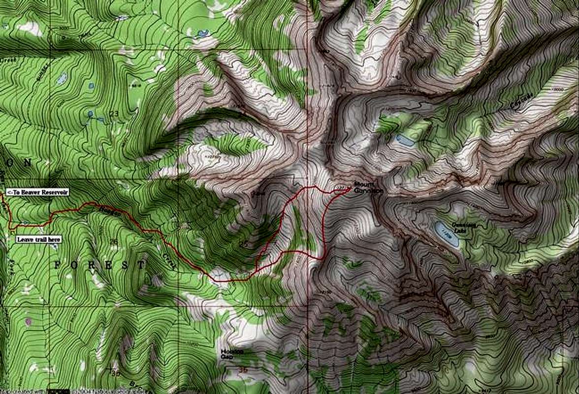
The following route description was provided by San Juaneer, with embellishments by ME!!
RT- 9miles & 4,620-ft
From the Beaver Reservoir Trailhead at 8,150-ft, follow trail #870 (signed as “Minnesota Pass”) for a mile to the second creek crossing (Hoodoo Creek). Go another 1/4 mile to the Hoodoo Gap Trail junction, and take a left. It is signed. Follow this trail for an 1/8 of a mile as it S's up to a meadow which has a great view of Pt. 12,246' on Mt. Gunnison's West Ridge. From here, leave the comforts of trail #870 and strike a line East and back towards Hoodoo Creek and across the short meadow and pick up a faint trail which continues East into the Aspens. The trail almost immediately gains clarity in the aspens. Continue on this secret trail as it continues up a wooded draw and parallels to and South of Hoodoo Creek. Later the trail T's into a bigger more clearly defined trail. Turn left here! Now you're on the right path for sure!
The next mile and a half go very smoothly as you follow the wide trail up Hoodoo Creek Drainage, cross to its North side, and find yourself in a large meadow at 10'080'. From the meadow, you can see a good majority of the remainder of the South Ridge Route. The gully constricts above you at 10,200' and funnels you in between steep walls either side. This basin is boulder strewn and presents two possible approaches to the upper, grassy reaches of Mount Gunnison.
Route Description
At the very north end of the basin you can see a grassy gully that can escort you to the upper plateau. We used this as a descent route. To your right, an obvious and easy rocky gully presents itself as a better and faster alternative to reach the upper plateau via the south ridge. Ascend this gully and slope for about 1000-ft and reach the grassy, rounded ridge crest of the south ridge. From here it is only .7 mile and 700-ft to the summit on alpine tundra.
Essential Gear
A compass and a good TOPO map. You must know how to read a TOPO to climb Mount Gunnison.