
|
|
Route |
|---|---|
|
|
38.38400°N / 119.667°W |
|
|
Hiking, Scrambling |
|
|
Summer, Fall |
|
|
Half a day |
|
|
Class 3 |
|
|
Walk-up |
|
|
Approach
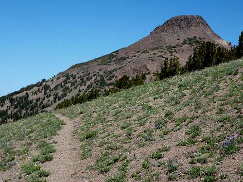
From the parking area, hike north 1.3 miles to St. Mary Pass. Here the mountain will come into view along with the main Clark Fork drainage. Take the trail heading north towards Stanislaus Peak, instead of the trail that continues east towards Sonora Peak.
The main trail follows a roughly 10,400' contour 2 3/4 miles toward a pass at the south side of the peak. One can also follow the north/south ridge connecting Sonora Peak to Stanislaus Peak. Snow conditions may dictate which approach is easier and quicker.
 |  |  |
Route Description
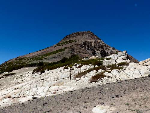
Eventually the trail reaches the base of the south side of the peak. It is really the east ridge of the south face that is used to summit. From the base of the peak it is about 700' to the summit in a third of a mile. The first several hundred feet of the hike are steep, but no scrambling is required. Continue steeply up until you reach a talus slope. From there, it is about a 200' Class 2 scramble to the summit. The route up is relatively straight-forward.
 |  |
Essential Gear
During the main part of the climbing season the only necessary equipment is good footwear. Early season may require snow shoes for the approach as the snow can be deep and mushy. Possible an ice axe and crampons very early in the season just after the highway pass opens.