
-
 9684 Hits
-
 83.69% Score
-
 17 Votes
|
|
Route |
|---|---|
|
|
37.86433°N / 107.4667°W |
|
|
Hiking |
|
|
Spring, Summer, Fall, Winter |
|
|
Most of a day |
|
|
Class 1-2 |
|
|
Overview
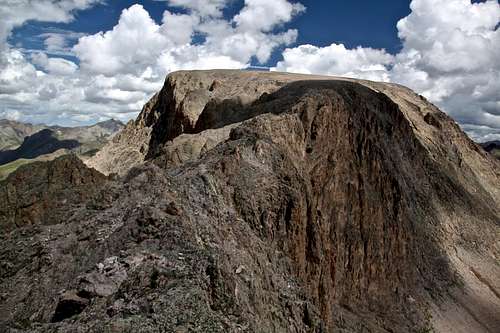
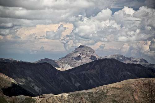
Nice view of Half Peak's summit from the south.
Colorado Rank: 87 per Guide to the Colorado Mountains (Centennial Peak ! - among the top 100 highest in Colorado)
This is the easiest route up Half Peak. It offers a long and scenic trail hike on a good trail for more than 90% of your outing. There is a short and fun scramble section (no more than class 2+) with a lot of exposure along a narrow summit ridge. It felt easy. The trail and length make this a perfect destination for a long distance trail runner. It is dog friendly (as long as your pouch will move that distance).
Many people choose to camp along the trail to make this hike shorter. There are several nice campsites, my favorite place appeared to be just above the waterfall (about 2 miles in) and then higher up by Cataract Lake (about 4 miles in). I did it as a day hike/run.
Many people choose to camp along the trail to make this hike shorter. There are several nice campsites, my favorite place appeared to be just above the waterfall (about 2 miles in) and then higher up by Cataract Lake (about 4 miles in). I did it as a day hike/run.
The advantage of this approach is the ease of reaching its trailhead - you don't need 4WD to get to Cataract Gulch TH, the road stays open even late in the season, and there is a nice camping right at the trailhead (including vault toilet).
The Cataract Trail is a popular scenic hike along the Cataract Gulch. At the start of the hike, you are likely to see others, higher up in basin close to the lake, expect solitude. The trail is located in Handies Peak Wilderness Study Area.
Getting There
Cataract Gulch Trailhead - From Lake City take highway 149 south for 2.5 miles. Turn right onto the road to Lake San Cristobal. Follow paved road approximately 4 miles (CO 30), then continue on dirt road for about 8.3 miles. Turn left at the fork toward Sherman; go 1.4 miles. A large sign marks the trailhead. There is good parking for several cars. Vault toilet on the north side of the road and nice campsite behind it.You can also approach the Trailhead from the west via Cinnamon Pass, but then you would need 4WD high clearance vehicle (great if coming from Silverton area). The drive over Cinnamon Pass is very spectacular.

How To Get There
Route Description
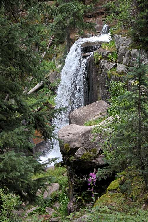
Waterfall along Cataract Stream.
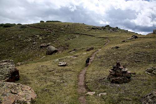
Section of Continental Divide trail - very pretty, great for trail running.
Gerry Roach calls this route "South Ridge Classic". I think the ridge is a little too much to put in its name - most of it is hiking on grassy slopes facing south, with a short section of ridge. However, this short section, is very spectacular and fun; without it - the peak would have been a boring hike.
Cataract Gulch TH is at 9,600 feet elevation, round trip distance is 14.0 miles, there is 4,241 feet elevation gain, and it is mostly on a nice trail. This trail is rated as Class 2, but the class 2 section is very short (there is some exposure).
Cuba Gulch TH as mentioned above requires a high clearance 4 WD vehicle, the elevation is higher at 10,700 feet. Round trip distance is 10.6 miles and elevation gain is 3,141 feet. The difficulty (or I better say easiness of the slopes) is the same, class 2 (only a short section), most of it is class 1.
Start at Cataract Gulch Trailhead and go south across Cottonwood Creek on a good pedestrian bridge. The trailhead is well marked. Shortly, you will encounter a 2nd log bridge (one big log), cross the creek and continue on a good path south through several switchbacks above Cataract Creek. The trail is initially steep - during the first 2 miles of the hike the trail gains over 2,000 feet of elevation. Several times along the trail, Cataract Creek will be crossed without bridges (some logs and rocks to step on). The trail climbs at a moderate rate through dense spruce and fir forest. At some sections you will be walking on thick layers of pine needles, feeling like walking on a carpet. About 2 miles in, you will encounter the large waterfall. There is a spectacular spot for camping right above this waterfall. You can even bring a hammock and hang it between the trees there.
You will cross the creek a couple more times and emerge in a more open area with several tundra lakes acting as sources for Cataract Creek. The trail is winding through rocks slides and willows (I hiked early morning after a night rain, and got completely soaked from moist willows). Beyond the 2 mile mark the grade eases a bit. Marmots and picas are very frequent and loud here. Along this section of the trail views open to Half Peak 13,841 feet) rising to the west of the trail. Be sure to turn around for a nice view of Sunshine Peak 14,001 feet located north (down canyon) across the Lake Fork Valley.
At the 3.0 mile mark the trail becomes markedly easier, ascending on gentle grades through alpine meadows past a few small tarns to Cataract Lake at 12,100 feet, 4 miles from the trailhead. The lake lies in a pretty meadow, no trees up here, but plenty of willows and shrubs. It is certainly worth to walk additional 0.3 miles south to reach the intersection with the Continental Divide trail, and enjoy the view of the Cataract Lake from higher up.
You gained 2,570 feet in altitude at this point, elevation 12,200 feet.
The Continental Divide Trail is just south of the largest lake at en elevation of 12,200 feet. It is possible to join the Cuba Gulch Trail, directions are well marked. I continued on the Continental Divide trail (also trail leading to Cuba Gulch) along a smaller lake (just 0.3 miles from Cataract Lake). Contour south east following the CD (=Continental Divide) trail for 1 mile and then entering west into a small dry drainage. Ascend this grassy drainage and end up on south slopes of Half Peak. This section of the hike is pretty boring. You go up on grassy slopes, enjoy nice views to the west of Niagara Peak, Jones Mountain and American Peak. Finally, you arrive at a spot that you can see the "ridge".
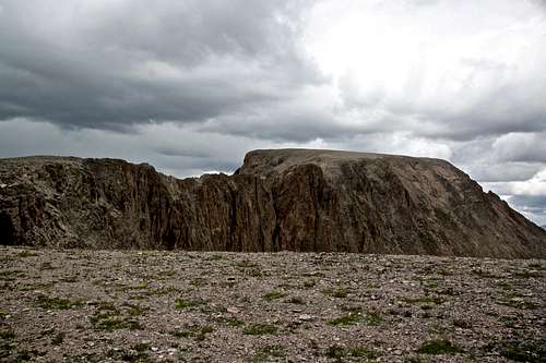
The view of the ridge may seem scary and exposed, but it is really easy. You can stay right on top of the ridge and make it a little more exposed and possibly even class 3, but there is a trail on the west side, which should not exceed class 2. The ridge is about 0.2 miles long (I wished it longer). In a few places there are small cairns to mark the trail. Get over a small notch, scramble to the final summit plateau. Another boring hike up gentle slopes for 0.2 miles and then you reach the summit. There are a couple of medium sized cairns. I did not find any register. The views are amazing! Many 14rs, including Uncompahgre, Wetterhorn, Handies, Redcloud and Sunshine. Also great view into the Grenadiers.
Half Peak and its ridge
Essential Gear
Comfortable shoes, backpack with day supplies (consider water purification tablets), trekking poles. Sunscreen, hat. Map, or some kind of navigation device.
Summit Views
 Uncompahgre Peak as seen from the summit of Half Peak. | 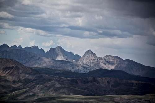 View into the Grenadiers from the summit of Half Peak. | 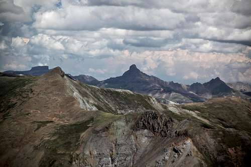 Wetterhorn - 14er in the middle, Coxcomb ( the left) and Matterhorn (right) |
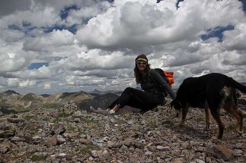 Photo with camera timer. | 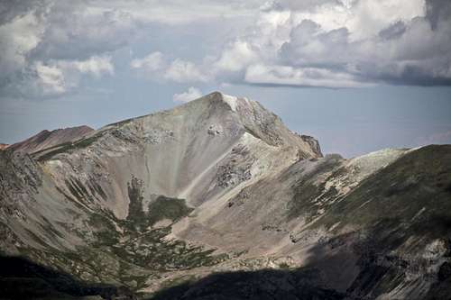 Handies Peak as seen from the summit of Half Peak. | 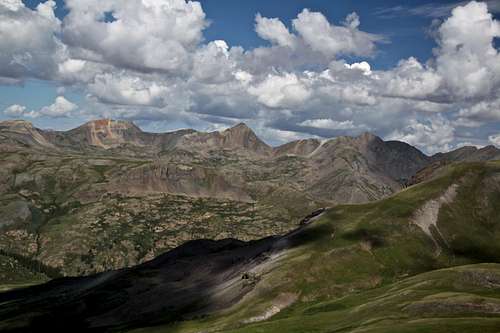 View west from the slopes of Half Peak - Niagara, Jones, and American peak. |