
-
 5988 Hits
-
 72.08% Score
-
 2 Votes
|
|
Route |
|---|---|
|
|
37.93650°N / 106.8667°W |
|
|
hike, partly off-trail |
|
|
Most of a day |
|
|
class 2; 11.5 miles/4100' gain round-trip |
|
|
Approach
The south slopes route is the easiest and most commonly used route on Phoenix Peak. Start from the East Willow Creek TH. Use directions given on the main page for Phoenix Peak.
Route Description
Topo by John Kirk

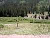
From the trailhead, start hiking north along the unmarked Phoenix Park Trail. The trail meets up with the 4WD road to Phoenix Park. Continue north along the 4WD road, using a somewhat flimsy footbridge to cross Whited Creek. In just under 2 miles, the road brings you to the expansive fields of Phoenix Park.
As you enter Phoenix Park, look east(right) to find FT 787, the Center Stock Driveway. A thin metal trail sign with cairn marks this turnoff. The turnoff is easy to miss, as there is no trail from the 4WD road down to the creek. Across the creek, note a 4WD road bending to the south. Walk down to East Willow Creek, cross, and follow the 4WD road.
Follow the 4WD road/trail south then east, crossing a branch of East Willow Creek to its south side in about half a mile. Continue east along the south side of the creek for almost 1.5 miles. Spectacular terrace ponds and many felled trees can be seen here, the work of industrious beavers. Initially, the trail is distinct and cairned, becoming faint as you approach treeline. When in doubt, just make sure you are following the creek along its south side.
As you approach treeline, almost 2 miles from Phoenix Park, look north for the rocky west-facing cliffs of the conglomerate ridge. Cross to the north side of the creek and head north up easy slopes to the east side of this small ridge. A trail follows this gentle ridge, and you will enjoy close-up views of exotic hoodoos.
Pass the ridge and head north up gentle slopes to the saddle between Phoenix Peak and point 13780. Continue northwest to the summit.
 |  |  |  |
Essential Gear
In snow conditions, snowshoes, ice axe, and crampons may be needed for this route.
Miscellaneous Info
If you have information about this route that doesn't pertain to any of the other sections, please add it here.
Larry V - Jul 10, 2013 8:52 pm - Hasn't voted
CLOSEDThe FT 787 trail part of this route is now closed, per signage at the trail junction. The East Willow Creek Falls route is a good, scenic, and shorter alternative.
bigperm7 - Oct 3, 2019 7:22 pm - Hasn't voted
Trail Not ClosedThe 787 trail is open to foot and horse traffic only. The trail is closed to motorized vehicles.