
|
|
Route |
|---|---|
|
|
38.68812°N / 110.68095°W |
|
|
Mountaineering, Trad Climbing, Scrambling |
|
|
Spring, Fall, Winter |
|
|
Most of a day |
|
|
5.4 (YDS) |
|
|
Overview
This might be considered the normal route on this seldom climbed mountain. It’s isn’t that difficult of a climb, but it is loose and potentially dangerous. Although we did the climb without a rope, others have been turned away at the crux pitch as well as the pitch before it. In some places on the route, a rope could actually hinder safety because of the loose scree, but it is highly recommended that both a rope and a standard climbing rack always be taken.Opinions vary, but various sources have rated this climb as 5.0 to 5.6 for the crux pitches. Most of the reason for the variation is that part of the route fell away a few years ago, making the climb more difficult. Most people now agree that it is at least 5.4. Either way, this is not an ascent to be taken lightly.
 SaraThompson's photo showing the descent after climbing the peak.
Getting There
The main paved road offering access to this peak is Utah's highway 24. The mountain is located roughly halfway between I-70, and Hanksville, Utah. From exit 149 on I-70, head south and drive 22 miles to Temple Junction, which will be sign posted for Goblin Valley State Park. The road, ironically, is called Temple Mountain Road on some maps. From Temple Junction, drive west on a Temple Mountain Road, (paved for much of the way) for 7 miles. Towards the last mile or so you will be driving through the San Rafael Reef. At mile 7 you will be just inside the reef and Temple Mountain will dominate the horizon to the north. At this location there area several lavatories and parking locations available. The perimeter here is fenced off to the north areas with an older log style fence. This will be the start of the route for those without access to a four wheel drive vehicle or mountain bike.For those out there with four wheel drive/high clearance vehicles and/or mountain bikes, you may be able to reach the base of the mountain's east side where the scrambling route begins, all depending on your driving ability. The BLM has designated the access road on this portion of the mountain for ATV's. The whole section of road from the main parking area to the end of the four wheel drive portion is just over 1.5 miles. The road is fairly rough on some portions, mainly about just under 1 mile in from the parking area mentioned above. Rock/mud slides have narrowed portions of this section of road recently. If you insist on driving this portion do it at your own risk to you and and your vehicle. See the map below for more information to the base of the mountain.
 Road approach to Temple mountain from Highway 24.
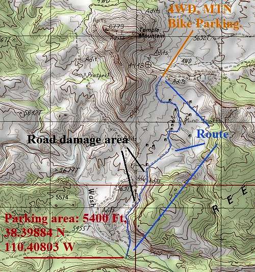 An overview of the access to Temple Mountain.
 Alternate access route with routes marked.
 Route Description
Note: The original route was written by Wasatch Voyage, but he has departed Summitpost. The page has been updated to reflect current conditions.This route may not be a cup of tea for those who are uncomfortable with some decent exposure. The route featured here starts from the normal parking area at the beginning of the 4WD/ATV road.
 Route diagram for the Standard Route. Click for full size.
From the parking area off Temple Mountain road, follow the well used 4WD/ATV trail to the north. There are several tracks cutting off to the left and right, continue heading north. The atv trail cuts up over a smaller ridge near a larger mine dump to the north east. This area is where it could be challenging for those wanting to approach the mountain in a motorized vehicle. Once reaching the top of this small ridge area, the ATV trail meanders in a north direction past another mine dump, to the east side of the mountain. After just over 1.6 miles, veer west on a smaller more obscure ATV trail, which soon tapers off into nothing after several hundred yards. This is where basic route finding skills will be needed. The saddle area can be seen above this location roughly 500 vertical feet. There are several different chutes full of loose rock which can be scrambled up to reach the ridge/saddle area. The chute furthest north looks to be the most challenging with cliff bands which will have to be negotiated up higher. The central chute does have one smaller cliff band which has to be crossed, class 3. The chute furthest south is the least challenging with class 3 scrambling and loose rock. If the latter is chosen a traverse across the ridge to the saddle above in a north direction will be needed. Portions of the ridge leading to the saddle area will need to be bypassed by dropping off a bit to the east on the ridge area.
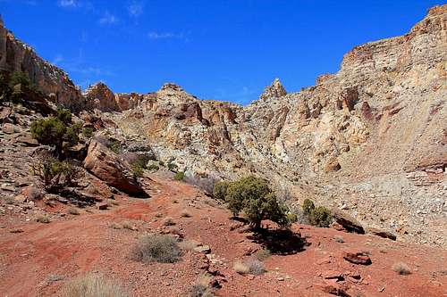 Looking up at the chutes to the saddle area.
Once reaching the saddle area, which is located directly north of a large rock outcropping on the lower ridge, begin heading up the smaller cliffbands to the north. After about 100 yards the terrain soon steepens. The first obstacle can be climbed over at upper class 3. At some point others have placed a small pile of rocks at the base of this small cliff. The cliff is roughly 15 feet in height. Above this point there are four other cliffs similar in size which will need to be negotiated to reach the upper summit ridge connecting the west and east summits of Temple Mountain. Once reaching the summit ridge, continue to either summit of your choice along the wide rounded ridge. If heading to the west summit, labeled 6,773 feet on the USGS map, you will need to downclimb a 15 foot cliff and traverse class 4 terrain for about 0.25 miles to the summit. If heading to the east summit, the base of the summit block is reached with a class 2 stroll. Class 3 scrambling will be needed to the summit block, which is best reached on the peaks east side. A small rock cairn awaits at the top.
 Class 4 to 5.4 terrain routes A and B, for access to Temple Mountain's Summit Ridge.
Another option to reach the summit ridge, Route B, is to reach the top of the first cliff. Look to the north east and locate a large steep crack in the upper cliff area. This crack is about 45 degrees, and about two feet wide at it's most narrow point. Reaching the base of the crack will require climbing two small cliffs above the first. The base of the crack is very exposed class 4 to 5.4 scrambling. However, once in the crack the exposure in minimal. You may have to take your pack off and drag it behind you to fit in there. The crack leads all the way to the summit ridge. This crack can offer more security for those wanting to avoid the class 4 terrain on the first route mentioned, route A. The crack offers a safer descent option than that of route A, though caution will be needed to traverse about 30 feet of extremely exposed terrain at the bottom.
 SP Member Kadee below the crux area near the saddle.
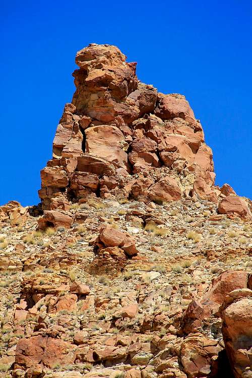 A look at the east summit area, scramble class 3 terrain to the right.
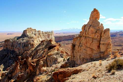 View south from the saddle area, lower ridge.
 A look at the east summit above the crux of the route.
The round trip mileage is 5.5 miles with 1400 feet elevation gain, but the route will take the better part of a day.