
-
 6231 Hits
-
 72.08% Score
-
 2 Votes
|
|
Route |
|---|---|
|
|
39.63600°N / 106.17°W |
|
|
Mountaineering, Skiing |
|
|
Spring |
|
|
Most of a day |
|
|
Intermediate Snow Climb, Advanced Ski Descent, D5 |
|
|
III |
|
|
Overview
Red Peak B is the second highest of the Red Peaks in Colorado, hence the B, but the highest ranked Red Peak in the state. Red Peak is the highest visible peak of the Gore Range from Silverthorne, Colorado. The Southeast Face is what ones sees when leering at Red Peak from Summit County, Colorado. Red's Southeast Face is far from technical, but is aesthetically pleasing and provides a great ski descent.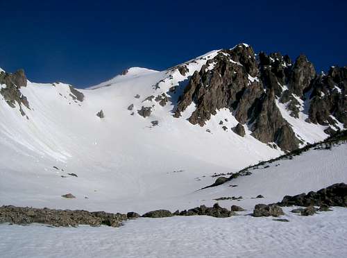
Getting There
Exit #205 "Silverthorne, Dillon" off of Interstate 70.Go north on CO 9.
Take the first left onto Wildernest Road.
Drive 3.3 miles to parking on left.
This is the Buffalo Cabin (Ryan Gulch) Trailhead.
Route Description
Follow the Buffalo Cabin Trail 0.5 miles to a four way intersection. Go straight at the intersection on the Willow Creek Trail to the base of Silver Couloir. Drop into Willow Ceek and meet up with the Gore Trail and follow it west to the base of a large avalanche path on the north side of Willow Creek. This is the base of Red Peak's Southeast Face. Climb up to the summit. The maximum slope angle is near 35 degrees and is rated as a D5 on the D Scale.
Round Trip Distance: ~8.2 miles
Elevation Gain: ~3829'
Essential Gear
Skis or snowshoes and poles.External Links
Stan Wagon's Page5/16/06 Trip Report