|
|
Route |
|---|---|
|
|
38.68560°N / 106.6211°W |
|
|
Spring, Summer |
|
|
Half a day |
|
|
Overview
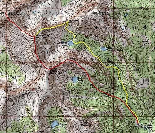
The Southeast Ridge is a grassy walk-up that can be reached in one of two ways. One route from Gunsight Pass seems to be the most popular, and involves class 3 scrambling to Square Top Mountain via its east ridge. A class 2 route is possible by ascending the south slopes of Fossil Mountain's East Ridge and continuing to Fossil Mountain's summit, then following the ridge north to meet the more popular route on Square Top Mountain.Getting There
Gold Creek trailhead is accessed from Parlin on road 76, 12 miles east of Gunnison on highway 50. After 8.5 miles northeast on this road to the townsite of Ohio, head north 6.5 miles of dirt road to Gold Creek Campground. Private property lines much of the road on approach to Gold Creek. Standard 2wd should make it to the campground without any problems. The best way to get to Parlin from Denver/CO Springs is taking Highway 285 southwest to Poncha Springs and then Highway 50 over Monarch Pass, continuing west for about 30 miles.Route Description
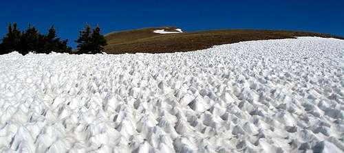
East Ridge below Fossil Mountain.
Follow the trail from Gold Creek Campground to a junction toward Mill Lake (should be signed). Follow the Mill Lake fork and leave the trail at about 11,200', heading north through the trees to gain the east ridge of Fossil Mountain. On the ridge, follow the gentle crest to treeline over grassy slopes up Fossil Mountain. The angle will increase as will the difficulty, but should remain at class 2. Follow the ridge north to Square Top Mountain from Fossil Mountain, the descend northwest to the Square Top/Henry Mountain saddle. Follow the gentle ridge to Henry Mountain's flat summit.
Map