
-
 8081 Hits
-
 72.85% Score
-
 3 Votes
|
|
Route |
|---|---|
|
|
37.97831°N / 105.58826°W |
|
|
Hiking, Mountaineering |
|
|
Spring, Summer, Fall, Winter |
|
|
One to two days |
|
|
Class 2 to 3 |
|
|
Overview
Round-trip distance from South Colony Lakes Trailhead:From 2wd trailhead: About 17 miles, 5,000 feet gain
From 4wd trailhead: About 7 miles, 2,800 feet gain
Note, I rated this a one-to-two day climb. Obviously, with a four wheel drive vehicle in the summer, this peak should not require a two day hike. However, if you do not have a four wheel drive, or you are hiking this one in winter, be prepared for a gorgeous backpacking trip in the South Colony Lakes basin.
Also, note that I say "class 2 to 3." The actual ascent of the mountain is an easy class 2 walk-up, but there is some surprising scrambling required along the ridge of Point 13,290. It is not difficult, but can be time-consuming, especially with snow or ice (see below: "Route Description").
Trailhead
South Colony Lakes Trailhead:2WD: 8,780 feet
4WD: 11,060 feet
From Westcliffe, drive south on Colorado 69 for four and a half miles. Turn onto Custer County 119 (Colfax Lane) unto the road ends at a “T.” Turn right. Humboldt Peak is ahead of you, and nothing separates you from the basin with South Colony Lakes except a rough 5.2-mile dirt and rock road. Two wheel drive vehicles must park at the trailhead before this. The first 1.5 miles of 4wd road run across private property, so stay on the road. Beyond this, you are in San Isabel National Forest, and there are numerous parking and camping spots along the road. If driving to the 4wd parking, there is also some room to park and camp in this area. Hike just more than a mile from here and you will be at timberline next to lower South Colony Lake (about 11,700 feet). There are numerous camping spots here as well, but be careful to obey the signs and do not camp within 300 yards of the lakes.
Route Description
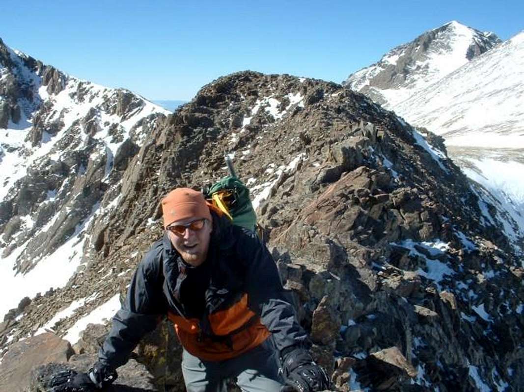
From South Colony Lakes, it is said that one can climb any of the snow chutes at the head of the basin, to the north of Crestone Peak. This option was corniced and looked dangerous during our climb in mid February, so we went with the other alternative: the ascent to the Humboldt Peak saddle. Follow the Colorado Fourteeners Intitiative trail, or in winter, ascend the slopes as best as possible to this 12,800-foot saddle. Continue west up a steepening ridge to Point 13,290.From here, you must bypass or go over several humps in this ridge, some of which involve some route-finding and easy scrambling. I will not ruin the fun by describing this section in detail, but it is the route's crux, and it can be time-consuming.
After getting through all the difficulties of that ridge, you will arrive abruptly at the park-like "Bear's Playground." Angle to the right and hike straight up the southeast slopes of "Obstruction Peak," completing a final ridge-walk to the summit. Enjoy the view, and be careful to make sure the wind does not blow you off the cliffs of the north face!