
-
 23752 Hits
-
 78.57% Score
-
 10 Votes
|
|
Route |
|---|---|
|
|
43.11054°N / 109.60073°W |
|
|
Mountaineering |
|
|
A few days |
|
|
Grade I Class 3 |
|
|
Class 3 |
|
|
Overview
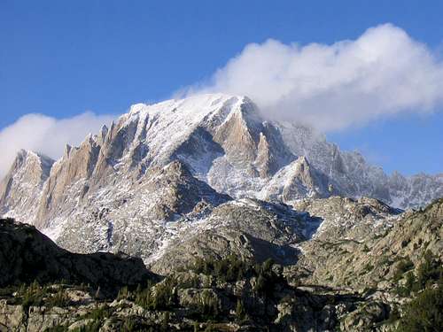
Fremont Peak and snow covered southwest buttress from Island Lake. Photo by mtneering.
Whether this is a good thing or a bad thing, Fremont Peak, the second-highest peak in the Winds and the third-highest in all of Wyoming, one of the state's most recognizable peaks and the one for a long time believed to be the highpoint of the state, has an easy clambering/scrambling route to its summit, yet the views are just as spectacular as any you would expect from any technical peak. Some of the highest peaks in Wyoming, including the highest (Gannett Peak), are visible from the summit, as are some of the largest glaciers and icefields of the U.S. Rockies. Even after taking the long approach into account, almost any climber would agree that there is a very high payoff factor associated with climbing Fremont Peak.
Because the round-trip distance from trailhead to summit and back is about 30 miles, most people will want to plan at least two nights for this outing. However, considering the setting, many will want to spend three or more, for this peak is in the heart of the Winds and in one of the most stunning and inspiring alpine settings in the world.
Many guidebook and online descriptions refer to this route as a Class 3 one, and for the sake of consistency, I label it as such here. However, I feel this is really a Class 2+ route, for I found very little true Class 3 scrambling on the route. While it is possible to engage quite a bit of it and even find harder terrain, it also possible to keep it easier than that just about the entire way. The summit block itself is Class 3, though, and a very memorable summit block at that, for it is small and terrifically exposed on its north side.
Getting There
Near the south end of Pinedale, turn east onto a signed road for Fremont Lake. Drive 14-15 miles to reach the Elkhart Park Trailhead.
For specific details, please see Bill Reed's page for Elkhart Park.
Approach
Either Titcomb Basin or Indian Basin can be used as a base for this route.Start from Elkhart Park, about 9400', and hike 10.5 mi to Island Lake, about 10,400'. While this sounds like one of the world's easiest backpacking approaches, it is more strenuous than it sounds, for the route does not ascend a drainage or other naturally ascending line but rather has several dips and reclimbs that make the total elevation gain closer to 2000' (still not that bad but frustrating nevertheless). And the first 5 miles are almost exclusively extremely dull hiking through lodgepole pine forest with no views of anything except more lodgepole pines.
Although there are several trail junctions along the way, with a good map and decent reading comprehension, you will not have trouble following the correct route.
Where you camp is up to you based on your itinerary. Island Lake makes a good base camp because routes to Titcomb Basin, Indian Basin, and other areas nearby all branch out from it. If you don't camp at Island Lake and if Titcomb Basin is your primary destination, then consider the extra hike into the basin to set up camp. However, be aware that finding good legal campsites in lower Titcomb Basin is tricky because you are required to camp at least 200' from lakes. Also, there is very little shelter in Titcomb Basin, and wood fires are not allowed.
From Island Lake, hike another mile to a signed junction. In August 2012, the sign indicated Indian Pass was 6 miles along the right fork (seems a bit too long, though). Going left, you immediately cross the stream draining Indian Basin and shortly thereafter enter famous and spectacular Titcomb Basin.
Route Description
From the junction, distance to the summit is about 3.5 miles. Elevation gain is about 3200'.
From Titcomb Basin
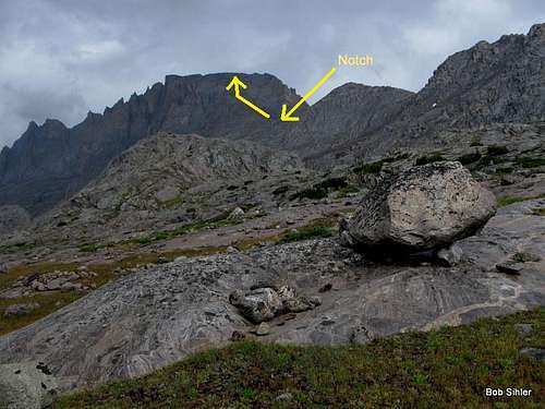
The next key destination is a col at 12,020' on a ridge separating Mistake Lake from Indian Basin. Note-- you want the col that is the northern of the two on the ridge and directly at the base of the SW buttress; the southern one can work as well but will result in extra elevation gain by going up from that col and then descending to the northern one.
From Indian Basin, the best way to get to the col is to leave the trail at the inlet of Lake 11,008 and head up the drainage, where you will find a cairned use trail in places (note that the drainage proper does not go all the way to the col). However, if you don't find the use trail or if you leave the trail earlier once the col comes into sight, it certainly won't keep you from reaching the saddle. The ascent to the saddle is a Class 2 ramble up slabs and talus.
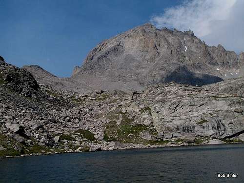
Seen from Indian Basin
This drainage is also the last place on the route you can expect to find water unless there is snow on the buttress above, which is not going to be too likely by mid-July in most years.
Once at the saddle, take a break and enjoy the views of Titcomb Basin and then head up the broad, obvious SW buttress. It's less than a mile to the summit know, but it's a steep haul-- over 1700' of elevation gain.
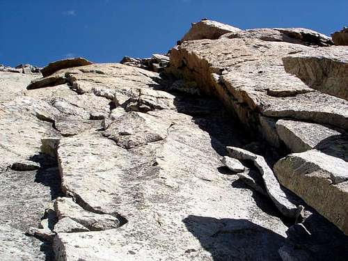
Lower, there is quite a bit of talus and scree, but as you get higher, the buttress becomes slabby. The easiest ground seems to be to the left and the right. It's not hard to stay on course, though, for if you go too far in one direction, you run into cliffs and other Class 5 rock.
 By csmcgranahan | 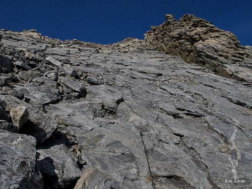 |
The summit block is one of several outcrops along the summit ridge, and it might appear somewhat suddenly. See John C. Fremont's quote below.
"I sprang upon the summit, and another step would have precipitated me to an immense snow field five hundred feet below." - from Fremont's report, 1842.
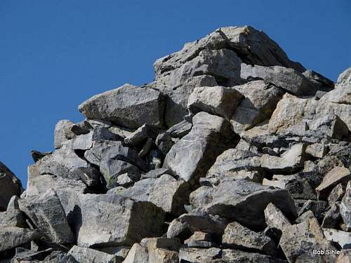 | 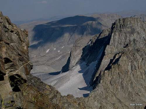 |
Indeed, once you top out on the summit ridge, you may suddenly pull back as you realize another step or two would send you on a quick trip to the Upper Fremont Glacier below. But it is a spectacular and memorable sight to come upon.
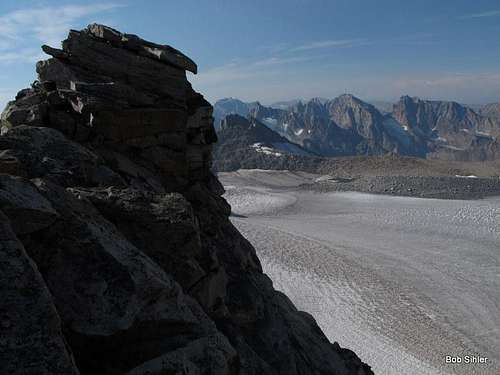
Summit block and million-dollar view
Map

This is the route profile from Elkhart Park to the summit of Fremont Peak via Indian Basin. It prints out nicely in 8x10 if you want to bring it with you. Map and diagram by Brendon.