
|
|
Route |
|---|---|
|
|
42.64180°N / 109.094°W |
|
|
Hiking |
|
|
Summer |
|
|
Most of a day |
|
|
Class 1 - 2 |
|
|
Approach
See the getting there section on the main page for driving directions to the start of this route.Route Description
Depending on your vehicle, walk up or drive forest road 890 to the trailhead, if you are driving you will be able to save about 600 feet of elevation gain and 2 miles one way.Round Trip Distance : 14 mi (measured from the start of FR-890)
Elevation Gain : 4000 ft (measured from the start of FR-890)
 Hike Overview highlighted in yellow
Once at the Sweetwater River trailhead, you will have the option to go left towards Little Sandy Lake or right towards Sweetwater Gap. Go left and head towards Little Sandy Lake. A view of Mount Nystrom and the southwest ridge from near the trailhead is here.
 View looking down the southwest ridge
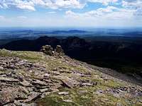
 Mount Nystroms summit area
The first mile of trail is easy going and does not ascend much in elevation, after this the trail becomes a little more difficult. From a forest fire years ago, there are many downed trees along the trail which will occasionally have to be bypassed. Each year it looks as though the past burnt trees fall and create new obstacles on the trail and trail maintenance is needed each year. Instead of looking for a way around the downed trees, I found it easiest to simply go over them. There were probably about 10 sections of downed trees from one to two miles from the trailhead as of 6/16/2007.
After 2 miles of hiking from the trailhead, the trail enters an area of older trees which have not been burnt and thus the trail is good and also becomes steeper. At about 3 miles you will reach the pass and the Continental Divide Trail (no real trail exists here) and the trees are mostly Bristlecone pines. Before the trail begins to descend to Little Sandy Lake, you will want to take a 90 degree turn to the right (northeast) and begin heading up the southwest ridge of Mount Nystrom. From the pass to the summit the elevation gain is about 2200 feet.
Try to keep headed in the same direction, the southwest ridge will be hard to see through the trees but you should have a general idea, after about ½ mile from the pass you will be above tree line. Once above tree line the summit is a little more than a mile and a half away. Instead of staying directly on the ridge, I found it easiest to stay to the left side (north and east) of the ridge and to stay like that all the way to the summit. Staying on the ridge seemed to be more rocky and much more boulder hoping and to the left of it was less rocky with more grassy areas.
You will soon be close to the summit, which is a series of rock outcrops, the highest is the northernmost bump of rocks, continue to here and you will find the summit with a benchmark.