
-
 7078 Hits
-
 72.08% Score
-
 2 Votes
|
|
Route |
|---|---|
|
|
37.61300°N / 107.591°W |
|
|
Hiking |
|
|
Spring, Summer, Fall |
|
|
A long day |
|
|
Class 2+ |
|
|
II |
|
|
Overview
Jupiter Mountain is at Needle Creek's head, 0.6 miles south of Windom Peak and fifteen miles south-southeast of Silverton. It is the 92nd highest peak in Colorado.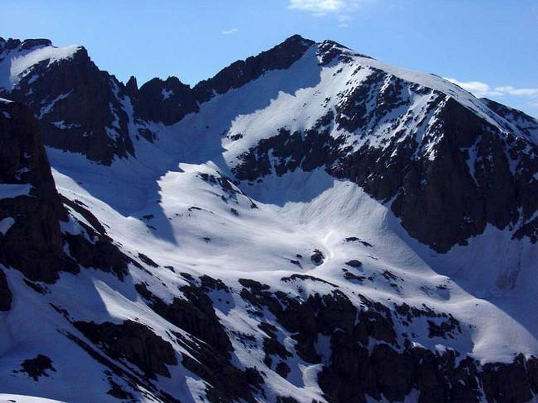
Jupiter Mountain's North Face. Jupiter's West Ridge leads right from the summit.
Jupiter is the first prominent peak one sees while hiking up the Needle Creek Trail into Chicago Basin in the Weminuche Wilderness, Colorado's largest. From the summit, there are great views of the Chicago Basin fourteeners Mount Eolus, North Eolus, Sunlight Peak & Windom Peak, Jagged Mountain and The Rio Grande Pyramid. The Southwest Slopes Route is Jupiter's standard and easiest route and the only route that should be climbed during snow free periods.
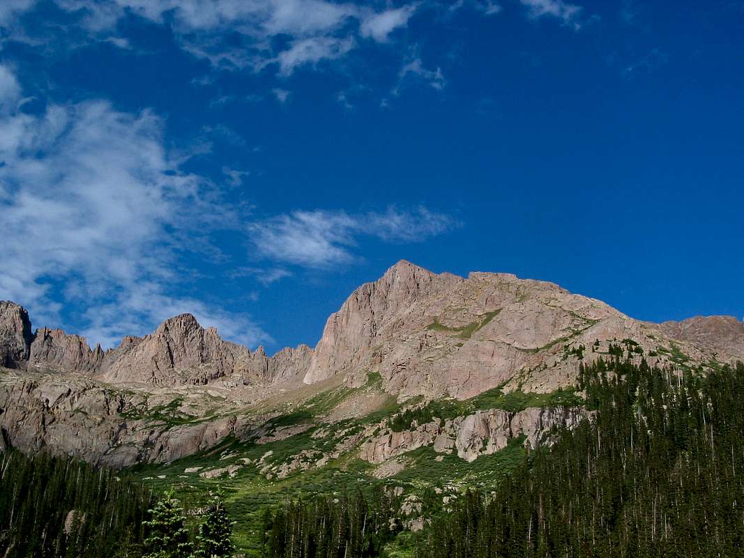
Jupiter Mountain from 11,100 in Chicago Basin
Getting There
Jupiter Mountain's Page describes the involved approach. The best place to camp if attempting Jupiter Mountain and the Chicago Basin Fourteeners in the same trip, but different days is near the upper Twin Lakes and Columbine Pass intersection at 11,200'.Route Description
From camp at 11,200' near the upper Twin Lakes and Columbine Pass intersection, follow the Columbine Pass Trail until over Jupiter Mountain's west ridge. Leave the trail here and gain Jupiter Mountain's west ridge. Follow the long ridge, staying south to avoid difficulties to the 13,780' false summit. From the false summit, follow the ridge to the true summit staying north to avoid difficulties.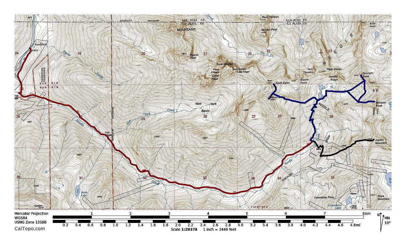
Red = approach. Black = Jupiter Mtn.'s SW slopes route. Blue = Mt. Eolus, N. Eolus, Windom & Sunlight Peaks.

Jupiter Mountain's Southwest Ridge Route
From Camp at 11,200'
Roundtrip Distance: ~2.7 miles
Elevation Gain: ~2,700'
From Needleton Trailhead at 8,212'
Roundtrip Distance: 15.9 miles
Elevation Gain: 5,700'