Some of you may be aware that there is a big music festival held here in the UK every year at Glastonbury. It takes place on a around the time of the summer solstice and features bands and artists both new and old from all over the world. If you live here, it’s very difficult to miss it as there are regular reports of it on news programs and the BBC devote 3 days of Live and recorded performances in their TV schedule over the long weekend in which it takes place.
I am not really interested in many modern artists but look out for any old favourites who may be appearing. This year, a name jumped out at me… a band called Sparks.
Those of you in the 60+ age group may remember them. Fronted by Russell and Ron Mael, they burst on to the music scene in 1974 with a song called “This town ain’t big enough for the both of us”. It was a catchy song and a huge worldwide hit. It came from the album “Kimono my house” which also became a huge hit.
At that time, I was 15 and into a mixture of American west coast music (think CSN &Y), hard rock and progressive bands like Deep Purple, Led Zeppelin and Yes. I thought Sparks were just another pop band and not worthy of my attention. I was surprised to find that the “serious” music mags here in the UK, thought they were really good and the album was one of the best of the year. I distinctly remember wondering if I should buy the album in case I was missing out on something important! (This was important stuff to 15 year old me!)
In the end, I didn’t buy their album and after several more hits over the next few years, Sparks vanished from view, I assumed they broke up.
Not so, the Mael brothers have been producing albums on a regular basis ever since.
So, I tuned in to watch their show at Glastonbury.
I was surprised, it was great! I only knew a few of the songs but the whole set was full of quirky and engaging music and the few familiar songs that I had been missing all these years. Once the songs got into my head, I couldn’t stop singing them! (I think that is known nowadays as an “ear – worm”!). And thanks to the BBC Iplayer, I could re-watch the show as many times as I wanted!
It was a bit of a revelation to find this music had been there waiting for me to re-discover it all along.
So why am I telling you all this?
The long road north to Scotland
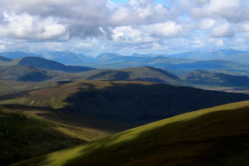
Glencoe in the distance, Scotland
Between 1983 and 2000, I think I visited the mountains of Scotland at least once each year (all except 1988) to climb in both Summer and Winter. In those days, the journey northwards was a lot harder than it is now with fewer motorways to help.
The vast majority of these visits were to the dramatic mountains of Scotland’s northwest coast. I had been captivated by the writings and images produced by the many British mountaineers who cut their teeth in these hills.
Driving northwards, the journey became exciting once Glasgow was left behind and Loch Lomond appeared. Ben Lomond was an easy mountain to recognise and I knew that the surrounding hills were high mountains themselves but I knew little about them. I was waiting for the moment when we crossed Rannoch moor and Glencoe came into view in the shape of the Buchaille Etive Mhor. Ben Nevis, Kintail, The Isle of Skye, Torridon – the mountain equivalents of Deep Purple and Led Zep - these were the areas I was interested in not the green and grey mountains further south. I was drawn towards the high craggy tops and ridges and the well known more “glamourous“ mountains.
Apart from a 3 day visit to Ben Lawers, I had ignored the whole area south of Rannoch Moor and eastwards to Loch Tay as “not worthy”.
Marie and I had already decided that 2023 was a time to try a new area in Scotland. I had re-ignited my desire to climb all the Scottish “Munros” and there are plenty around Loch Tay.
As the week unfolded, I couldn’t help but compare these new (to me) mountains to the Sparks music I had recently discovered.
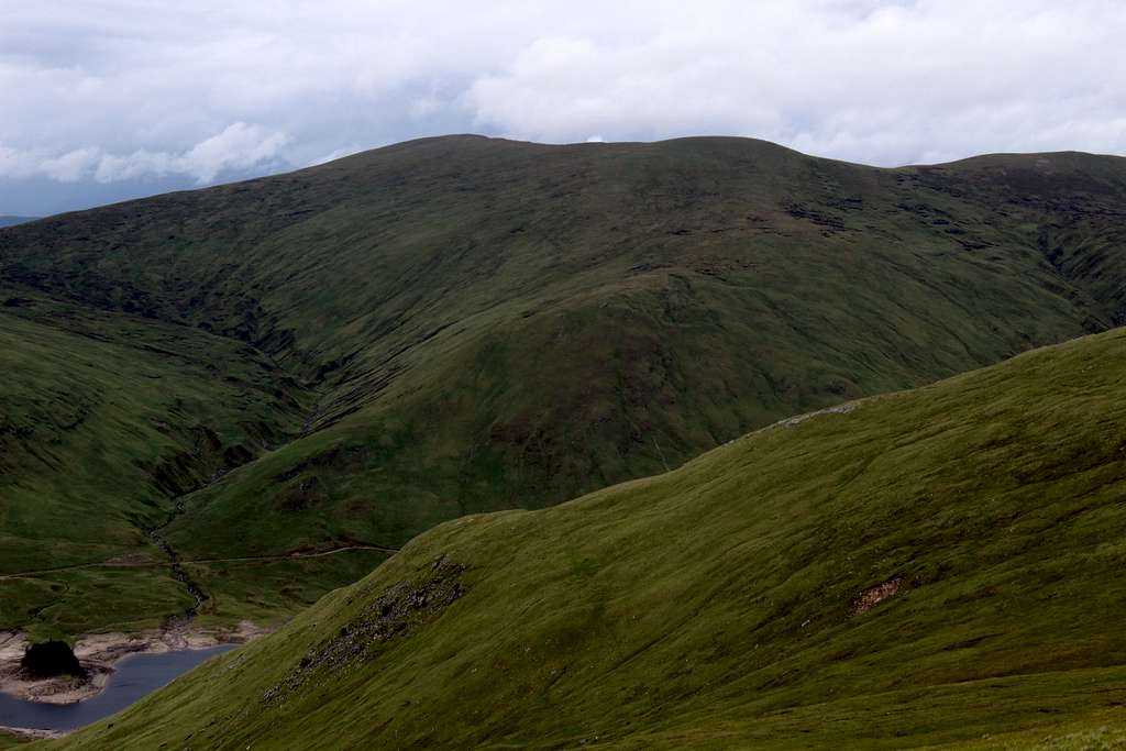
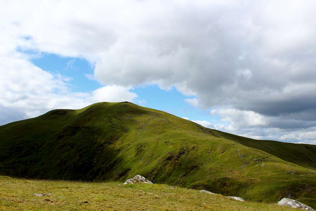
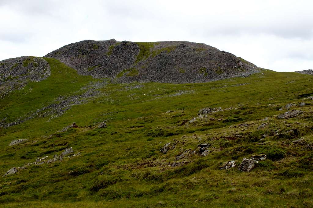
Mealle Buidhe (932m) and Stuc an Lochain (960m)
Meall Buidhe (932m), Scotland
A week after the Glastonbury festival, we were staying near the town of Killin in Scotland, on the banks of Loch Tay.
The Scottish weather was not co-operating with our plans. After a day of unpleasant wind and rain, we really wanted to get out and do something. The forecast was for less wind but frequent showers.
“What is the quickest hill we could climb.” Marie asked.
I consulted my notes and guidebooks and came up with Mealle Buidhe.
“1 hour 50 mins up and about an hour down, 3 hours round trip.” I said.
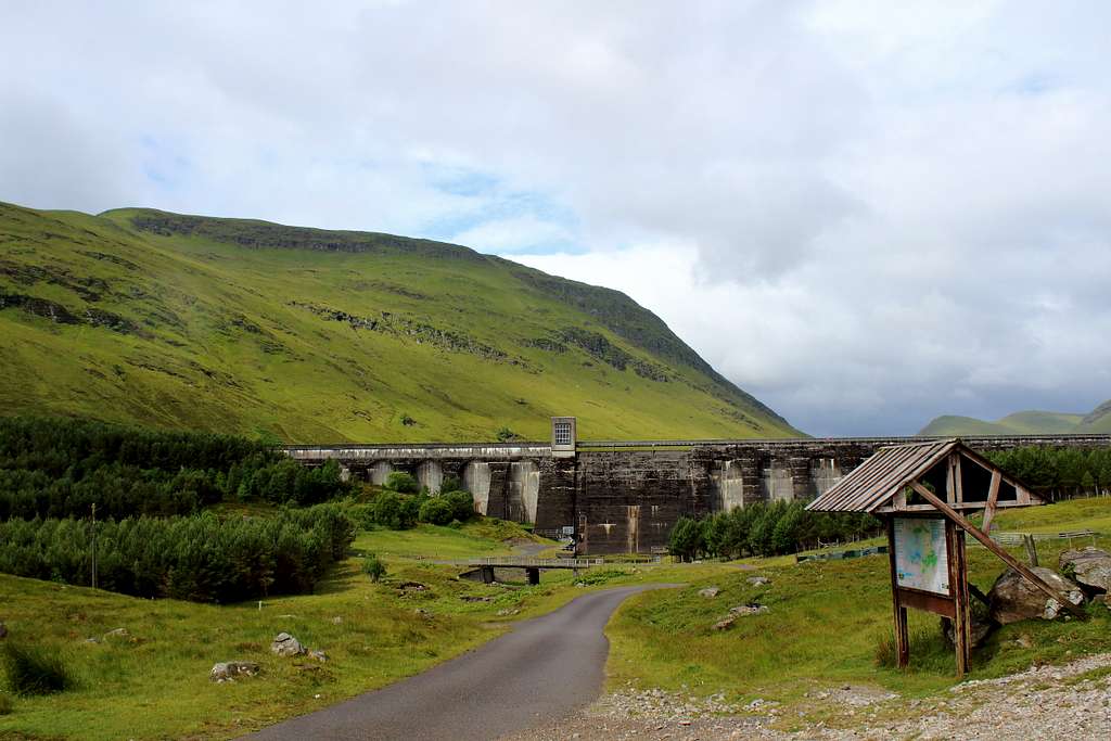
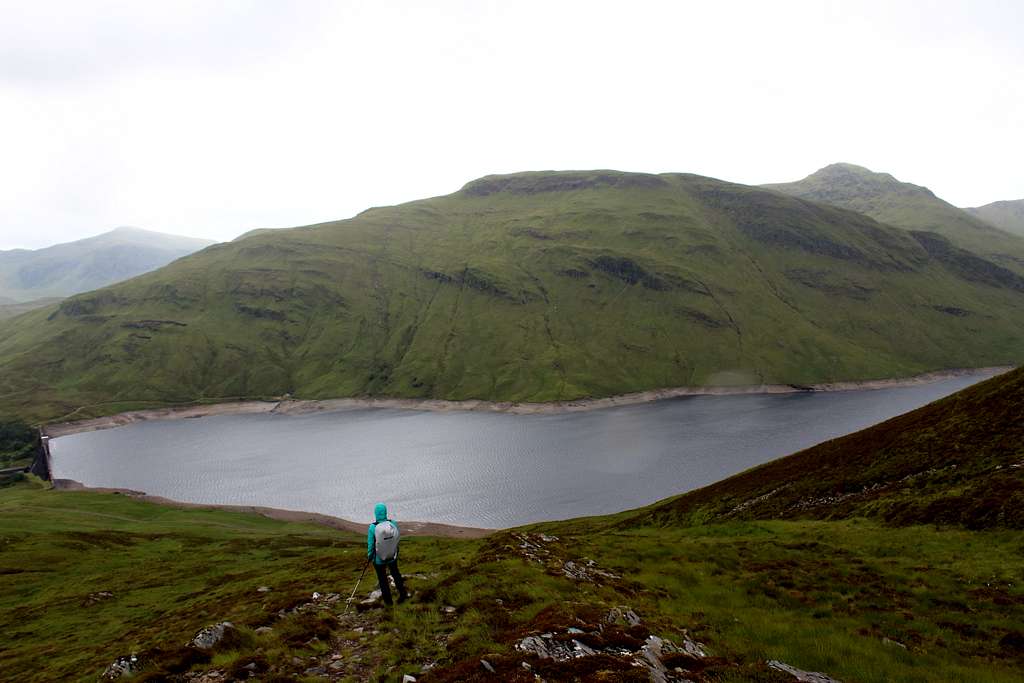
It was a long slow drive over to the lonely road in Glen Lyon – said to be the “longest, loneliest and loveliest glen in Scotland” by Sir Walter Scott - then a continuation further up to the Giorra Dam on Loch an Daimh where there is rough parking for a few cars.
We arrived in grey, breezy but dry conditions, there was already one car there but we never saw its occupants.
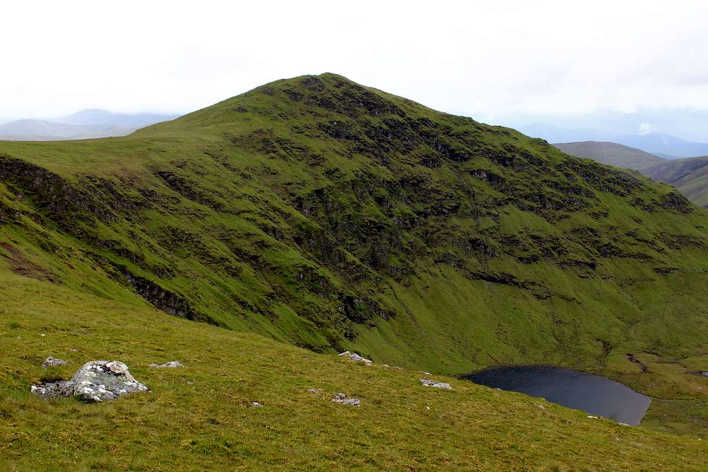
We set off at 10.00 am and followed the track which heads west around the north side of the loch which, despite the recent wet weather, looked rather low in water. At a cairn beside the track, we set off uphill on a small path. I expected it to be muddy but it wasn’t too bad. As we ascended, we had some views over the Loch to Stuc an Lochain, a Munro on the other side of the water.
I had an idea that we might climb that as well later but a shower blew in and obscured the view for a while dampening any enthusiasm. Luckily, the rain didn’t last and we put our heads down and kept going.
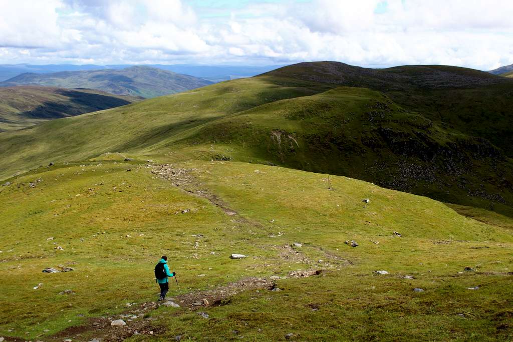
We reached the cairn at Pt 917m much quicker than expected and ahead we could see the broad ridge heading north towards the summit cairn. It was windier here and misty clouds blew across the ridge but we had no trouble making the traverse.
Meall Buidhe (932m), Scotland
We reached the summit in the mist at 11.30, 90 mins after starting out. We hung around for 10 minutes – I hoped it would clear for some photos – but after that we were both getting cold so we headed back.
Again, we covered the ground quickly and the ridge cleared a little. We had some views across to Stuc an Lochain again which now looked a much bigger proposition despite the guidebook giving it a similar ascent time.
We descended quickly but took a different path by accident and this seemed to delay the descent. All the same, we arrived back at the car at 1.00 pm – exactly 3 hours after leaving it – just as a shower approached across the loch.
We jumped in to enjoy our lunch in the dry and warmth while the rain battered the car!
Giorra dam, Loch an Daimh in Glen Lyon, Scotland
After a while, the rain stopped and it actually looked brighter. The thought of heading back down so early in the day made us feel guilty(!) so there was only one thing we could do!
We set off at 1.45 pm - knowing the guidebook time for an ascent and descent of Stuc an Lochain was 3 hours 20 mins – we thought we would be back by 5.30pm.
We quickly reached the south side of the loch and found the path upwards. This was a much steeper route that the previous mountain and was more of a wet, rocky stream than an actual path. Occasionally, the rocks under our feet would slip causing us to stumble.
This was much tougher and we slowly made progress up towards the ridge top.
“I am not looking forward to coming down this.” Marie told me more than once.
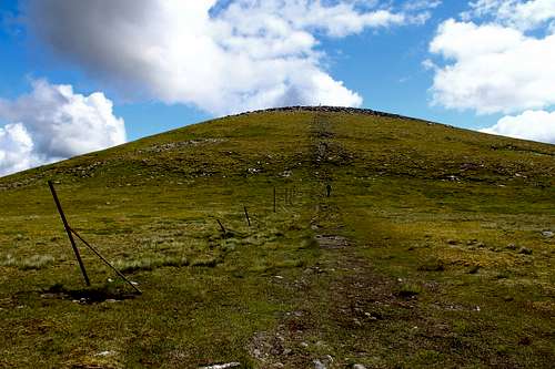
We crested the ridge at a cairn and found the line of old fence posts to lead us up to the first top, Creag an Fheadain at 887m. This was not so steep and was easier going but as we reached the top, we became exposed to the strong west wind and a heavy rain shower.
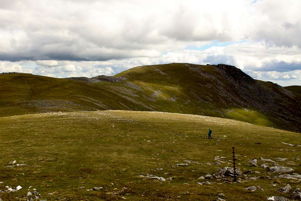
Stuc an Lochain (960m), Scotland
We checked our position on the map and set off into the wind along the cloud covered ridge. When the rain stopped, we could see the summit across the other side of the corrie in which Lochan nan Cat lies.
We carried on, making progress but we were slower than earlier, on what was clearly a more substantial mountain.
We by-passed the Munro top of Sron Chona Choirein, descended to make the final steep ascent up the rough ridge to the summit of Stuc an Lochain at 3.45 pm.
Stuc an Lochain (960m), Scotland
Here, it was grey cloud above us but the summit was clear. We stayed for a few minutes then dropped out of the wind to have a cup of tea.
As we sat looking out over the corrie, I couldn’t help but feel pleased with our day.
“I’d rather be here on a mountain in the clouds than be in the sun further south.” I decided
As we finished our tea, more cloud blew in from the west and we hurried to move off. We re-traced our steps downwards although, this time I visited the top of Sron Chona Choirein just to tick it!
With the wind now behind us, we made progress a lot quicker and soon reached the steep descent path down to the loch.
We were both tired after a long first day and I think we both feared the rough descent, an injury here could easily make like very difficult.
In the end, it was tough but not as bad as we had feared. We took it slowly and gradually descended to the track and then the road back to the car.
We arrived at 5.45pm.
2 Munros on our first day in the hills and 20 km walked. We hadn’t expected to have such a big day but it was worth it.
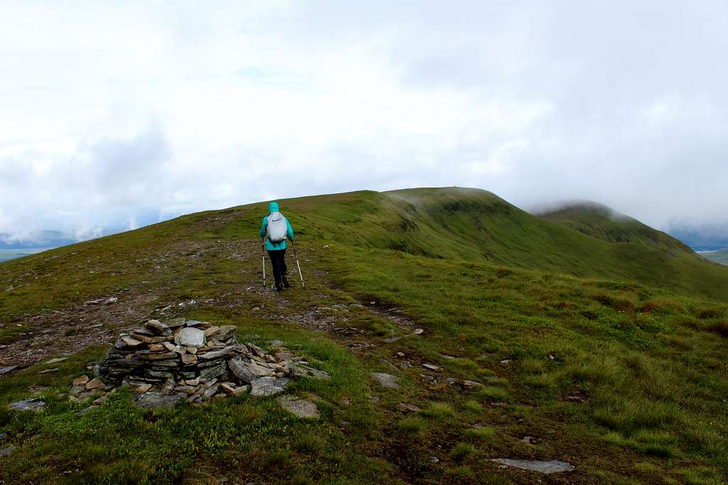
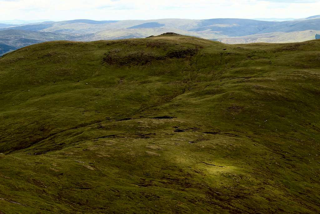
Meall nan Tarmachan (1044m)
Meall nan Tarmachan (1044m), Scotland
All morning it had rained. The forecast had been correct and we had decided to have a rest day.
We read the route descriptions for prospective days out, checked the maps and listened to Sparks on my phone!
Just before lunch, the rain unexpectedly stopped. Almost immediately, the clouds started to break up and patches of blue sky appeared.
We checked the forecast again – now it showed an afternoon of sun and clouds.
(Question: When does a “forecast”” just become a “change of mind when you look out the window?”)
“What was the next shortest route?” Marie asked.
Of course, we had to go out.
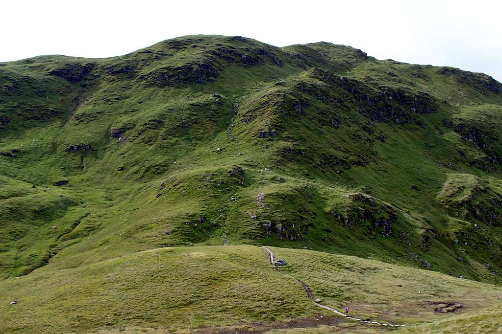
By 2.15 pm we were at the car park on the minor road east of Meall nan Tarmachan and ready to leave in the improving weather.
From here, the path upwards is well marked and easy to find as it crosses a track and wends its way up the grassy hillside. The view ahead still showed that the mountain was covered in clouds but we were hopeful these would disperse.
The path led us up the broad ridge and into the clouds on the Southeast Top. As we reached this top, the clouds thinned and it was disappointing to see we had to drop down the other side of the hill, only to have to re-climb to the main summit.
We climbed the steep, grassy runnel and onto the constructed stone steps. Only our second day and I was definitely not feeling completely fit. Marie was going much better than me and she reached the top while I was still climbing.
“Come on!” she called. “There’s a view.”
Sure enough, as I arrived at the top, the clouds cleared to show us views in all directions. We walked the short distance to the summit, arriving at about 4.00 pm.
Originally, I had wanted to climb this route and continue on the traverse of the ridge westwards. It looked great in the sunshine and we briefly discussed this option. However, we knew that if we did this, a late finish might jeopardize our plans for the next day – supposedly the day with the best weather of the week.
Looking north, we could see the mountains around Loch an Daimh where we had been on the previous day and I fancied I could see Ben Nevis on the horizon. Not such a bad day after all. We decided that in Scotland, you have to grab a good mountain while you can!
We left the summit and descended our ascent route. As we did, the sun became brighter and we had great views of the Ben Lawers massif further east.
We reached the part of the path that passes through an area of bog and still water, the sun was behind the hill and the wind had dropped and a frightening thought entered my head….. Midges!
We continued on, I was expecting to feel them on my face any second. The dreaded creatures didn’t appear, I’m not sure why but we enjoyed a pleasant descent back to the car without being savaged!
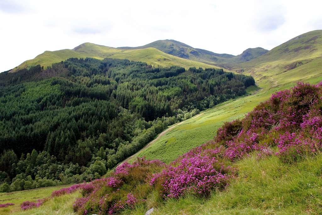
For the day with the best forecast of the week, we had decided to do one of the classic ridge traverses of the area. Set above the hamlet of Invervar, at the eastern end of Glen Lyon, the traverse of the four Munros is a rewarding day with great views, if the weather allows so, we were hopeful for a good day.
Most of the route descriptions advised us to park in the designated car park at Invervar but we had already checked this out. It was closed and looked like it had been for a while so, we reverted to plan B. Further west, down the road past Invervar, there is a large off-road area that we had seen parked cars in. We headed for this, at 8.10 am, we were the first to arrive.
We headed back up the road towards Invervar, to the start of the footpath at a gate marked “Lint Mill”. As we passed through the gate, a car drove by slowly. The two young guys inside took note of the sign and drove on towards the parking area. We were to see them again later.
The first part of the route took us through woods and 3 large gates designed to keep Deer from jumping over them. Some of the woods had been felled and the extra daylight had allowed many Foxgloves to thrive.
We followed the signs to a track for the local hydro electric scheme, then more signs over a wooden bridge and onwards. I was looking for a footbridge across the Allt Coire a’ Chearcaill and I thought I must have missed it as I couldn’t see it until we were nearly right upon it. It was a bit old and shakey but we were soon across.
The path soon left the small river and headed away from any woods onto the open hillside. Carn Gorm is a large, steep grassy hill with rocky outcrops towards the top. I had read that this ascent is technically easy but a lot of hard work so, we put our heads down and went upwards.
The path was good, it wasn’t that sunny so it wasn’t too hot and we made quite good time.
In front of us, the path went steeply up to what I thought was the summit.
Wrong! It was a false top. Looking back, we had noticed the two lads from the car following a long way off.
Carn Gorm (1029m), Glen Lyon, Scotland
Then another grassy slope and another false top. The third one had a cairn at the top, this must be it I thought?
No, the summit of Carn Gorm was further back but after two hours, we were there.
The views north were far reaching towards Loch Rannoch and beyond. Again, I spotted Ben Nevis and Carn Mor Dearg in the distance.
We stopped for some tea and biscuits out of the wind and admire the views, then set off to descend to the northeast.
As we left, the sun came out and the two lads from the car arrived at the summit.
Meall Garbh (968m), Glen Lyon, Scotland
We descended quickly and I insisted on heading up An Sgorr, a Munro top to tick it rather than bypass it on the main path. It was easy and enjoyable walking in the sunshine. The two lads followed me and stopped on its summit as I descended.
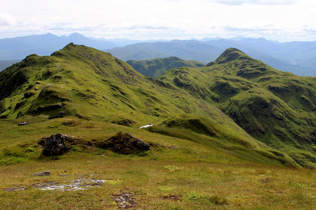
We crossed the col and started the ascent up the broad ridge of Meall Garbh. A line of old angle-iron fence posts indicated the way to the summit although there was a feint path through the rocky ground.
We reached the summit cairn quicker than I had expected – we had been watching it for a while as it was a rather strange mixture of rocks and old iron posts and reminded me of a ruined building!
Meall Garbh (968m), Glen Lyon Scotland.
Meall Garbh (968m), Glen Lyon Scotland.
We reached it in sunshine and I set about photographing Schiehallion (1083m) of which we had a great view looking to the northeast for a good part of the day.
The two lads arrived and commented on Schiehallion “looking bonny!” which we had to agree.
We all admired the views. They pointed out the Buchaille Etive Mhor and the entrance to Glencoe, Ben Alder and confirmed our view of the Drumochter pass.
After a while they headed off as another couple arrived. It seemed that everyone had the same idea for today!
We descended eastwards to another rocky col and stopped for lunch. The lads disturbed a herd of Deer as they continued, which sent them running across the hillside.
At 12.30 pm Marie and I set off to climb the 150m of height up to Meall a’ Bharr, a Munro top. From here, we got a view of the easy ascent ahead of us up to the summit of Cairn Mairg (1041m), the third and highest Munro of the traverse.
Carn Mairg (1041m), Glen Lyon, Scotland
The easy, grassy hillside gave way to a very rocky summit and a nearby craggy buttress which looks south. I briefly explored this and admired the views towards Ben Lawers, which had been going in and out of clouds all day.
From here, we had a slow, careful descent over the boulder strewn slopes to again reach the relative ease of the grassy hillside leading up to the last Munro, Meall na Aighean.
Marie looked back northwards to Carn Mairg.
“I think that is the ugliest mountain I have ever seen.” She suddenly exclaimed.
Carn Mairg (1041m), Glen Lyon, Scotland
I hadn’t really thought about it but from that angle, it is (as they say) no oil painting!
We quickly made our way up to the rocky tor that forms the top of Meall na Aighean (981m). Here, we stopped for the rest of our tea and to admire the views of Ben Lawers again. Then we headed off to the southwest and the path over the west top of the mountain.
Meall na Aighean (981m), Glen Lyon, Scotland
From here, we enjoyed an easy, grassy descent down the southwest ridge. We could see back over all the Munros we had traversed, now in some afternoon sunshine and we had some good views westwards up Glen Lyon.
We reached the hydro track we had ascended in the morning and re-traced our steps down to Invervar.
The whole day had been an enjoyable outing. It didn’t have the raw excitement of scrambling over steep, precipitous and rocky buttresses but it had a different feel to it that reminded me of the Cairngorms further north. It may have been the wild feel to the hills or maybe the extensive views all set in soft greens and greys.
Definitely the best day for us to do probably the best route in the area.
Postscript: Kimono my House
So, I finally bought the album. It’s good and full of Spark’s trademark quirky, singalong songs. I am enjoying it but I wonder if 15 year old me would have appreciated it? Somehow, I doubt it, it lacks the power guitar music of my old favourites. I’m glad I waited until now to discover its charms.
I feel the same way about the mountains in the area around Loch Tay we have just visited, I think that younger me may have dismissed them too easily, I wouldn’t have appreciated them.
Sometimes it’s a good thing to discover something you may have overlooked before. It has just been waiting there for you to see it at the right time.
Thanks Mike for another TR which contradicts the adage 'a picture is worth a thousand words' as it is, no doubt, worth much more than a few good SP photos. As for the green Sparks-like areas, in recent years my favourite mountain range in the Sudetes (the mountains lying near where I live) has become the Suche Mts, which I NEVER felt like visiting when I was young.
Cheers,
Jacek
Hi Jacek,
Thanks for the comment, I'm glad you enjoyed it.
I have just had a look at your page on the Suche mountains, they look good.
We are all lucky that there are so many fantastic mountain areas that we still have to discover and explore.
Take care,
Mike
Parents refers to a larger category under which an object falls. For example, theAconcagua mountain page has the 'Aconcagua Group' and the 'Seven Summits' asparents and is a parent itself to many routes, photos, and Trip Reports.


Comments
Post a Comment