
-
 9483 Hits
-
 75.81% Score
-
 6 Votes
|
|
Route |
|---|---|
|
|
32.29540°N / 110.6659°W |
|
|
Hiking |
|
|
Spring, Fall, Winter |
|
|
Half a day |
|
|
Overview
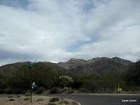
 Bump along the trail
This mellow trail leverages a pair of western ridgelines to the summit of Aqua Caliente Hill. Gaining close to 3,000 vertical feet in about 4.5 miles, this trail is a great weekend workout very close to most residents of Tucson, Arizona. The trail is well-marked and easy to follow right on up to the summit cairn and makes a good outing for any fit hiker.
Roundtrip Distance: 9 miles
Elevation Gain: About 2,700 feet (net)
YDS Class: 1
Getting There
 Lower trail conditions
 Beginning the ascent
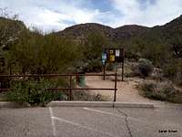
Agua Caliente hill is on the western edge of Tucson and relatively close to most residents and visitors of the area. Most visitors to this summit will access the peak via the Pima County trailhead providing access into Coronado National Forest. Driving directions per Pima County Natural Resources, Parks & Recreation:
From Tanque Verde Road go east until Houghton Road. Turn left onto Houghton Road and after a short distance turn right onto Fort Lowell Road. Follow this until nearly the end, into a development where Camino Remuda breaks off to the left. Take this and stay left as smaller roads go right. Eventually it ends at a paved parking area on the right.
The trail departs from the north end of the parking area. Note a trailhead kiosk and a metal trail marker indicating Agua Caliente Hill Trail #46.
NOTE: I used 3255 N Houghton Road as my vehicle GPS waypoint – to Desert Skies United Methodist.
 |  |  |  |  |
Route Description
 Trail Map
• After a pleasant, relatively flat warm-up, the trail begins climbing a small rocky escarpment to gain the ridgeline.
• The trail follows the ridgeline for about one mile until it descends to Cat Track Tank.
• Past Cat Track Tank, the trail winds its way for about ¾ of a mile through a canyon area before steeply re-ascending to a saddle roughly 3 miles into the walk.
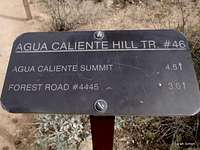
• From the saddle, at the junction with Trail (old 4x4 road) #4445, a sign indicates the summit of Agua Caliente Hill is only 1.5 miles away!
• From the saddle, the trail continues climbing on gentler terrain around the right side of a small hill (USGS elevation point 4,779 on the map).
• Reach another grassy saddle almost due-west of the summit of Agua Caliente Hill.
• Follow the trail as it arcs around, following the ridgeline, then climbs a mix of regular trail surface and bare rock to the grassy summit.
• Simply descend the way you came.
 Cruising along the ridge Cruising along the ridge |  Dropping into Cat Track Tank Dropping into Cat Track Tank | 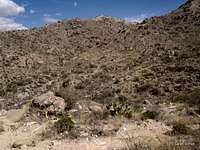 Trail climbing out of the tank Trail climbing out of the tank |  At the saddle At the saddle |
 Climbing out of the saddle Climbing out of the saddle | 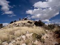 Rouding point 4779 Rouding point 4779 |  Traversing point 4779 Traversing point 4779 | 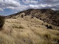 About a mile to go About a mile to go |
 Brief rocky section Brief rocky section | 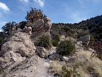 Nearing the last tug Nearing the last tug | 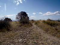 Last few paces Last few paces |  Descent from Agua Caliente Hill Descent from Agua Caliente Hill |
Essential Gear
 Dropping back to the parking lot
 Looking back up to the peak
• Comfortable hiking shoes
• Trekking poles are nice for the steeper, looser sections of trail
• A sun hat
• Sun screen
• A lot of water