-
 13360 Hits
-
 86.52% Score
-
 23 Votes
|
|
Mountain/Rock |
|---|---|
|
|
38.85356°N / 109.729°W |
|
|
Trad Climbing, Sport Climbing |
|
|
Spring, Summer, Fall, Winter |
|
|
4110 ft / 1253 m |
|
|
Overview
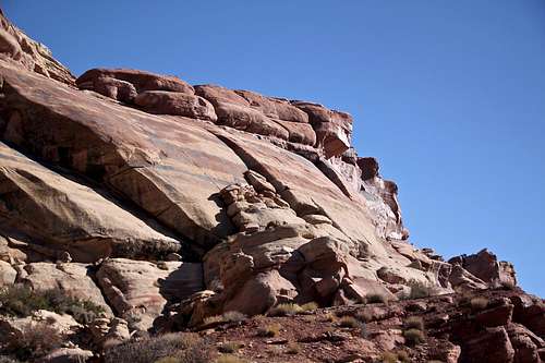
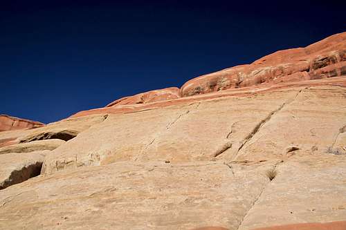
Sunshine Wall is a south facing Wingate sandstone cliff in the northern end of Salt Valley. It is located just a few miles north of Arches National Park (Mountain Project describes this crag under Arches climbs although technically it is outside the boundaries of the national park).This is more remote destination, and do not expect any crowds. Unlike some other areas around Moab, e.g. Wall Street where one can expect to wait in-line for some of the more popular climbs.
![Sunshine Wall]()
Sunshine Wall as seen from the Salt Valley Road - just head for the last outcropping.![Cowboy Art]()
Cowboy Art
![Baker Slabs]()
Baker slabs5. Lesson in Braille 5.10c: 140 feet (43 m), FA: Mike Baker and Leslie Henderson, 1998. Excellent slab climb, Bjornstad gives it 4 stars. Start on the far right side of the left side of the ledge at some boulders. Friction up on bumps and smears and finish just right of a sharp arete. 9 bolts to a 2 bolt anchor.
The cliff is easily accessed from US 191 and I-70. It offers a lot of good bolted slab routes. It gets a lot of sun, so I would not recommend this place in the summer. It is great winter destination.
The wall is located on BLM land.
The wall is located on BLM land.
The tower Tezcatlipoca is located in this same area - it is above the Sunshine Wall. For more information on Tezcatlipoca click here. You would use the same parking and camping spot.
Guidebooks: Rock Climbing Desert Rock IV: The Colorado Plateau Backcountry Utah By Eric Bjornstad
Best Climbs Moab: by Steward M. Green (more updated, more routes described in this book), available in iTunes.
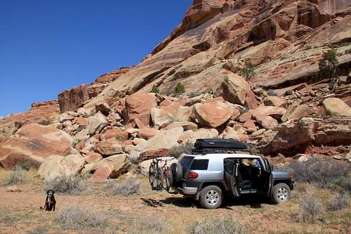
 Nice view of Sunshine Slabs from the parking area - the wall deserves its name, expect plenty of sunshine. | 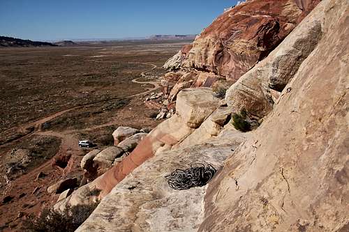 Nice view from Sunshine slabs towards Salt Valley, parking and possibly camping area below. |
Getting There
Sunshine Wall as seen from the Salt Valley Road - just head for the last outcropping.
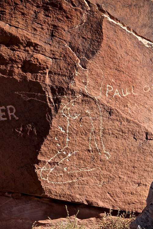
Cowboy Art
Drive south from the intersection of I-70 and US 191 for 4.2 miles or 27 miles north on US 191 from Moab and turn east on an unmarked dirt road = Salt Valley Road between mile markers 152 and 153. Cross railroad tracks and follow the dirt road for 1.2 miles to a right turn on Salt Valley Road just past a white bridge. Take a right turn southeast to another road junction, then bear right and head southeast down upper Salt Valley toward Arches National Park (you can enter the national park this way, bring 4WD vehicle although some websites are describing that normal car can make it in dry conditions). The hogback with Sunshine Wall rises above the road and is visible as you drive in. Drive 1.4 miles to a road that branches left to the obvious cliff an primitive campsites. I did not find any difficulties with finding this crag.
Salt Valley Road can be used as an alternative entrance to Arches National Park. Check with the national park service on the condition of the road. The road can be impassable in wet weather to even 4 WD vehicles, and the road can be temporarily closed. Arches National Park visitor information phone number: (435)719-2299.
Mileage Log - Sunshine Wall through Arches National Park. The Salt Valley trail traverses on Manco shale, and because of its composition, which includes volcanic ash and bentonite clay, it is undrivable even if only slightly wet.
13.3 miles from Sunshine Wall to the Park entrance, inside the park you will see Dark Angel 0.8 miles from park boundary, 2.9 miles Klondike Bluffs and the Tower Arch trailhead. 6.2 miles from park boundary you can get a distant view of Castleton Tower on the east. 11.1 miles Skyline Arch comes into the view (odometer from the park boundary). 13.2 miles junction of the Salt Valley trail with the paved road inside the Arches National Park.
![Learning Curve 5.7]()
Learning Curve 5.7![Love Hurts 5.9]()
Love Hurts 5.9Sunshine Wall climbing routes are located in 3 separate and yet very close by sections:
Route
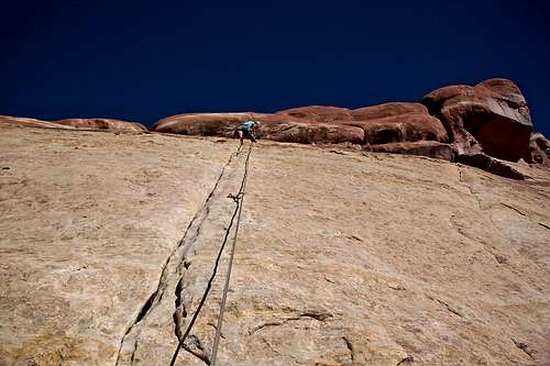
Learning Curve 5.7
Love Hurts 5.9
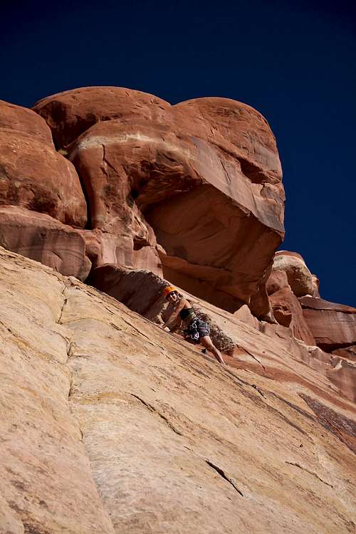
Baker Slab: named for the late Mike Baker, who established most of the routes here. This is the western more slab with established routes. You have to scramble through boulder fields and up onto a ledge to access these slabs. Bring 70 meter rope! (Bjornastad is describing some routes being 41 meters long, however our 70 meter rope was plenty sufficient - about 2 meters left, the routes are winding a little bit on the slab). The routes are long and 60 meter rope may not make it even with elongation during lowering down. All routes are one pitch and over 100 feet long. There is a belay bolt right at the start of Learning Curve (use this belay bolt for all climbs except the Unknown and Lesson in Braille).
1. Unknown 5.9+: on the left side. Climb over boulders to the base of a thin left facing corner past bolts to a 2 bolt anchor. I did not climb this one.
2. Mosquito Coast 5.8 R: 120 feet (37 meters), FA: Andy Roberts, Liz Devaney, 1990. The route starts on the left side of the low angled red and white slab. Pull over a short headwall, then smear up the slab above to easier climbing. Pitons and bolts (5), good anchors at the top. The crux is the first two or three moves, higher the climbing gets much easier. 70 meter rope sufficient (elongation).
3. Learning Curve 5.7 R: 130 feet (40 m), Eric Bjornstad gives it 4 stars. FA: Leslie Henderson, Mike Baker, 1998. The route face climbs a sloping wall just right of Mosquito Coast to rappel anchors. 5 bolts. There is a huge run out between 1st and 2nd bolt: a fall there would definitively mean falling onto a deck. You can protect this run out well with small nuts and C4 since this section has a small crack. We did not bring any gear, and both of us (girls) lead it. I did not find it scary, and felt that the grade felt easier.
4. Love Hurts 5.9: 135 feet (41 m), Bjornstad gives it 3 stars. FA: Mike Baker, solo, 1999. Start right of the belay bolt. It shares anchors with Learning Curve. Work up right along an angling seam to a short crux, then smear up left on easier rock to anchors. 8 bolts and pitons.
Baker slabs
Mike Baker: "I just returned from climbing in the Black Hills South Dakota. After four good days of climbing, the weather took a turn for the worse so we headed for the Sunshine Wall. Amazingly the weather there was not too hot! We established a new climb called Lesson in Braille. It is a face climb on bumps with occasional edge." From Desert Rock IV.
Science Friction Slab: located to the right of Baker Slab. Access if from valley floor by scrambling through a boulder field or traverse east from Baker slab along cliff base.
6. Melanoma Shuffle 5.8+: excellent. Climb the left side of the slab using bumps, knows and smears to anchors. 140 feet (43 m), 9 bolts to a 2 bolt anchor.
7. Science Friction 5.9+: FA: Mike Baker, solo, 1998. Fun route up the middle. Start at the slab's low point and smear directly up to a crux. Continue to some holes and finish up a runout seam crack to anchors. 10 bolts/pitons to a 2-bolt anchor. I have not done this route. Bjornstad is giving it 160 feet (49 m), which means double ropes.
8. Unknown 5.11: Climb edges up a maroon face. Pull past an overlap and smear up the slab above to anchor on the headwall. 10 bolts to 2 bolt anchor.
Falcon Face: The next big slab right of Science Friction is Falcon Face. Access is by hiking up the valley past the first slabs, then following a rough path through boulders. Named after a falcon nest.
9. Walking on Sunshine 5.10d: Bjornstad gives it 4 stars. FA: Mike Baker and Wilson Goodrich, 1998. Superb but thin climbing. Expect serious smearing - per S. Green. Start right of a sandy corner. Climb directly to the third bolt, then work up right to a tenuous mantle. 10 bolts to 2 bolt anchor. This climb is located roughly 100 yards (90 m) right = southeast of the Science Friction Buttress. 80 feet long (24 m).
10. Brainiac 5.12- or 5.10aA0: located right of Walking on Sunshine. A hard mantle and thin moves to 2nd bolt. Continue with sustained edge and friction moves to a thin arch and the final upper slab. 10 bolts to 2 bolt anchor.
Red Tape
There is no red tape. Camping, parking and climbing are for free.There are several primitive campsites (bring water - there is no running stream close by). Absolutely wonderful destination for cooler season of the year, very uncrowded. I visited twice and did not see anyone.
Verizon has mobile reception there.