
|
|
Route |
|---|---|
|
|
39.15430°N / 119.88321°W |
|
|
Hiking |
|
|
Spring, Summer, Fall |
|
|
Half a day |
|
|
Walk-up |
|
|
Overview
At 9214 feet, one would not expect to be too far above the trees on Snow Valley Peak. However, this mountain is known for its wide open slopes that seem to sit above the trees. Snow Valley Peak is not alpine, however, it does provide wonderful viewpoints from its upper slopes. One way to enjoy this splendid mountain, situated east of Lake Tahoe, is to hike it via the Tahoe Rim Trail.The Tahoe Rim Trail (TRT) takes you within 1/3rd mile of the summit. It is accessed from U.S. Highway 50, easy to reach from Carson City and Reno, Nevada. The trail takes you just over 5 2/3rds miles up on a high ridge below the peak, and a road takes you another 1/3rd mile or so up to the summit.
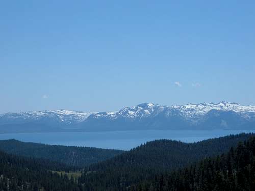
Lake Tahoe from the TRT on the way to Snow Valley Peak
Getting There
If you are coming from the Reno-Carson City area, you need to reach U.S. Highway 50. About 3/4 of a mile before you get to the junction with 28 is Spooner Summit. Spooner Summit is a starting point for the Tahoe Rim Trail. Unlike at the nearby trailhead for Spooner Lake, there is no cost to park at Spooner Summit. However, keep in mind that parking is limited, so if you don't come early enough, you may not have anywhere to put your car.Route Description
The Tahoe Rim Trail starts at the parking area. There is a clear sign just before the trail starts.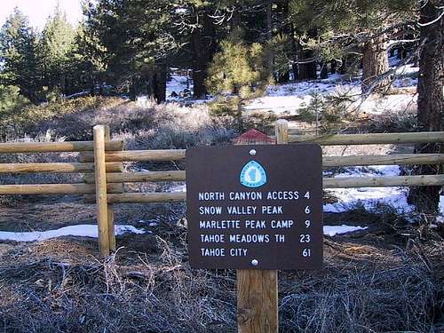
Sign at the start of the Tahoe Rim Trail accessed from Spooner Summit
The trail meanders through the woods for four miles without many viewpoints. Elevation gain through the first four miles is moderate. It is basically a pleasant hike in the woods with a nice, smooth trail. After four miles, you'll see a sign that says "Snow Valley Peak - 1 1/2 miles". Continue up the trail where tremendous views open up. Lake Tahoe sits to the west along with the mountains west of the Lake. Continue up the trail for about 1 2/3rd miles.
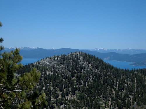
View from the TRT over Lake Tahoe
Hike the TRT until you reach a fence and a dirt road. Look to your right and you will see the summit plateau rise approximately 260 feet above you. There is communication equipment right next to the true summit. Follow the road for just over a third of a mile to the summit and enjoy the view!
The Tahoe Rim Trail route is roughly 6 miles to reach the summit of Snow Valley Peak from Spooner Summit. Spooner Summit is at an elevation of 7156 feet, and some minor descents along the trail cause the total elevation gain to be about 2,400 feet.
You can descend via the North Canyon Route which takes you back to Spooner Lake, for which you need to take the Spooner Lake loop trail back to the Tahoe Rim Trail and Spooner Summit. This is roughly the same distance given the extra walking it takes to get back to Spooner Summit.