
-
 3204 Hits
-
 74.92% Score
-
 5 Votes
|
|
Route |
|---|---|
|
|
39.53730°N / 105.5667°W |
|
|
Hiking, Scrambling |
|
|
Spring, Summer, Fall, Winter |
|
|
Half a day |
|
|
Overview
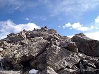
 Views from the summit of Royal Mountain
This pleasant outing leverages the Tanglewood Trail then dives into the woods for a bushwhack before emerging onto a surprisingly rocky, rugged ridge with bomber views to reach the summit of Royal Mountain. Moderate distance and elevation gain combined with minimal exposure to high risk avy slopes make this an ideal winter outing.
Roundtrip Distance: 7 miles
Elevation Gain: 2,300 feet
YDS Class: Class 2+ - Class 3 (depending on route through boulders on north ridge)
Getting There
 Lower reaches of Tanglewood Trail
 Angel on the Tanglewood Trail
Follow Hwy 285 west from Denver for 28 miles. At a stop light, turn northwest (right, if coming from Denver) onto Park County Road 43. Follow CR 43 for 6.8 miles to a fork in the road. Bear left at this fork and continue an additional 2 miles (past the campground) to the Deer Creek Trailhead.
Route Description
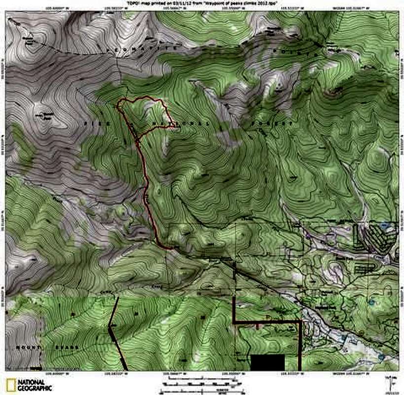 Route Map
Ascent
• Head toward the trailhead kiosk and immediately begin ascending the Tanglewood Trail. The Tanglewood Trail is easy to follow and any junctions (e.g. Rosalie Trail) are well-marked and obvious. On the lower reaches of the trail, you will cross Tanglewood Creek a few times on rustic foot bridges.
• After approximately 2 ¼ miles of travel, cross Tanglewood Creek (no bridge). Soon after this crossing, the trail ascends steeply. Before the trail begins switchbacking, look for a break in the willows to your right and leave the trail.
• Strike out through a short distance of brush/willows, then ascend steeply almost due east through timber (aiming for an open meadow northwest of Royal Mountain).
• Upon gaining the open meadow, you have only about ¾ of a mile to the summit, but it will be a fun ¾ of a mile!
• Depending on conditions (deep snow or water in the willows), you may need to wrap around the northeast perimeter of the meadow. Then, begin the ascent of the northwest ridge of Royal Mountain.
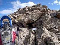
• At first, the ridge is gentle and indistinct, as you weave your way through rocks and pigmy conifer forest. Soon, the ridge becomes increasingly rocky and the views open wide! Easy scrambling and boulder-hopping will be required to ride along the ridgeline. (When snow is absent, it may be possible to contour around these boulders…but why?)
• After fun scrambling and rock travel, you will reach the highest outcrop…but you have not reached the summit! Descend the outcrop and continue southeast along the summit plateau to a small cairn in a clearing among the trees. Congratulations!
Descent
• To descend, pick your way west-southwest down the slopes of Royal Mountain. The upper reaches of these slopes are steep and rocky, so watch your footing and be careful not to launch rocks on your partners.
• Quickly loose elevation, dropping eventually into the forest, to regain the Tanglewood Trail at about 10,250 feet.
• From the junction with the trail, it’s an easy cruise of less than 2 miles back to the parking lot.
 Heading off-trail approximately 10,400 ft. Heading off-trail approximately 10,400 ft. |  Views to the Northeast Views to the Northeast | 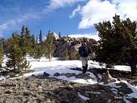 South across the summit plateau South across the summit plateau |
 |  |  |
 |  |  |  |
Essential Gear
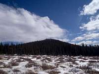
 Base of the Northwest Ridge
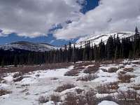
 Taking turns breaking trail
• Trails Illustrated #104: Idaho Springs | Georgetown | Loveland Pass
• Outerwear appropriate to the season
• Flotation (snowshoes or skis) in snow season