
|
|
Route |
|---|---|
|
|
36.16300°N / 106.503°W |
|
|
Scramble |
|
|
Half a day |
|
|
Class 4 |
|
|
Approach
Temolime Canyon Trailhead- From the town of Espanola in New Mexico, which is Southwest of Taos, drive on US 285 / US 84 Northwest. Follow US 84 when US 285 branches off.
- After 23 miles, turn left on NM 96.
- After 11.1 miles, turn left onto Forest Service (FS) 100. This turn is just east of the small town of Youngsville. Reset your trip odometer.
- Follow FS 100 (dirt) for 5.5 miles until you reach an unsigned trailhead where a 4WD road turns left (east). This is the trailhead for 2WD vehicles. There isn't much parking possible here.
4WD vehicles can proceed much further.
- Reset you trip odometer.
- Go 1.1 miles down the length of Temolime Canyon until the road takes a sharp turn north. There is a good parking spot here where an old road is blocked. A high clearance 2WD can easily make it this far.
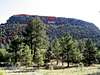
- To go as far as possible, continue 1.8 more miles on the 4WD drive road until you find yourself in a large meadow with a good view of Cerro Pedernal.
- A recent visitor to the area drove 0.25 mile past the large meadow until he was directly northwest of Cerro Pedernal, and found a good trail leaving from there.
Route Description
Depending on where you parked your vehicle, walk the remainder of the 4WD road. Use the road directions in the "Getting There" section. When you reach a high meadow at 9,000 feet, leave the road and begin your climb.There is no official trail on Cerro Pedernal, and this has created many use trails through this area. Any of the use trails is fine to take, but some will offer better travel than others. The best trail I found was one that cut from the high meadow toward Pedernal. It was cairned and it wasn't too loose. A result of the volcanic processes here is really loose terrain. Several of the trails that travel up the south face of Pedernal travel through this loose dirt. Avoid them if you can, they will slow you down greatly.
Another more recent visitor parked directly northwest of the peak and found a better trail that switches back across the northwest slopes. This is likely the best route.
The key to avoiding roped climbing on Cerro Pedernal is a weakness in the cliff bands that offers a short pitch of Class 4 climbing. This weakness is actually very easy to find. When you are in the upper meadows below Pedernal, look closely at the center area of the south side cliff band. A large, black cave should be visible near the center of this face. The weakness in the cliffs is about 100 feet to the left of the cave. As you negotiate the approach to the south face on the use trails, keep aiming for the cave. You will lose sight of it in the trees, but try to figure out what side of it you are on.
Once you climb the loose, steep terrain below the cliffs (Class 2), you will find a decent trail that follows the bottom of the cliffs. Depending on where you meet this trail, contour East or West to find the aforementioned cave. From the cave, walk 100 feet to the West (left of cave) until you find the weakness in the cliffs.
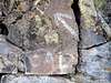
This weakness is marked with a large white arrow and what looks like "CAL." The paint is faded, but it is apparent as you walk below the cliffs. Also, the weakness is a crack system with a right-sloping ramp above it. It's a little tough to notice because the trail literally travels right next to the cliff.
This crack is the crux of your climb. It requires about 15 feet of easy Class 4 climbing. The rock is solid, and holds abound. Climb the easy pitch to a secure spot and walk up a right-sloping ramp (Class 2+) to the upper trail that will take you to the summit. The beginning portions of this steep trail that switches-back across the upper cliff area is sometimes exposed. Gain the summit ridge of Pedernal and walk to the summit high point. Enjoy the amazing vantage point.
Route Stats:
From 2WD Trailhead:
RT Mileage: 7 miles
Elevation Gain: 1,900 feet.
From end of 4WD road:
RT Mileage: 1 mile
Elevation Gain: 700 feet
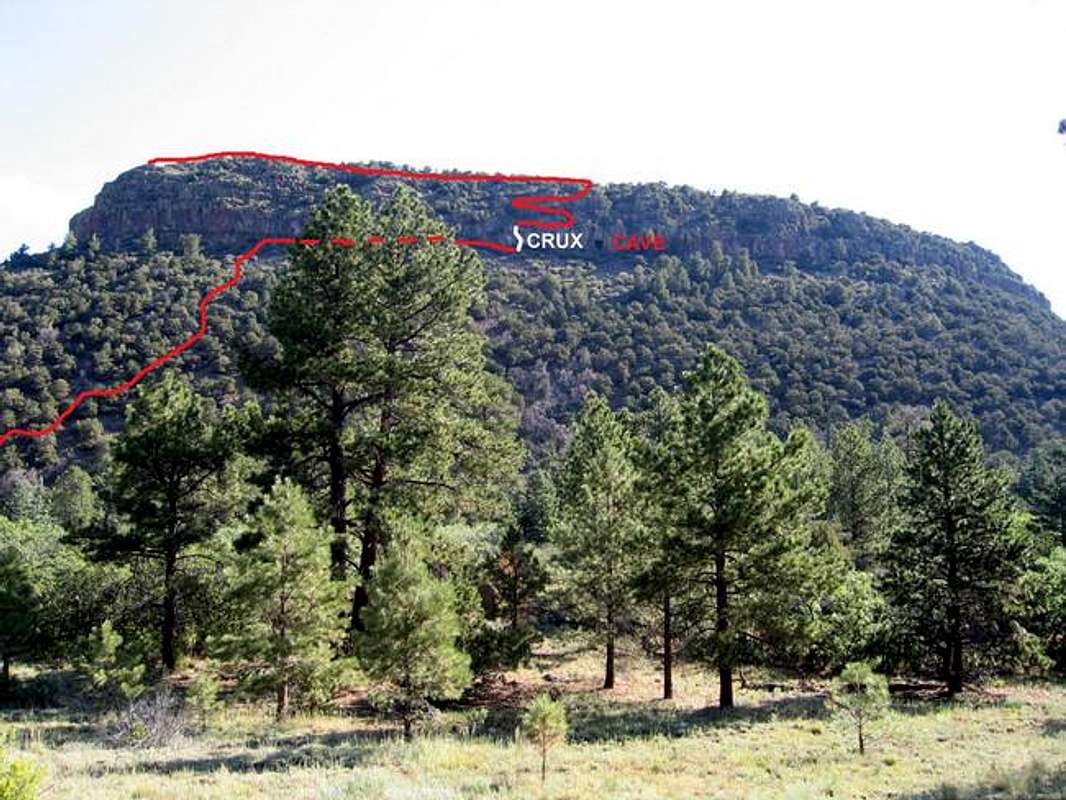
This route photo shows one of the use trails that leads to the cave and the crux pitch.
>

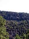
This photo is looking down the crux pitch from above.
 |  |  |  |  |