

Bob Burd - Mar 30, 2005 11:32 pm - Hasn't voted
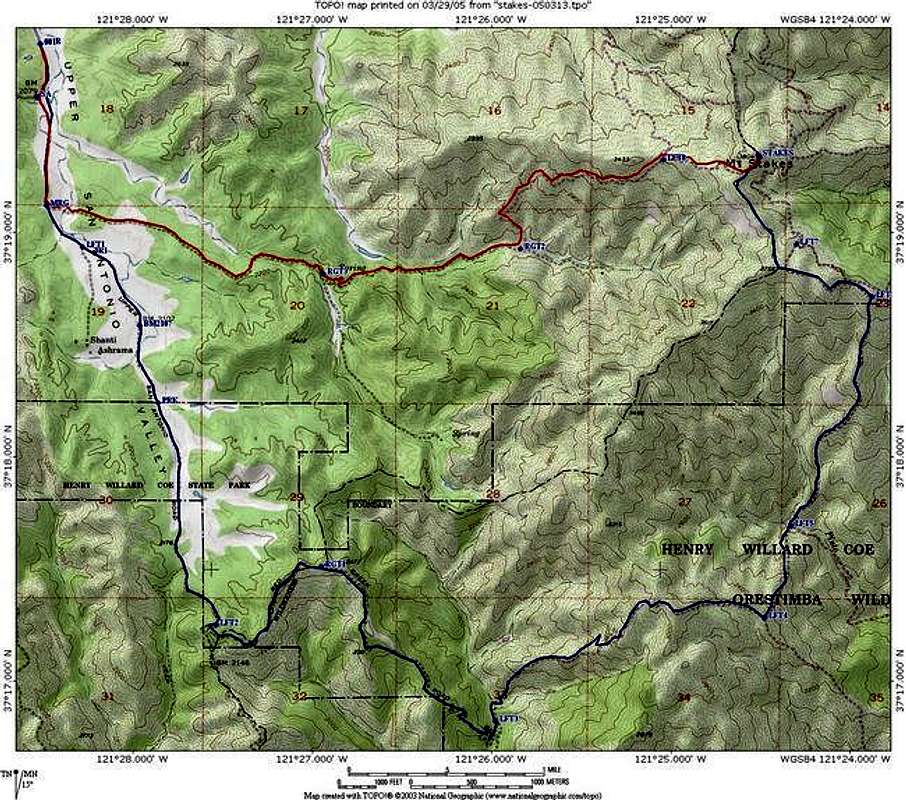
The last mile...on your blue route should be red. That is private property outside HC and the Orestemba Wilderness.

rgreene - Mar 31, 2005 9:01 pm - Hasn't voted
Re: The last mile...Yeah, I agree. I was trying to differentiate the two different routes rather than the legal/illegal sections. Maybe your approach is better since it's more "useful". People can probably figure out what the two routes are! Thanks for the comment.
Bob Burd - Apr 4, 2005 2:08 pm - Hasn't voted
Re: The last mile...Oh, I misunderstood the use of the color-coding. It makes sense just as you wrote it. Perhaps if you could indicate which portions of the 73% route are illegal - maybe with the dashed line feature? Or not. I think it's a pretty helpful picture as it is. Though why someone would suffer the 73% route once they've already started crossing private party is unclear. :-) You're going to be looking off to the east there and realize you can save quite a few hours...


Comments
Post a Comment