![Basalt Columns]() Basalt Joints
Basalt JointsOverview
Near the summit of Compton Peak, as is mentioned on the main page, there are two spur trails, each going to a nice overlook. At each of those overlooks, there are some nice climbing opportunities in a semi-wilderness setting (I use
semi- because the crags require more than just a few minutes to reach but are not deep enough in the park or far enough from busy thoroughfares to feel like true wilderness).
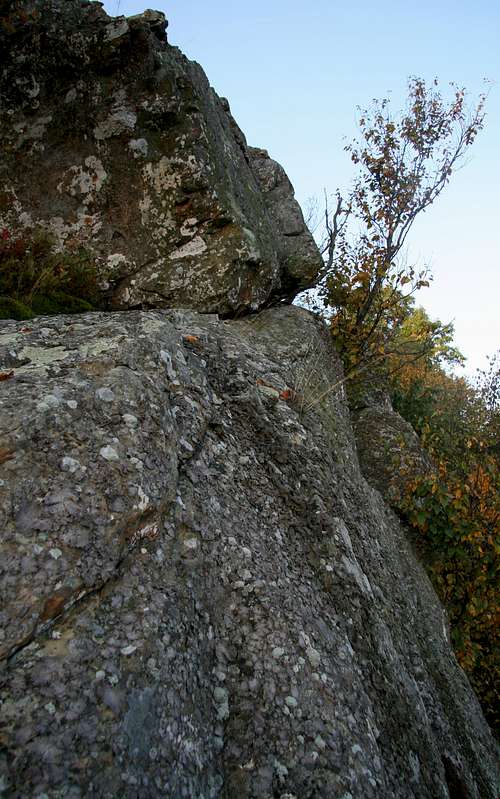
The "north cliffs" offer some short toproping opportunities and some scrambles. The better technical climbing is to the middle and the left side of the cliffs (as one stands atop them and faces out); there is a nice overhang on the left side.
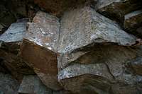
The "south cliffs" offer a scenic rarity-- basalt joints like those visible at Devil's Tower (WY), Devil's Postpile (CA), and Yellowstone National Park near Tower Falls. Here in Shenandoah, only the lower ends of the columns are exposed, unlike in those other areas where the full columns are on display, but there is enough of them to get a nice sense (and nice pictures) of their shape and texture.
The angle of the joints creates an overhang that is difficult to surmount without having the security of a rope. Once above the overhanging section, which is about 6-8 feet above the ground, the climbing is easier and more like scrambling than anything technical. There is also pretty easy scrambling on the right side of the cliffs (as viewed from the base).
![Compton Cliffs]() North cliffs
North cliffs![Basalt Cliffs]() South cliffs
South cliffsGetting There, Finding the Crags, and Climbing Options
Skyline Drive runs north-south through Shenandoah National Park, and there are four access points for it. To reach the crags on Compton Peak, it makes the most sense to enter either at the Front Royal (north) entrance or the Thornton Gap entrance.
Even though Compton is on the western side of Skyline Drive, the parking area for the hike up Compton is on the eastern side. Park at Compton Gap, which is about halfway between Mileposts 10 and 11, and cross the road to pick up the Appalachian Trail.
Follow the AT south for 1.2 miles, gaining almost 500' of elevation, to a junction and a concrete post.
The right branch leads 0.2 miles north to cliffs and an overlook a little past Compton's wooded summit.
The left branch, which is also marked as 0.2 miles in length, though it feels a little longer than that, leads south to the basalt cliffs. You can scramble down on easy rock to the left or descend via a steep gully on the right. In June 2011, this gully had fallen trees at its upper end, and they seemed intentionally placed, suggesting that the Park Service would prefer people not to use that way to access the base of the cliffs.
I don't have the experience to recommend gear for leading anything here, which is why I suggest toproping these rocks if you want to get into the technical stuff. The crags seem to have sufficient natural anchors atop or close to them, but it would be wise to bring your own gear for setting up anchors, especially your first time visiting these crags.
It is illegal to drill, chip, or do anything else to alter the rock!
Comments
No comments posted yet.