
Comments
No comments posted yet.
|
|
Trip Report |
|---|---|
|
|
36.72916°N / 118.33821°W |
|
|
Jul 31, 2023 |
|
|
Hiking, Mountaineering, Scrambling |
|
|
Summer |
We all know what they say about the plans of mice and men, but perhaps some men simply abandon their plans too quickly. Had I succeeded in executing my original vision for today, it would have stood as the most ambitious day hike of my fourteen years as a mountaineer. But after ten hours of near-ceaseless bushwhacking, scrambling, clawing, and thigh-busting foot-stomping through every kind of brush, sand, scree and talus imaginable, I found myself too tired and thirsty, and too concerned about the descent, to explore much of the supposedly “class 2” ridge connecting Bradley’s summit to Courte-Echelle. So, I gave up on my dream of linking Mount Bradley to Mount Keith in a single big day from Symmes Creek, not knowing as I began my retreat that my exit route would be so difficult that I might have finished in better shape if I had spent the time necessary to find passage to Keith and picked up the Shepherd Pass Trail from there.

Neither Bradley nor Keith had been on my radar until I hiked Mount Williamson with my friend Tracie last August. As we set out on the Shepherd Pass Trail, however, it didn’t take long for the arresting views of Bradley’s sprawling East Ridge to captivate my attention, nor for my motivation to swell with imaginings of a big and bold ascent. Later in the trip, I caught sight of Keith’s crisp, white granite from various vantages, and these imaginings took new dimensions. At home, I sketched out a route that would cover Bradley's entire East Ridge, a traverse to Keith, and a descent either straight from Keith or through Junction Pass to the Shepherd Pass Trail, leading back to Symmes Creek basin. Past day hikes of Williamson and of Tyndall were my yardsticks to appreciate the staggering measure of this potential 10,000+ foot climb through the roughest terrain. I figured I could probably do it, but I’m not so young anymore.
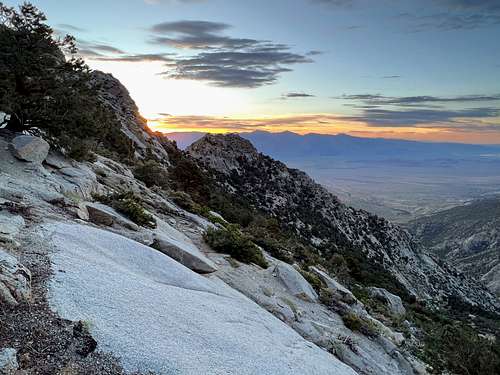
On the drive in, I made the mistake of opting for the Symmes Creek 13S01 road instead of approaching from Onion Valley, subjecting my poor Crosstrek to a true test of regrettable stream crossings, severely rutted terrain, and a thorny gauntlet of sagebrush, mahogany and whitethorn that etched permanent scars into its once-pretty door panels. I set up camp beside the newly rebuilt bridge spanning the Symmes drainage (5,656’), but I slept poorly. It was hot, the ground was sloped, I was nervous and excited, and I had to get moving at 2 am for fear that any later start might put me at the Symmes Creek crossings after nightfall. Groggy and weighed down by a severely-overloaded 11 L Osprey, I managed to start hiking by 2:35 am. The desert air was remarkably warm even in the predawn darkness—so warm that I found myself shedding my shirt almost immediately (and chiding myself for bringing a jacket). The alpine start spared me of any immediate need for sunscreen or sunglasses, and I reveled in the simple pleasure of unmediated exposure to the twinkling lights above. The resilient presence of shrubs and pesky mosquitos diminished the purity of this pleasure, but amidst these encounters, the serenity of the night remained, interrupted only by the occasional rustling of unseen creatures and a soft breeze through the underbrush.
The first in a series of major route-finding challenges was the choice of where to access the ridge, which at its eastern base was not one ridge but a confusing network of diverging spines separated by steep drainages. I would use CalTopo to navigate in the dark, but even in broad daylight it would be difficult to see far ahead and plot the best course amidst the convolution of cliff faces and trees. The path of least resistance led me up a bumpy spine two drainages north of the southernmost branch of the ridge. I hiked along the south side of this spine for a couple hours, moving left whenever granite outcroppings appeared to block progress, until major cliff walls at 8,600’ brought my advance to a near halt. This obstacle proved frustrating and slightly frightening in the darkness, especially as I considered that the only way past it might be up. But these feelings eased with the gradual emergence of the sun’s rays, and before long, I found safe passage along a leftward-leaning bench to a notch in a major rib extending south from the cliffs.

|
The notch gave entry to bowl-shaped terrain encircling a major drainage, evoking some relief tempered with the expectation of a grueling tussle with the thickest battery of brush, pines and junipers I had yet seen. This expectation bore early fruit when, soon after exiting the notch, I slipped and planted my right hand directly onto a beavertail pricklypear. The effect was surprisingly painful. I was unable to extract the many fine quills from my palm and fingers, and I felt their retaliatory sting for days afterward. |
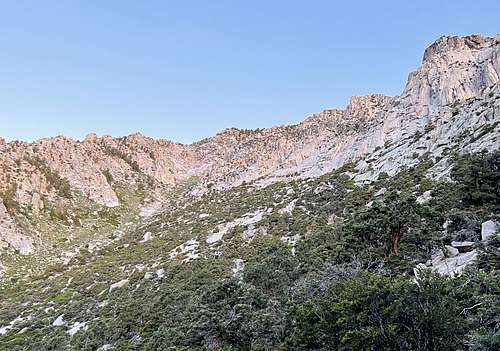 |
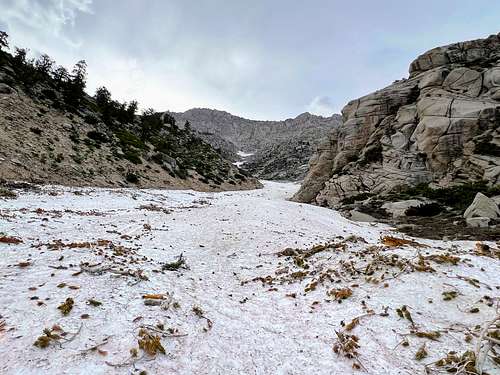
I cut left as quickly as I could, aiming for the drainage where the vegetation was thinner. I followed the drainage to a thousand-foot bluff at the head of the bowl, which had appeared from a distance to be an appealing scramble but proved up close to be difficult class 4. I reeled at the thought of attempting this section, knowing that the strength and delicate concentration it would require would be anathema to these legs that had already endured five hours of trudging up 4500 feet of sand, brush and scree. So I headed south up a very steep, loose, wooded gully system (class 3) that gratefully deposited me on gentler terrain and afforded me the first view Bradley’s summit. From here, an effortful, 900-foot slog brought me at last to the start of the ridge proper at 11,250’.
Now I was in my element, scrambling along a semi-flat ridge free of brush and tree, with long but forgiving drops on either side of pleasantly stable granite.
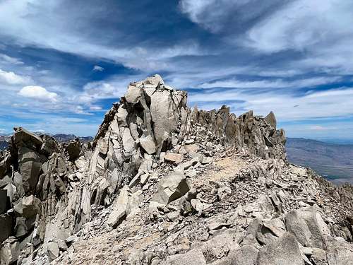
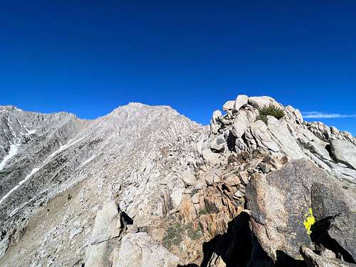 The climbing tightened after an hour of this and changed character to a zigzagging, off-ridge traverse across numerous avalanche chutes on the south side. The chutes were flanked by ribs and aretes that obscured the route and created perpetual uncertainty that upped the excitement. The rock constantly looked as though it might increase in difficulty, but owing to numerous friendly notches in the ribs and some delicate route-finding, the climbing never felt harder than class 3. Still, this was no place to get careless, and I took my time locating and ascending to the last notch (12,530’) that deposited me on the north side of the ridge, just a short scramble shy of Mount Bradley’s huge summit plateau.
| The final pitch along the southern edge of the plateau was a true ridge scramble with several false summits and a classic feel. If I wasn’t so hot and exhausted at this point, I might really have enjoyed it. I finally reached the summit at 12:26p, almost exactly ten hours after leaving camp and two hours behind my estimation. But this had been a serious hike with a gain of over 7700 vertical feet and many challenges, dangers, and potential pitfalls, so I could forgive myself the slip in pace. | 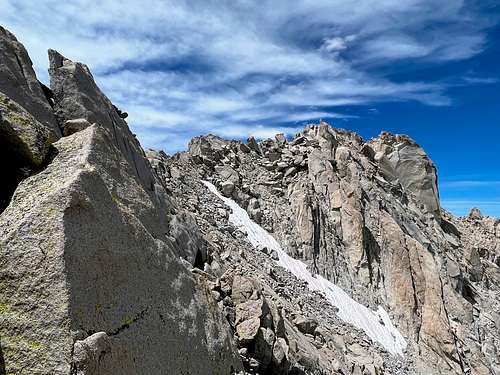 |
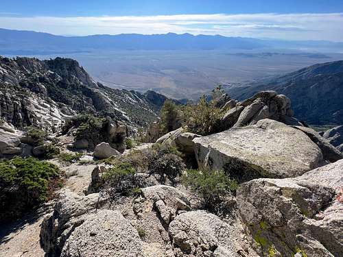
Yet whatever feelings of pride and accomplishment I felt on completing this feat quickly gave way to disappointing doubts about my chances for continuing on to Keith and completing the dream loop. The terrain to the south beneath the summit looked difficult and Keith appeared unapproachably distant. It didn’t help that thunderheads had started coalescing above, or that I had downed my entire 5-liter supply of water, with no possibility of refill before Keith, save for whatever the snow might provide. A mixture of stubborn ambition and dread over the thought that my only other recourse might be to descend the route I came up produced enough staying power for me to probe several unyielding cliff sections below me before the desire to escape prevailed. My only regret now is that I did not descend further into the gully on the west side, where I think it may have been possible to find easier terrain.
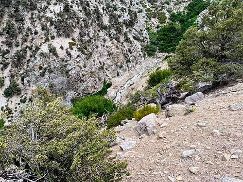
My only option now was to retrace my steps along the ridge and search for a chute or gully on the south side that could provide safe passage to the unmarked north fork of Symmes Creek. This was no easy task, as there were at least eight significant gaps in the cliffs between the summit and the beginning of the notches; and when the steeps beneath you plummet over 2000 feet before finally fanning out, you know there’s a good chance some impasse will appear to block your progress. Study them all you want from above, even the most seasoned and discerning eyes cannot guarantee a viable line to their base; for any miniscule horizon that appears in that seemingly continuous band of cascading talus can transform into an insurmountable cliff as you draw near. The mountain holds her secrets close, consigning the mountaineer to intuition and luck in the face of constant uncertainty.
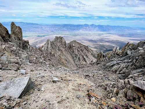
Fortunately, the chute I eventually chose did lead me almost down to the base, though the ride was anything but smooth. I came to several steeper sections where the granite slickened and slabbed up, requiring some class 4 moves and delicate tip-toing on some of the most slippery rock I have ever held my own against. This 1800-foot descent culminated in a waterfall, which forced me to contour left until a sandy gully appeared among the bluffs that would take me the final 500 feet to the avalanche debris field that marked the beginning of easier terrain.
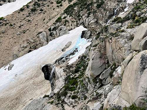
I reached the avalanche field at 5:09p, feeling good about my chances of exiting the canyon before nightfall. The debris field stretched for half a mile down the drainage, its slope gentle enough (averaging 26°) to permit a standing glissade. For the first time all day, after nearly 15 hours of unrelenting movement on risky and inscrutable terrain, I experienced the freedom to move swiftly and unburdened by calculation or caution.
Of course, this freedom lasted only as far as the snow, and the remaining descent of the north branch of Symmes Creek proved arduous and slow, with many eroded sections that seemed poised to calve at the slightest disturbance. When the gradient increased and the flow accelerated and dropped over a blind horizon, I tried following its north bank in hopes of reaching the confluence with the south fork, where I could finally gain the Shepherd Pass Trail. This led to a cliff face and impossibly thick Aspen, which, from the looks of nearby prints in the sand, was home to a very large creature. So, I crossed the creek and hiked up to a ridge that separated the two forks, which occasioned an elegant descent to the confluence.
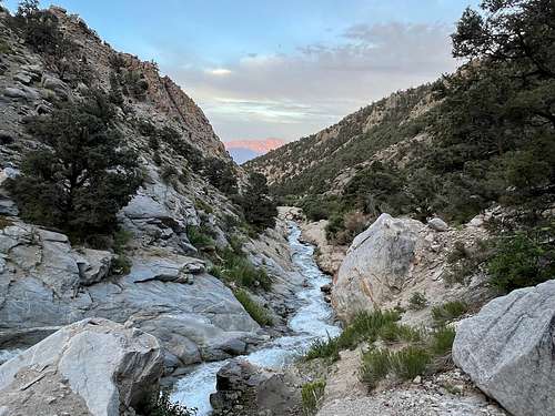
Following the trail through the main creek drainage proved easier than I feared, save one mandatory crossing in which it was impossible to remain dry. It took less than an hour to hike the 2.3 miles from the confluence back to the gauging station.
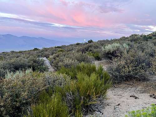
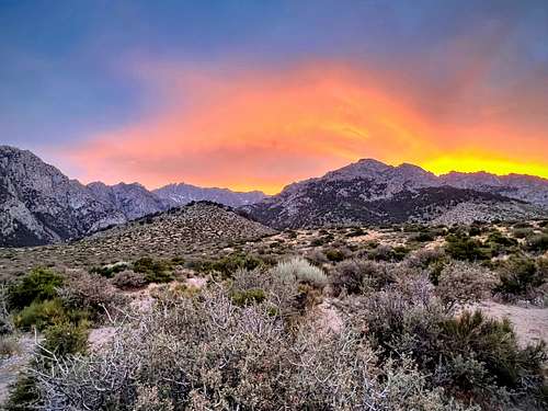
It was 8:26 pm. Eighteen hours had passed since I first left this lovely desert that bristles with mountain mahogany and rabbitsage, now lit up by the telltale red of dusk. I had succeeded in my goal of returning before nightfall. But now the shadow of unfulfilled aspirations began to creep in through gaps in the brambles, and the sinking sun evoked a sense of missed opportunity. Had I been too quick to abandon the hunt for a route from Bradley to Keith? I could have made it without water. There was snow, after all. And that descent was so brutal. Might it not have actually been easier to pass over Keith and return on trail from Anvil Camp?
Surely today had been my one chance to fulfill this vision I had nursed for a year; for I was already coming to terms with the belief that I would never willingly repeat the East Ridge of Bradley. So it goes, I suppose. Men have their plans. Mountains have others.
But then again, Keith is still out there. I will need to climb it. And, well, I have to get up to it somehow....