
-
 16657 Hits
-
 79.04% Score
-
 10 Votes
|
|
Route |
|---|---|
|
|
45.16473°N / 109.81034°W |
|
|
Hiking, Mountaineering, Trad Climbing, Scrambling |
|
|
Spring, Summer, Fall |
|
|
A long day |
|
|
5.4 (YDS) |
|
|
1 |
|
|
II |
|
|
Overview
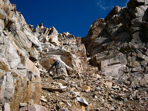
This is one of the premier mountaineering routes on Granite Peak and makes for an excellent, rarely done route on Montana's highest peak. This traverse tags both Granite Peak, and West Granite Peak (Point 12,745) which is the second highest peak in the state. See the West Granite Peak page for more information regarding this peak. This route starts from the summit of West Granite and goes east to Granite Peak. Note that this route DOES NOT go the other way. The traverse would be considerably more difficult from east to west (possibly Class 5.10 or higher). The idea for this traverse is to get to the summit of West Granite by whichever approach and route you choose, then descend some steep Class 4 slabs and follow a handy ledge system just to the south side of the ridge crest to the top of the notch. From here, the technical stuff begins and includes 45 meters of rappelling, a long pitch of Class 5.4 climbing and more scrambling to reach the summit of Granite Peak. This route is not for the faint of heart as there is much exposure, loose rock and route finding to be had. Approach this traverse with caution and be sure you are prepared to bail if the weather makes a turn for the worse.
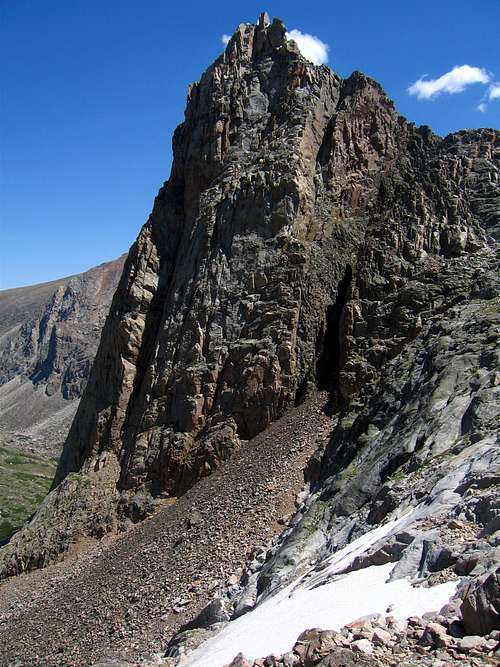
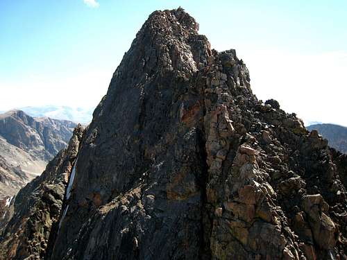
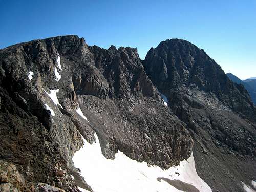 A look at the Granite Traverse A look at the Granite Traverse |
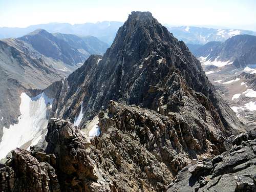 The traverse to Granite Peak from West Granite The traverse to Granite Peak from West Granite |
Getting There
To start this route you need to get to the summit of West Granite Peak. Use either the Southwest Ridge route approaching via Aero Lakes or the West face route approaching via Huckleberry Creek. See the West Granite Peak page for complete details about these approaches and routes. Do not ascend Granite Peak first with the intention to make the traverse from east to west!
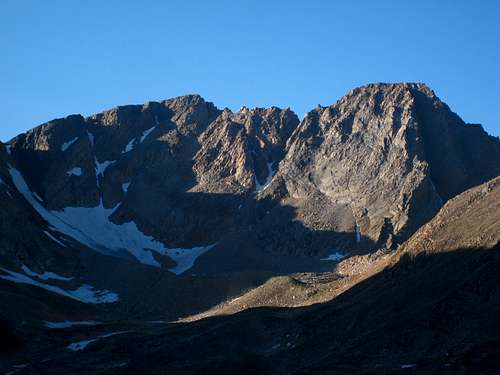 West Granite and Granite Peak from the south West Granite and Granite Peak from the south |
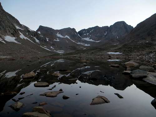 Granite Peak reflection in Sky Top Lakes Granite Peak reflection in Sky Top Lakes |
 Storm Spire just below Storm Lakes Storm Spire just below Storm Lakes |
Route Description
The Traverse
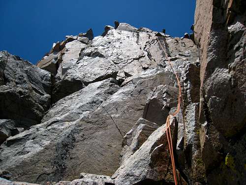
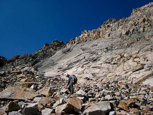
From the 12,745 foot summit of West Granite, locate a 4 foot wide ledge leading steeply down towards the north and take it 20 feet down. Curve back to the right and descend down a tricky 20 foot slab until you enter a large loose gully dropping towards Cairn Mountain to the south (Class 4). Descend this loose gully for 100 feet to 12,600 feet and work left onto a system of ledges. Begin traversing loose ledges on the south side of the ridge crest. The ledges more or less stay around 12,600 feet. Pass by a 1 foot wide crack almost wide enough to squeeze through by climbing up 20 feet and just above it and to the left (Class 3). Here the ledge system continues until it suddenly ends at a huge dropp off. Just before reaching the cliff, climb back to the ridge crest and cross over to the north side of the ridge through a small notch right before the final tower. Climb around the white colored tower (glean granite) and emerge on a huge ledge overlooking the big drop into the notch below. Make a 35 meter rappel (with a 70 meter rope) off this ledge from a large flat boulder strategically sitting on the ledge. I put a good piece of webbing around this rock in August 2013. The start of this rappel is very intimidating as it is slightly overhanging but once you are off the ledge it becomes mellower. There is a couple small ledges you will poass on the way down seperated by very smooth, featureless vertical walls (hence the reason the traverse would be much harder going east to west!). A 70 meter rope will not quite make it all the way to the notch below so an additional 30 foot rappel from a large horn is needed. I also placed a good piece of webbing here in August 2013 but always have extras of your own. Once at the 12,480 foot notch, scramble across it a short ways to the base of the opposing wall (Class 3).
Now locate a piton in a small crack on the wall at about hip level and belay here. You want to climb the obvious deep chimney just to the left of this piton for a full 70 meter pitch (Class 5.4). The chimney itself is filled with loose rock but the rock just to the left (north) is more solid. The climb is very low angle (about 60-65 degrees) so it isn't difficult but extreme care should be taken not to pull any large blocks down which may take your leader down with it. The belayer for the most part will be out of the fall zone but it's best to try and keep all the rocks in place and wear a helmet. At the top of the chimney around 12,660 feet, reach a flat section of the ridge and belay your second up on a nice horn. You will be able to watch your second most of the way up on this comfortable belay. Once atop the chimney, hike across the short flat section of ridge and scramble 100 feet up an obvious gully just to the right (south) of the crest (Class 3). Exit to the right and make another short ledge traverse. Climb briefly up to the ridge crest and above a very exposed 10 foot section of ledge. Pass through a tiny notch just below the summit and continue 30 feet up the ridge to the flat summit ridge (Class 3). Walk easily along the summit ridge for 100 yards to the highest point! Congratulations...you have completed the Granite Traverse.
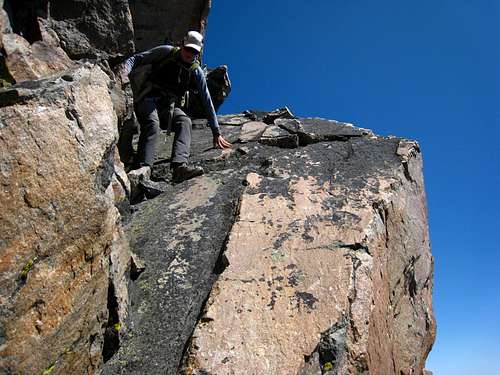 Descending the slab just below West Granite Descending the slab just below West Granite |
 Traversing the ledges Traversing the ledges |
 Steep DC'ing off Granite West Steep DC'ing off Granite West |
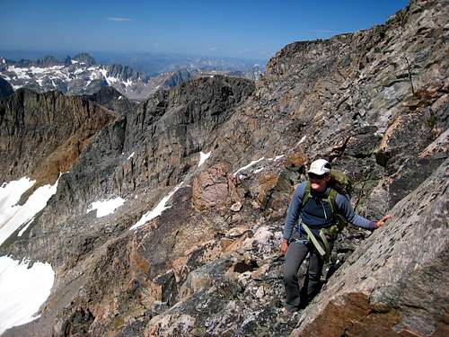
 Rappelling into the notch Rappelling into the notch |
 Looking across the notch to the 5.4 chimney from the top of the rappel Looking across the notch to the 5.4 chimney from the top of the rappel |
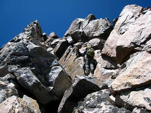
 Looking at the final 100 foot gully from the top of the chimney Looking at the final 100 foot gully from the top of the chimney |
Descent
If you approached from the north descend the standard East Ridge.
 The route on the upper East Ridge The route on the upper East Ridge |
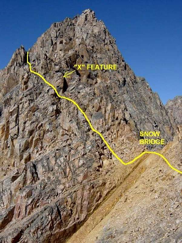 The route on the lower east ridge to the snow bridge The route on the lower east ridge to the snow bridge |
If you approached from the south, descend the Southwest Couloir.
 Descending the SW Couloir Descending the SW Couloir |
 Looking at the distinctive slab at the base of the SW Couloir Looking at the distinctive slab at the base of the SW Couloir |
Essential Gear
A 70 meter rope is essential. I would not recommend double 60's because the chimney climb up the opposite side of the rappel is a full 70 meter pitch and there IS NO GOOD PLACE to set up an intermediate belay. The rock in and around the chimney poorly accepts pro so I would recommend a full 70 meter rope to make it in one pitch. I placed 4 pieces on the pitch and didn't need any more. I really only found 5-6 good cam placements. Therefore a small alpine rack consisting of single Camelots from 0.3 - 2 inches and the number 0 and 1 Mastercam will be plenty. Bring more slings and runners than anything else. You can sling a horn for the belay atop the chimney. I didn't use any nuts. As always, bring a helmet, standard rappelling gear, and enough camping gear/food for three days.
Map
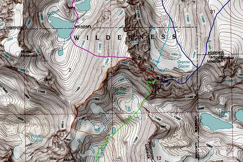
DARK BLUE: Granite Peak East Ridge - Class 4
LIGHT BLUE: Granite Peak Notch Couloir - Class 5.4 and Steep Snow
GREEN: Granite Peak Southwest Couloir - Class 3
RED: West Granite to Granite Peak Traverse - Class 5.4
ORANGE: West Granite Peak Southwest Ridge - Class 2+
PURPLE: West Granite Peak West Face - Class 2
External Links
Our trip report is the only well documented one I have found online for this route. See it here!