-
 34604 Hits
-
 76.66% Score
-
 7 Votes
|
|
List |
|---|---|
|
|
The Lookouts of Glacier National Park
Glacier National Park once had an array of seventeen manned fire lookouts within its borders, only nine remain standing.
Due to improvements in fire detection technologies, most have been deemed unnecessary and have gone the way of the dinosaurs.
Many were destroyed, only four are still in use today.
Roughly half of these lookouts existed at or near the summit of their mountains, the rest were on prominent ridges.
All had fantastic views of the surrounding country side, which obviously is why their locations were chosen.
Numa Ridge Lookout
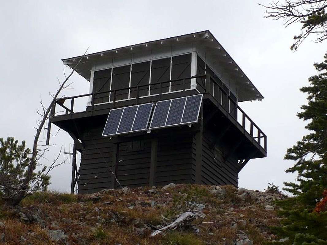
Built: 1934. Still manned during the summer. Elevation: 6960ft GPS Coordinates: 48.88373 -114.17992 On a point 1.5 miles SW of Numa Peak over looking Bowman Lake. Accessible via trail Trailhead: Bowman Lake Campground Distance: 5.6 miles Elevation gain: 2930ft I have read descriptions saying this is the easiest lookout trail in the park; Not true. It is a bit of work getting to this one. The trail is boring, nothing but trees until you reach the lookout. The views are OK, but nothing to brag about. Although, the day I went the tops of Rainbow Peak and Mt. Carter were in hidden in clouds. |
 |
Scalplock Lookout
Built: 1931. Still manned during the summer. Elevation: 6919ft GPS Coordinates: 48.29958 -113.57467 On the summit of Scalplock Mountain Accessible via trailTrailhead: Walton Ranger Station Distance: 4.7 miles Elevation gain: 3079ft A wonderful hike in the summer, trail is always in good shape. Its also a fantastic snowshoe in the winter. |
 |
Swiftcurrent Lookout
Built: 1935. Still manned during the summer, as needed. Elevation: 8436ft GPS Coordinates: 48.78543 -113.76703 On the summit of Swiftcurrent Mountain. Accessible via trail Three possible trail heads Trailhead: Going-To-The-Sun LoopDistance: 6.2 milesElevation gain: 4178ft Trailhead: Many Glacier, Swiftcurrent InnDistance 7.8 milesElevation gain: 3492ft Trailhead: Logan PassDistance: 9.9 milesElevation gain: 2550ft All the trails leading to Swiftcurrent Pass are great, try each of them.Just west of the pass is the turn off up Swiftcurrent Mountain. It's a bald, brown, round, hump not much to look at. The trail has a dozen or more switch backs. It's kind of eerie in spots where the ghostly white remnants of alpine trees that were killed in the fires of 2003 line the trail. |
 |
Huckleberry Mountain Lookout
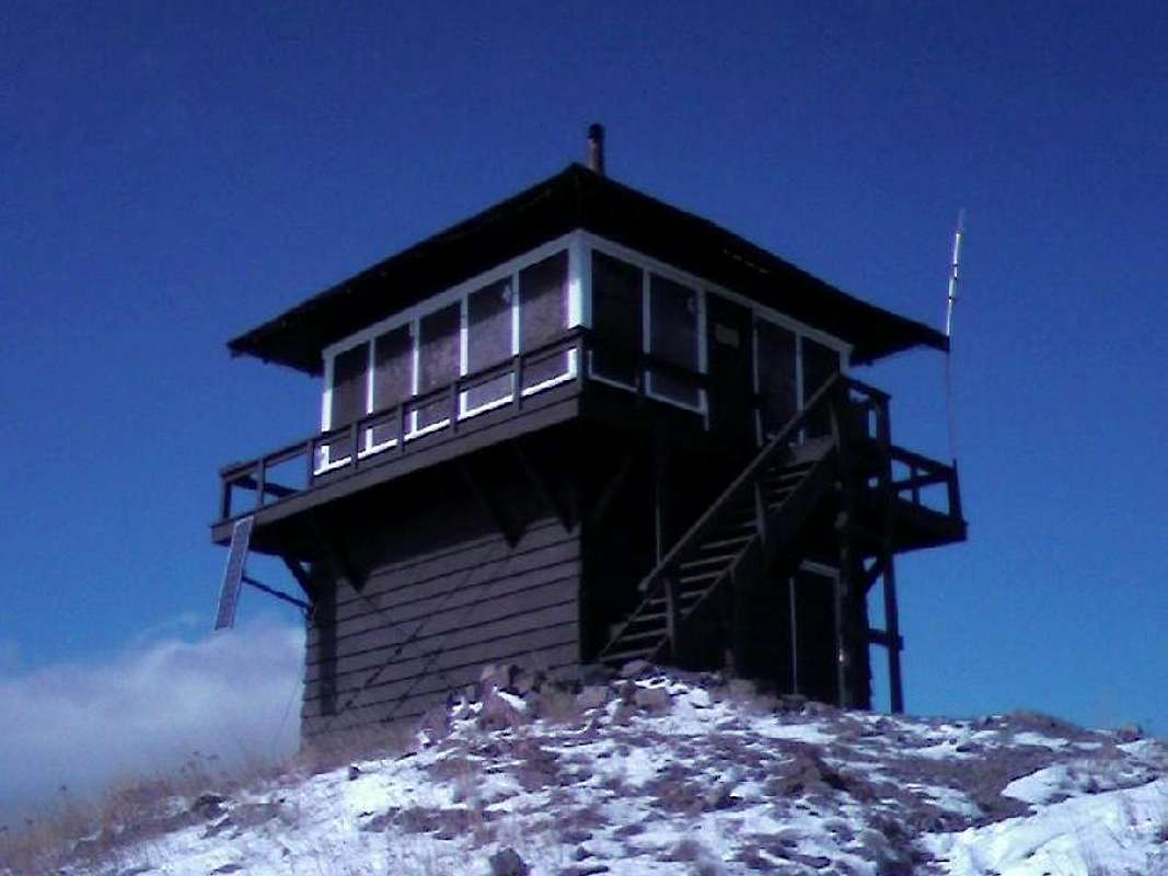
Built: 1968. Still manned during the summer. Elevation: 6593 ft GPS Coordinates: 48.60017 -114.13410 On summit of Huckleberry Mountain. Accessible via trail Trailhead: On Camas Rd. 5 miles north of Apgar Distance: 6 miles Elevation gain: 3403ft Two previous lookouts stood on this site each burned down in the fires of 1929 and 1967.This is a great hike. The fist few miles are kind of boring, just trees. But then with each turn and rise you see something new and wonderful.The trail keeps you guessing all the way; Where is the lookout? Then suddenly there it is.There are great views of the North Fork of the Flathead River, Longfellow Mountain and Heaven's Peak. Edwards, Gunsight, Jackson, and Stimson fill the eastern horizon.Bear frequent this trail, so keep your eyes open and your pepper spray handy. |
 |
Apgar Mountain Lookout
Built 1929. Still standing, not currently in use Elevation: 5236ft GPS Coordinates: 48.51809 -114.02070 On southern most point ofThe Apgar Mountains. Accessible via trail Trailhead: 1.5 mile past Quarter Circle bridge just inside the West entrance. Distance: 2.8 miles Elevation gain: 1835ft A previous lookout on this site burned in the fire of 1929.This is the shortest lookout trail in the park, but not the easiest, it is pretty steep.A simple hike up, though I recommend going early morning the trial is on a south facing slope with very little shade. |
  |
Mount Brown Lookout
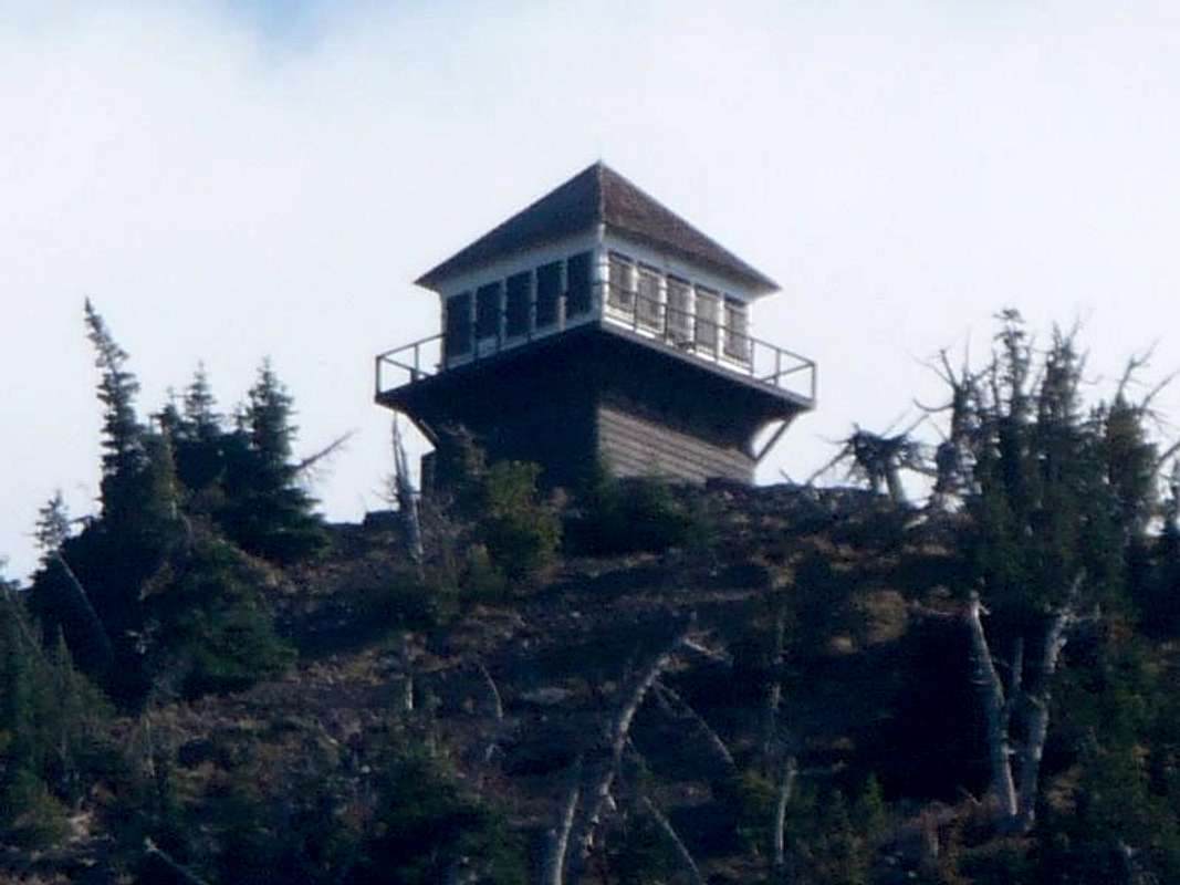
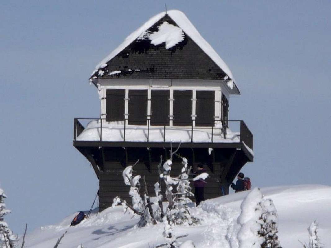
Built: 1929. Still standing, not currently in use Elevation: 7487ft GPS Coordinates: 48.62854 -113.83376 On point 1 miles SW of Mount Brown's Summit Accessible via trail Trailhead: Lake McDonald Lodge Distance: 5.4 miles Elevation gain: 4305ft From here you have views of Lake McDonald, Mt Edwards, and the Belton Hills.This is the steepest lookout trail in the park. The trail is same as used to reach Sperry Chalet and Snyder Lake for the first two miles, were you turn at Brown Lookout Junction. Then things get steep.A total 30 switch backs from the junction. The only good views while on the trail come at turn 7, 25, and 26, the rest of the time all you see are trees.This is a great snowshoe destination since the road is open to this trail head year round. |
  |
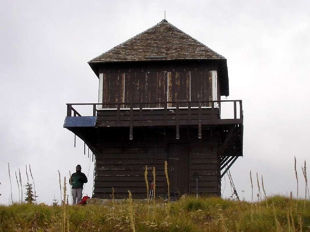
Loneman Lookout
Built: 1929. Still standing, not currently in use Elevation: 7181ft GPS Coordinates: 48.48899 -113.76963 On summit of Loneman Mountain. Accessible via trail Trail head: Nyack Ford just past mile marker 164 on Hwy 2 Distance: 7 miles Elevation gain: 3900ft A previous lookout stood here which burned in the fire of 1929.There are no bridges on the trail to this lookout, so you have to ford the Flathead River and Nyack Creek.Once you cross Nyack Creek, one mile in, the trail starts a very steady climb to lookout. It's easy to set and maintain a good pace all the way. Not much for views on the trail but once you get to the lookout the mountains of the Great Bear Wilderness and Nyack Valley open up to you. |
 |
Porcupine Ridge Lookout
Heaven's Peak Lookout
Built: 1945. Still standing, Abandoned. Elevation: 7244ft GPS Coordinates: 48.74899 -113.87591 On ridge 3 miles north of Heaven's Peak Bushwhack up from McDonald Creek trail 3 miles north of Packers' Roost.This is probably the most difficult Lookout to reach in the park.link to Heaven's Peak Lookout Route |
 |
Red Eagle Lookout
Built: 1960. Destroyed: 1986 Elevation: 4896ft GPS Coordinates: 48.71600 -113.4455 12miles SSW of St. Mary above Red Eagle Trail Was the only steel structure lookout in the park. |
Bear Mountain Point Lookout
Built: 1935 Destroyed: 1965 Elevation: 6200ft GPS Coordinates: 48.93558 -113.7505 12 miles south of Bear Mountain Summit overlooking Cosley Lake |
Heaven's Peak South Lookout
Built: 1945 Destroyed: 1963 Elevation: 4700ft GPS Coordinates: 48.70226 -113.82398 Mid slope on the east side of Heaven's Peak. |
Reynolds Ridge Lookout
Built: 1931 Destroyed: 1963 Elevation: 6400ft GPS 48.66791 -113.66782 East end of Mt. Reynolds spur overlooking Mirror Pond. |
Curly Bear Lookout
Built: 1934 Destroyed: 1963 Elevation: 6500ft GPS Coordinates: 48.66797 -113.44568 Mid Slope .5 miles north of summit |
Elk Mountain Lookout
Built: 1930 Destroyed: 1963 Elevation: 7835ft GPS Coordinates: 48.30662 -113.44454 Summit of Elk Mountain. Accessible by trail Distance 2.6miles Elevation gain: 3175 |
Waterton Lake Lookout
Built: 1930s Abandoned 1940 and destroyed Elevation: 5300ft GPS Coordinates: 48.96147 -113.88000 .5 miles NE of the end of Waterton Lake The site is accessible by Waterton Overlook trail. Distance: 1 mile Elevation gain: 1100ft |
Riverview Mountain Lookout
Built: 1923 Abandoned: 1930s I could find no traces of it when I visited in 2011 Elevation: 5740ft GPS Coordinates: 48.364040 -113.628439 South side of Riverview Mountain |


