
|
|
Route |
|---|---|
|
|
35.72500°N / 83.242°W |
|
|
Hike. |
|
|
Most of a day |
|
|
Walk-up. |
|
|
Approach
Take 321/73 to Baxter Road. Make a left onto Baxter if coming from the north, or a right if coming from the south (Gatlinburg). Drive down Baxter road about one half mile (passing some houses) and see a sign for The Maddron Bald Trailhead on the right. Hang a very hard right turn and drive down to the trailhead.WARNING: THIS AREA HAS A HIGH BREAK-IN RATE FOR AUTOS! DO NOT LEAVE YOUR AUTO HERE OVERNIGHT. CHANCES ARE, IF YOU DO, IT WILL BE BROKEN INTO AND, PERHAPS, STRIPPED OR STOLEN.
There are businesses on 321 that will allow you to leave your vehicle for a fee (no details, sorry).
Route Description
This route involves a round-trip distance of 16.4 miles (if you include the Albright Grove Loop). And a gain in elevation of about 5000 feet.The Maddron Bald Trail starts as a very wide, graded, gravel road. Once you leave your car.
 Easy going.
Continuing along, you will soon enter a very nice cove hardwood forest as you climb steadily at a moderate rate.
 Hardwoods
Within the first mile, you will begin to enter a genuine old growth forest, mainly of hemlock and tulip trees. I encounted this old tree in Albright Grove Loop which forms a side tril on the hike.
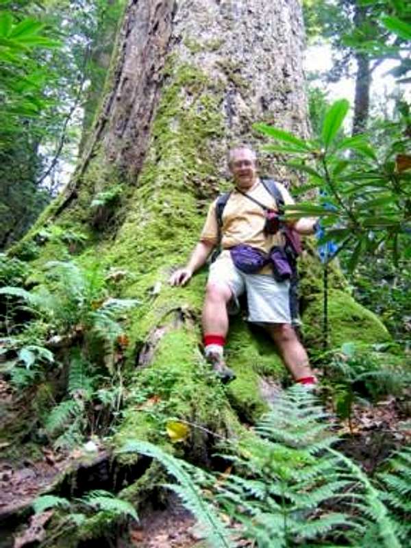 A massive old poplar (and an old man)on the way to Inadu Knob.
At about 1.2 miles into the hike, you will cross the Gabes Mountain Trail. Continue climbing, passing by a large stone the park service has placed in the trail to discourage horseback riders from using The Maddron Bald Trail.
At about the 2.7 mile mark, you will come to the Albright Grove Loop Trail. This will add about seven tenths of a mile to your hike (if going all the way to the summit), but it is more than worth any extra effort involved. If you miss this section, you will have missed one of the great forests of the Smokies.
A lot of the trees in this grove are hemlocks, and are likely going to succumb to the hemlock wooly adelgid. Go see this place while it's still healthy.
Along the way, you will have to make a few easy fords. Some of them have official log bridges, and at least one unnofficial bridge.
After climbing out of the cove hardwoods at around the 4300 foot mark, you will begin to enter a more northerly ecosystem. About six miles into the hike you will cross Otter Creek and see, on your left, the Otter Creek backcountry campsite, one of the most beautiful sites in the park. Soon, the steep ascent will taper off as you achieve the ridgeline and the hiking becomes easier.
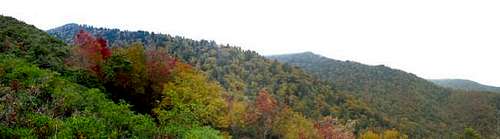
 More northern types.
Push on past Maddron Bald. After a little more easy hiking, you will pass the Snake Den Ridge Trail on your left. Continue on another seven tenths of a mile to the summit of Inadu Knob and the Appalachian Trail.
 Higher ridges.
Essential Gear
In warmer weather, have good boots, hiking staff, plenty of water, and pack a windbreaker or light jacket just in case.In cold weather, make sure you have clothing suitable for any extremes that can quickly arise in this high country.
Sarah Simon - Jan 19, 2010 12:02 pm - Hasn't voted
Images not showingHi Bob, I noticed that your images on this page are not appearing - they are instead replaced by a "red x" and a note that the "images are hosted by..." Just a courtesy FYI. Sarah
BobSmith - Jan 19, 2010 9:49 pm - Hasn't voted
Re: Images not showingThanks! Old photos that I had linked. I'll fix it!