Toggle navigation
Mountains
Routes
Images
Trip Reports
Forum
What's New
People
Areas & Ranges
Articles
Trailheads
Canyons
Huts & Campgrounds
Albums
Logistical Centers
Fact Sheets
Lists
Custom Objects
Gear
Plans & Partners
WELCOME TO SUMMITPOST
SIGN IN
REGISTER
Tenmile Range
Additional Parents
Pacific Peak
Northeast Slopes via Spruce Creek
Image
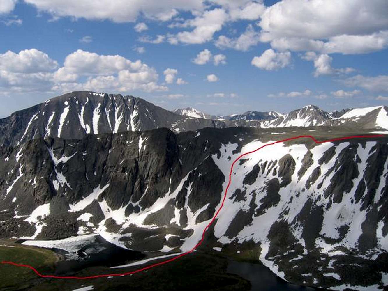
The red line shows the route...
View High-Resolution Image
The red line shows the route...
The red line shows the route after you pass the final lake and ascend the steep snow above it. Just out of view to the right is Pacific Peak's summit. Photo taken 7-6-05.
« PREV
NEXT »
Ed F
on
Jul 19, 2005 5:02 pm
Comments & voting
Other parents
Lat/Lon:
39.42310°N / 106.1228°W
Image ID:
115577
4192 Hits
72.52
% Score
5
Votes
Log in to vote
Comments
No comments posted yet.
to post!
Don't have an account?
Tenmile Range
(Area/Range)
« PREV
Viewing
#114 of 169
GALLERY
NEXT »
Ed F's Image Gallery
« PREV
Viewing
#626 of 962
GALLERY
NEXT »
Pacific Peak
(Mountain/Rock)
Loading....
Northeast Slopes via Spruce Creek
(Route)
Loading....
×
You need to login in order to vote!
User Name
Password
Remember me
Forgot your password?
Log me out when I close my browser.
Keep me logged in all the time.
sign in as a user
Don't have an account?
Register now for FREE
Rating available
Suggested routes for you
People who climb the same things as you
Comments Available
Create Albums
Register Here


