
|
|
Route |
|---|---|
|
|
39.42310°N / 106.1228°W |
|
|
Snow Climb |
|
|
Most of a day |
|
|
Class 2+, Moderate Snow |
|
|
Introduction
This route on Pacific Peak allows you to travel the beautiful Spruce Creek drainage, make an exciting snow climb, and finish off on the pinnacle of the summit. The Spruce Creek drainage is an amazing area with several lakes, waterfalls, and lots of mining history. Take your time on your descent to tour this area. It is a very popular hiking destination in the summer.
This route is recommended while snow still covers the crux slope (see below). This is typically until August on most years.
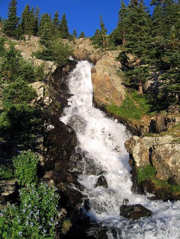
Continental Falls, One of the Attractions in the Spruce Creek Drainage
Approach
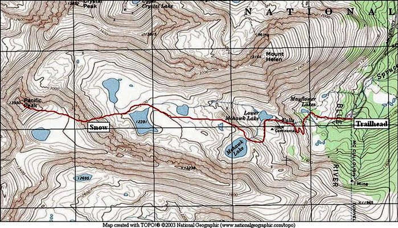
Spruce Creek Trailhead
From Hoosier Pass, south of Breckenridge on Colorado 9, go 7.6 miles north to the well-marked Spruce Creek Road. Turn onto the Spruce Creek Road, and follow it for approximately 2 miles to an obvious parking area. This is where to park 2WD vehicles.
4WD vehicles can continue on the Spruce Creek road for 1.8 more miles. The end of the road to the actual trailhead is the roughest part. There are several areas along the way on this road to pull-out and park. There is room for 4-5 vehicles at the actual trailhead.
Route Description
If you parked before the actual trailhead, follow the Spruce Creek road until it ends.
Take the well-marked trail into the dense forest. Shortly, you will find a trail intersection for Mayflower Lake to the right and Mohawk Lakes and Continental Falls to the left. Go Left toward Mohawk Lakes.
This area is extremely confusing. Unfortunately, social trails go in nearly every direction. Try your best to remain on what looks like the main trail. The first landmark you should look for is Continental Falls. The Falls are very obvious when you get close enough. You should be able to hear them from the trail intersection. Trails go everywhere here. Try to follow the main trail, which switches back across the steep slope to the southeast of the Falls. On your return trip, take a moment to view these beautiful waterfalls by taking one of the many social trails going toward them.
Once above the falls, the main trail heads for an old mining apparatus that looks like a ski lift. Go right past this mining apparatus and continue on the trail. If you made it this far, then you are on the right trail, and staying on it now is much easier.
The trail goes skirts Lower Mohawk Lake on its south side, and then takes a hard turn south. The trail now is taking the long way around the cliffs and waterfalls below Mohawk Lake (which is out of view). The trail goes near a small pond, and takes a hard turn to the west, skirting the cliffs previously mentioned.
Your next landmark is Mohawk Lake. The trail immediately begins to veer away from the lake to the north, and will take you past another small, unnamed lake on the lake's north side.
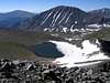
The trail you are on will quickly diminish as you go toward unnamed Lake 12,391. Cross this lake on its north side by rock-hopping across the exit of the lake. Skirt the lake and proceed directly toward the snow slope that is now directly ahead.
This slope is the crux of this route. This snow slope holds snow into August on most years. It isn't very steep, but the center section is steep enough to produce a fall with dire consequences. Climb directly up the snow to the East Ridge of Pacific Peak. Take note of the highest lake in the United States, which is named "Pacific Tarn." It is at 13,420 feet.
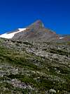
From the ridge, the remaining route is simple, although there is no trail. Ascend the East Ridge. The easiest way is actually to stay close to the side of the ridge. The exposure here is breathtaking. If the exposure is too great, there is nothing wrong with staying away from the edge. The tradeoff is looser rock.
The best way down is the way you came up. Take care descending the snow slope. A fall will spill you onto rocks far below. This slope is often skied.
Route Stats:
From 4WD Parking:
Round Trip Mileage: 7.0 miles
Elevation Gain: 2,870 feet
From 2WD Parking:
Round Trip Mileage: 10.5 miles
Elevation Gain: 3,570 feet
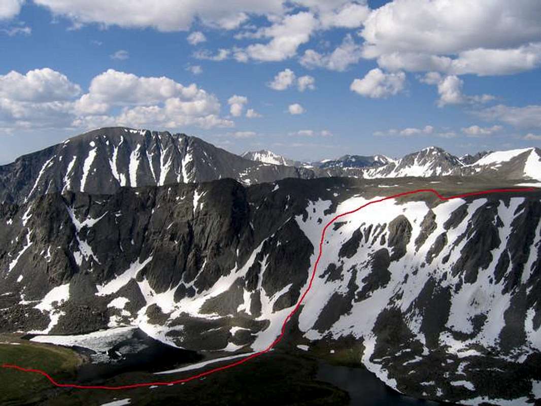
This route photo shows the snow slope you will climb. Just out of view to the right is the summit.
 |  |  |  |
Essential Gear
An ice axe and crampons are mandatory for the snow slope. A helmet is a good idea also. The rock near the snow slope is loose, and rockfall is an issue.