
-
 5868 Hits
-
 76.66% Score
-
 7 Votes
|
|
Route |
|---|---|
|
|
46.41639°N / 13.88263°E |
|
|
Hiking |
|
|
Spring, Summer, Fall |
|
|
Half a day |
|
|
Medium hard hike |
|
|
Overview
 Start of the route
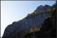
 On the ridge
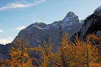
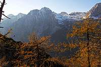
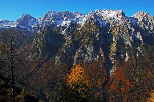 The view across Vrata valley on Martuljek group
As our beloved mountain writer, the late Tine Mihelič says, this tour hardly belongs to any known category. It's just hiking along an overgrown (above with dwarf pines, below with woods) ridge, summiting a few unimportant bumps. The summit of Požar will hardly get it's own SP page, so I'm attaching the route page to Triglav's group. Still, there is nearby a mountain, worth of description. Higher up the ridge there's Požgana Mlinarica, 1873 m. But the tour would be different if including that summit. When I do it once, then may be I'll attach also this page there.
Požar means fire in our language and also Požgana Mlinarica means a burnt mountain. Yet nowadays you will se no trace of fire up there on the ridge.
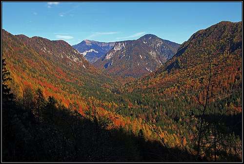
Geographically the ridge which is lowering from Požgana Mlinarica is the continuation of a much higher ridge of Vrbanove špice. Below Požgana Mlinarica it is dividing two famous valleys of Triglav group: Vrata and Kot. Its direction is SW-NE.
The value of this tour lies in its solitude. You do it best when larches are most beautiful, yes you are guessing correctly, in October. But views from the ridge can be beautiful any season of the year. Only in a hard winter you better avoid this tour. Even if it's not hard in normal conditions, the terrain is steep enough to make you troubles in winter. The most beautiful views from the ridge are on Martuljek group, which is seen from its SE side, and on the other side on the long ridge descending from Rjavina.
Rating the Route (By Hiking Standards)
The grading system for hiking and scrambling routes is here.0. General: From Kot, 950m to cca 1600m, exposition SE, SW, NE. First by a comfortable hunters path over steep slopes on the ridge, then by a steep, narrow ridge on the panoramic point, finally by the whole ridge down (predominantly woods, a few steep sections). Gear: Only good shoes and poles.
1. Effort: cca 850m, less than 5h.
2. Power: 1 - No difficulties, only walk-up.
3. Psyche: 3 - Mostly easy (2), but a few steper passages.
4. Orientation: 3 - medium. Don't try to go down the ridge on your own!
Getting There
You can drive in Kot valley, some 300 meters after Lengarjev rovt (alpine meadow) there's the parking place. You will however end the tour in the beginning of Kot valley. Those 5 km you will have to do in addition, or plan to have a bike or two cars.Route Description
 Kot
Kot Macesnovec Macesnovec |
 Hunters path Hunters path |
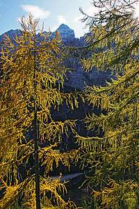 Golden larches Golden larches |
 Luknja peč Luknja peč |
 Škrlatica and Rokavi Škrlatica and Rokavi |
 Stenar Stenar |
 On the ridge On the ridge |
 Rjavina Rjavina |
 Črna gora Črna gora |