
This is reworked road map,...
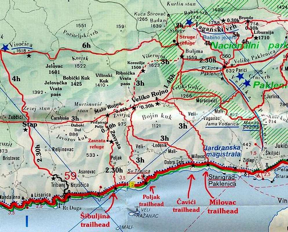
This is reworked road map, 1:200 000 scale, which is showing most of the marked routes of Rujno – Velika Paklenica area. I also added lot of geographical names which are mentioned on Viserujna page. Between black stars are time distances on some of the routes, expressed in hours. Interrupted line shows unmarked section of Viserujna Circle. Because it is large area it is not possible to scan mountaineering map and reduce it to 640 pixels. Area covered here is 19x15km. When visiting this area you can buy maps at the entrance to Paklenica National Park.
Graphics: Aleksandar Gospic


