Timothy Peaks, Uintas, Utah

Timothy Peaks, Uintas, Utah

Page Type Page Type: Trip Report
Location Lat/Lon: 40.72802°N / 110.37378°W
Date Date Climbed/Hiked: May 31, 2008
Activities Activities: Hiking
Seasons Season: Spring

Timothy Peaks, Uintas, Utah


After my recent hike with MOCKBA to Paul Benchmark and Bluebell Pass Peak, I had two other day hikes in mind from the Swift Creek Trailhead (elev 8100). The first was a 21.5 mile round trip to the two peaks just north of Bluebell Pass, South Timothy Peak (12646) and North Timothy Peak (12685), about 3.3 miles south of Kings Peak, the Utah high point. The second was a 20 miler to Mount Emmons (13440), South Mount Emmons (13170), and Owl (12826).

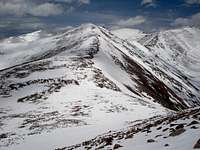
Emmons RidgeEmmons Ridge


I decided to save Mount Emmons for later since there was a better chance that I could get someone else to go on that one. This trip was very spur of the moment and I thought it was too late to get any takers. I drove up Friday evening, passing one deserted campground after another to arrive at the trailhead just before 9pm. I thought there would be at least a little action given it was a Friday night, but I appeared to be it. However, sometime during the night, another group did pull in.

Even though I was the only car around, I still managed to park in an area I wasn't supposed to and the campground host arrived out of nowhere to ask me to move. I was worried he was going to give me a hard time for "unauthorized camping" aka sleeping in my car at the trailhead, but he didn't. He was very nice and inquired as to what I would be doing and I just told him I was heading toward Bluebell Pass. I guess I looked pretty wimpy because he stressed that "the trail rises 1000' in the first mile". He expressed considerable skepticism that I'd make it anywhere near the 9 miles and 3500' to Bluebell Pass (11600). I didn't tell him my full plan to go 2 miles farther to South and North Timothy Peaks and climb an additional 1500 feet, because I thought he'd think I was truly nuts.

Paul Benchmark RidgePaul Benchmark ridge

I thought this would be an easy trip compared to the trip to Paul Benchmark since that one had a lot of rolling ups and downs and this one would be a nice steady grade mostly on a trail or on snow to the top. But it was tough. I started at 5:25 am with the temperature just above freezing at 8100'. I had an easy 3.5 mile walk on a well defined trail to the first stream crossing. Well, there was no way I was going to cross that thing in the height of spring runoff. It wouldn't be so much dangerous as unpleasant. It was about 20' across and about a foot deep. I had anticipated this possibility and chose to bushwhack about 1 mile to where the trail crossed back. This was painful and chewed up a lot of time, but at last I reached the trail again and resumed progress. I encountered the occasional snow patch and mostly was able to stay on top, but sunk to the bottom around the edges. I thought "oh no, what's this going to be like in the late afternoon". Solid snow wouldn't have been nearly so bad since I had brought snowshoes.

Deer LakeDeer Lake

Some time before 9am I reached Deer Lake at elevation 10240. It showed considerable signs of melting, the edges were mostly water. This was the farthest point anyone had made it this year on the trail according to the campground host and he had expressed doubt that they had actually made it. I crossed the outlet on a snow bridge and continued on my way to about 10500' at which point there was so much snow there was no longer any point in following the trail.

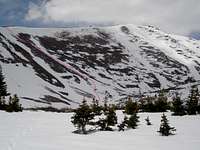
South Timothy PeakWhite Miller Lake and South Timothy Peak
Bluebell PassBluebell Pass

I turned nw, heading for the east shore of White Miller Lake (10680), passing a small unnamed lake at 10560 in the process. I put on my snowshoes at about 10800' and continued on my way toward Bluebell Pass, encountering several more small lakes along the way, each of them equally beautiful, yielding views of the high peaks far above. It seemed like I was doing a lot of unnessesary meandering and small ups and downs on this section and I began to feel pressed for time. On our 21.6 mile RT Paul Benchmark hike, with MOCKBA doing most of the trail breaking, we had reached the far point, Bluebell Pass Peak (12036), just shy of Bluebell Pass at 1:38 pm. We didn't get back to the car until 8:40 pm. As the crow flies, I was headed more than 2 miles farther away and had no trail breaker along. We had encountered horrible collapsing snow conditions descending and had had a very tiring time going downhill to the trail when we should have been cruising. Two pm was the absolute latest I wanted to turn around. One pm would be better. It was about 10:30 am and I hoped to make it to Bluebell Pass by noon, South Timothy Peak by 1, and North Timothy Peak by 2. But at that elevation, these times seemed overly optimistic. It was getting cloudy, and I was getting worried.

My route to South Timothy PeakMy route to South Timothy Peak
View northwestAlmost to the top of South Timothy peak, looking NW

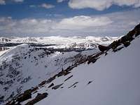
When planning this trip, I figured that traveling the ridge north from Bluebell Pass was for sure doable, although not the most direct way, which was straight up the southeast side of South Timothy Peak (12646). I wasn't sure that was feasible, it looked pretty steep on the map and I was worried there might be some cliffy sections. But, fortunately, I had a clear view of it now and it looked good, having several snow swatches that led all the way to the top of the ridge. I headed for the one leading almost directly to the summit and upon reaching a rocky section took off my snowshoes. When I hit snow again it was perfectly consolidated and I had an easy time booting up the remaining 1000'. Abandoning the Bluebell Pass idea saved me at least an hour and I was on top of South Timothy Peak shortly after noon. The views were fantastic, the cloud cover provided good contrast, and the coating from a recent snowstorm made everything a brilliant white. Kings Peak and South Kings Peak were ahead to the north, Emmons to the east, and scads of peaks to the west. Lakes seemed to be everywhere.
Kings Peak et alKings Peak et al

View west from South Timothy PeakView west from South Timothy Peak


North Timothy PeakNorth Timothy Peak
South Timothy PeakSouth Timothy peak
Descent route from Timothy Peaks saddleDescent route

It was very easy getting from the south to the north peak, being about a mile with a 500' descent and a 500' ascent all on snow. I arrived about 12:50, plenty of time to make it back the 11 miles to the trailhead before dark. Again, there was a fantastic view in every direction. I backtracked the half mile to the saddle between the two where I had dumped my pack and hoped that if I peered over the edge to the east I'd find a nice route down on snow. Voila!, there it was, a path of snow all the way down to West Timothy Lake, steep, but the perfect consistency for plunge stepping.

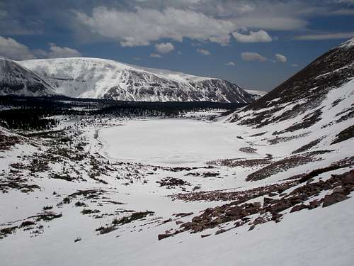
I reached the basin and if I had been brave or foolhardy I would have walked right across West Timothy Lake, but I didn't dare. As it was, with all the snow, it was hard to tell where the shore ended and the lake began and occasionally I would find my foot in water. The snow was good and I was able to make it a long way before I had to put the snowshoes back on at about 11000'. Not only did they work well on the snow, but they were great at the almost melted out boggy areas that wouldn't have been so nice in the summer. But, once I got back to where the snow was patchy it was kind of painful to choose between hearing the annoying sound of snowshoes scraping over rocks in bare patches or sinking to the bottom without the snowshoes.

West Timothy LakeWest Timothy Lake


Swift Creek crossingLower stream crossing
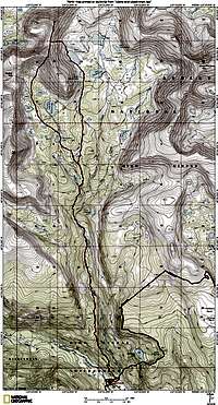
Topo of Timothy Peaks tripTopo of trip

Eventually the snowshoes came off and it was back to dirt and I rejoined my ascent route. I followed the trail back the way I had come, but it was pretty rocky in places and it was hard to make good time. I checked out the upper stream crossing and again rejected it. This time I took another approach to the bushwhack. On the way up I stayed high, this time I would try to stick more to the bottom. That didn't work very long since I soon encountered 2 sets of cliffs that went all the way to the water. The first I was able to get around with a little scrambling, and the second required a very steep uphill. So the bottom line is it's better to traverse high, away from the stream.

My interest in doing Emmons via this route has waned considerably since it requires crossing the stream. But, maybe in a month or so the creek will be crossable without getting wet.

The whole trip was 21.5 miles, took 14 hours and 20 minutes, and had a total elevation gain of 5300 feet. I made it back to the car about 7:45 pm. I expected the campground host to pounce on me upon my return, but I was wrong, it must have taken him at least 10 minutes to wander over. Poor guy, I hope he gets more visitors soon.


Comments

Post a Comment
Viewing: 1-10 of 10
Dmitry Pruss

Dmitry Pruss - Jun 4, 2008 4:43 pm - Voted 10/10

So did the CG host ask you

where have you been? :)

ZeeJay

ZeeJay - Jun 4, 2008 5:00 pm - Hasn't voted

Re: So did the CG host ask you

Of course, but unfortunately I couldn't remember exactly where my map was at that point so I'm not sure I communicated clearly.

Matthew Van Horn

Matthew Van Horn - Jun 4, 2008 6:42 pm - Hasn't voted

wimpy? no way

ZeeJay, after seeing you march to the top of Lone Peak in January (and reading about your Uinta adventures)I will never ever underestimate you.

ZeeJay

ZeeJay - Jun 4, 2008 7:53 pm - Hasn't voted

Re: wimpy? no way

Thanks, I didn't say I was wimpy, I said I must have looked wimpy :)

Matthew Van Horn

Matthew Van Horn - Jun 4, 2008 11:00 pm - Hasn't voted

Re: wimpy? no way

I know-- I meant from the point of view of the camp host :) Anyway, I enjoy your trip reports.

ZeeJay

ZeeJay - Jun 5, 2008 8:39 am - Hasn't voted

Re: wimpy? no way

Thanks!

Dmitry Pruss

Dmitry Pruss - Jun 5, 2008 1:50 pm - Voted 10/10

Re: wimpy? no way

... but you really don't like getting your feet wet, right? :)

ZeeJay

ZeeJay - Jun 7, 2008 12:58 pm - Hasn't voted

Re: wimpy? no way

Crossing creeks is the only thing I don't like about hiking.

JDrake

JDrake - Jun 7, 2008 1:41 pm - Voted 10/10

Wow,

I need to become friends with the Uintas. Reading about your and Mockba's adventures out there is almost enough to facilitate a change from WasatchNut to UintaNut :) Great report.

ZeeJay

ZeeJay - Jun 7, 2008 5:59 pm - Hasn't voted

Re: Wow,

Thanks. The Uintas are beautiful and only a 1-3 hour drive from SLC, depending upon where you go. Except for Kings Peak and Bald Mt., and maybe Gilbert, you are unlikely to encounter anyone on a peak.

Viewing: 1-10 of 10


Parents 

Parents

Parents refers to a larger category under which an object falls. For example, theAconcagua mountain page has the 'Aconcagua Group' and the 'Seven Summits' asparents and is a parent itself to many routes, photos, and Trip Reports.

Timothy PeaksTrip Reports