mountaindog - Jun 21, 2005 12:49 pm - Voted 10/10
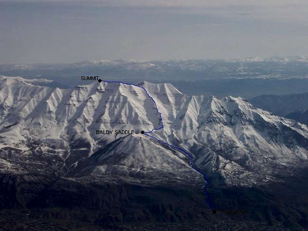
Great shot Scott!Thanks for the route info on the picture - this is what we should see more of here on SP.
Chris
Scott - Jun 21, 2005 1:15 pm - Hasn't voted
Re: Great shot Scott!Thanks. I took the shot while flying to SLC. I always like to pick out the routes I have done from an airplane!
Dean - Jun 21, 2005 2:09 pm - Voted 10/10
Re: Great shot Scott!I have to chime in and concur. Pics like this one really help add to the understanding of the mountain.
Scott - Jun 29, 2005 11:48 am - Hasn't voted
Re: YeahYou should take the original and either diagram the rest of the routes (Everest Ridge, any other SW face variations) or let others do it to that original photo. It'd be nice to have one of these for every mountain here.
When I have time, I could do this, or I wouldn't mind if someone else used the photo to do it. I actually took several similar ones. I'll keep this one with the one route marked though, because it is attached to the route page.
PellucidWombat - Jul 11, 2005 10:41 am - Hasn't voted
Re: YeahMay I? I'll mark all the routes in Kelsey's book if you want :-D


Comments
Post a Comment